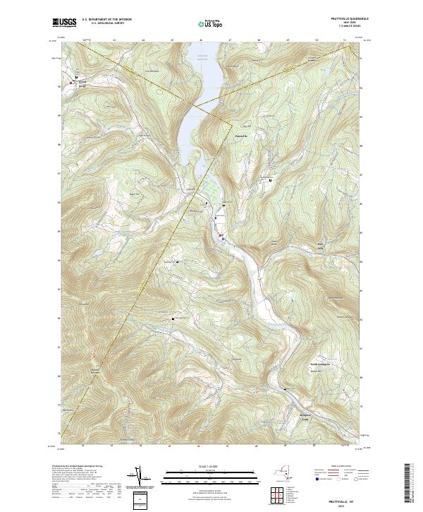
2023 Map of Prattsville
USGS Topo · Published 2023About this map
Prattsville sits at a geographic crossroads in the Catskills, where the Schoharie Creek meets the Batavia Kill. This modern survey documents the high-elevation landscape of the Greene County, Delaware County, and Schoharie County borders. The mapping highlights a deep-rooted network of family and community burial grounds, including the Fairlawn, Huggins, and Rappelea cemeteries, which serve as vital markers for local genealogy. To the north, the Schoharie Reservoir dominates the valley floor, while landmarks like Pratt Rocks and Bearpen Mountain define the surrounding peaks. The settlement patterns at Grand Gorge and North Lexington reveal how mountain geography has dictated transportation and growth along watercourses like the Little West Kill and Bear Kill across generations.
Find a feature on this map
91 named features on this map. Tap any name to fly to it.
Don’t see what you’re looking for? This feature index may not catch every label — zoom into the map to look around manually.
Map Details
Editions of this 2023 Prattsville Map
This is the sole edition of this map. No revisions or reprints were ever made.
Other maps of this area

1900 · Phoenicia
USGS Topo · 1:62,500

1901 · Margaretville
USGS Topo · 1:62,500

1901 · Gilboa
USGS Topo · 1:62,500

1903 · Gilboa
USGS Topo · 1:62,500

1903 · Phoenicia
USGS Topo · 1:62,500

1904 · Hobart
USGS Topo · 1:62,500

1904 · Margaretville
USGS Topo · 1:62,500

1945 · West Kill
USGS Topo · 1:24,000

1945 · Gilboa
USGS Topo · 1:24,000

1945 · Fleischmanns
USGS Topo · 1:24,000