
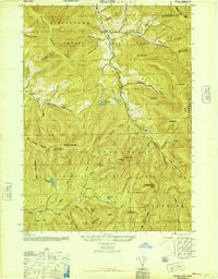
1945 Map of West Kill
USGS Topo · Published 1946About this map
Catskill State Park dominates the mountainous landscape in this 1945 survey, where the peaks of Balsam Mtn, Vly Mtn, and Halcott Mtn shape the settlement patterns of several valley communities. The map captures the social infrastructure of mid-century rural New York through its network of numbered schoolhouses, such as School No 4 and School No 13, alongside family and community burial grounds like Halcott Cem and Deyoe Cem. Transportation is defined by the steep terrain, notably the passage through Deep Notch and the presence of the New York Central railroad corridor in the southern reaches. The convergence of three counties—Greene, Delaware, and Ulster—is clearly delineated across the high ridges, providing a precise record of municipal boundaries as they existed just after the war.
Find a feature on this map
49 named features on this map. Tap any name to fly to it.
Don’t see what you’re looking for? This feature index may not catch every label — zoom into the map to look around manually.
Map Details
Editions of this 1945 West Kill Map
This is the sole edition of this map. No revisions or reprints were ever made.
Other maps of this area

1900 · Phoenicia
USGS Topo · 1:62,500

1901 · Margaretville
USGS Topo · 1:62,500

1901 · Gilboa
USGS Topo · 1:62,500

1903 · Gilboa
USGS Topo · 1:62,500

1903 · Phoenicia
USGS Topo · 1:62,500

1904 · Hobart
USGS Topo · 1:62,500

1904 · Margaretville
USGS Topo · 1:62,500
1945 · Seager
USGS Topo · 1:24,000

1945 · Fleischmanns
USGS Topo · 1:24,000
1945 · Roxbury
USGS Topo · 1:24,000