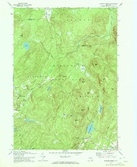
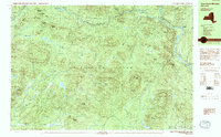
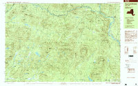
Old Maps of Benson, New York for Metal Detecting
Plan your next treasure hunt with 57 historic maps of Benson. Find old homesites, ghost towns, trails, and gathering spots that may be lost to time — perfect for identifying promising metal detecting locations.
- Locate forgotten sites: Uncover places like long-lost settlements, abandoned rail lines, or gathering spots.
- Plan better hunts: Use map overlays combined with LiDAR or satellite views to narrow in on historically rich areas.
- Made for detectorists: Thousands of hobbyists use these maps to discover relics, coins, and hidden history.
Use these historic maps to boost your research and find new opportunities beneath the surface of Benson.
Benson, NY maps
(57)- 1899 Map of Broadalbin, 1954 Print
 1899 Broadalbin1954 Print · USGSFulton and Saratoga counties are shown here just before the turn of the century as the local economy balanced rail transport and river-powered industry. Genealogists can trace family roots through numerous mill hamlets and settlements like Northampton, Vail Mills, and Osborn Bridge.
 - 1902 Map of Broadalbin
 1902 Broadalbin1902 Print · USGSThe Sacandaga River valley is shown here at the turn of the century, prior to the major hydroelectric projects that reshaped this Fulton County landscape. Genealogists can trace early homesteads and milling sites near Vail Mills, Hagedorns Mills, and the Sacandaga Park rail terminus.9 unique versions available
 - 1903 Map of Gloversville
 1903 Gloversville1903 Print · USGSGloversville and Johnstown anchor this turn-of-the-century survey as the region's industrial heart, surrounded by the growing Adirondack resort and timber lands. Genealogists and historians can trace the Electric R.R. or locate historic markers like the Battle Monument and old hamlets like Bleecker Center.8 unique versions available
 - 1907 Map of Lake Pleasant
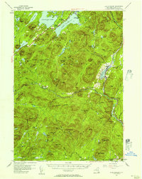
 1907 Lake Pleasant1907 Print · USGSThe Adirondack interior in the early twentieth century centered on the river-fed settlements of Wells and Lake Pleasant. Researchers can trace early post offices and remote industries like the Alvord PO and the Silver Lake Min.8 unique versions available
 - 1910 Map of Stony Creek
 1910 Stony Creek1910 Print · USGSThe southern Adirondacks at the turn of the century are captured here, centered on the intersection of Hamilton, Warren, and Saratoga counties. Genealogists can trace early outposts and hamlets like Harrisburg West Stony Creek PO, Hope Falls, and Griffin.7 unique versions available
 - 1943 Map of Gloversville
 1943 Gloversville1943 Print · USGSGloversville and Johnstown serve as the industrial anchors of this Adirondack foothills region during the early twentieth century. Genealogists and historians can trace the paths of the Electric R. R. and locate family landmarks like Kingsboro, Bleecker, and the Battle Monument.
 - 1945 Map of Caroga Lake, 1946 Print
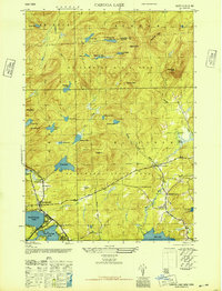 1945 Caroga Lake1946 Print · USGSThe Southern Adirondacks and the Fulton County line appear here in the mid-1940s, showcasing a network of mountain hamlets and glacial lakes. Genealogists and local historians can trace early schoolhouse locations like Union School and remote landmarks such as St Josephs Cem.2 unique versions available
 - 1945 Map of Northville, 1962 Print
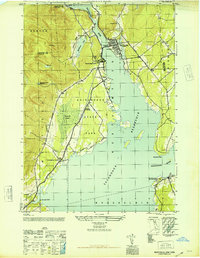
 1945 Northville1962 Print · USGSThe foothills of the Adirondacks meet the expanding reservoir in the mid-1940s, showing the vital connections between mountain valleys and the river. Genealogists can locate family burial sites at King Cem and Gifford Valley Cem or trace the early layout of Northville and Fish House.
 - 1945 Map of Jackson Summit, 1963 Print
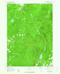 1945 Jackson Summit1963 Print · USGSThe southern Adirondacks at the close of the second World War reveal a landscape of mountain peaks and isolated hamlets. Family historians can locate specific burial sites at Bleecker Cem and trace old routes through Lindsley Corners or Ernst Corners.
 - 1946 Map of Jackson Summit
 1946 Jackson Summit1946 Print · USGSAdirondack State Park and the rural highlands of Fulton County are shown here just after the war. Researchers can locate small mountain settlements like Jackson Summit and Lindsley Corners, as well as family-history markers such as the Bleeker Cem and Berry Cem.
 - 1946 Map of Northville
 1946 Northville1946 Print · USGSThe southern Adirondacks at the conclusion of the second World War reveal a landscape shaped by the new reservoir and traditional rail lines. Researchers can trace the F J & G RR through Sacandaga Park and locate historic burial sites like Christie Cem and King Cem.
 - 1950 Map of Utica, 1951 Print
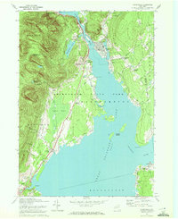
 1950 Utica1951 Print · USGSCentral New York in the post-war era showcases the industrial Mohawk Valley and the pristine Adirondack interior. Researchers can trace transportation networks like the New York Central Railroad and find early Cold War sites such as Griffiss Air Force Base.
 - 1954 Map of Lake Pleasant, 1957 Print
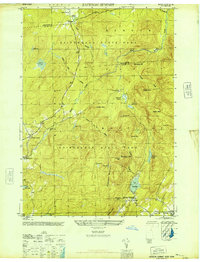
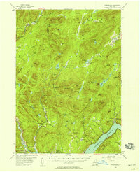
 1954 Lake Pleasant1957 Print · USGSMid-century Hamilton County comes alive in this survey of the Lake Pleasant and Sacandaga Lake wilderness. Genealogists and researchers can trace the roads to Speculator, locate the Piseco Sch, or find remote landmarks like Whitehouse.6 unique versions available
 - 1954 Map of Harrisburg, 1958 Print
 1954 Harrisburg1958 Print · USGSThe Adirondack foothills and the Sacandaga valley appear here in the mid-fifties, showing a landscape defined by mountain hamlets and seasonal camps. Researchers can trace family history through sites like Scofield Cem, the Edinburg Ch, and the remote settlement of Griffin.5 unique versions available
 - 1957 Map of Utica
 1957 Utica1957 Print · USGSCentral New York and the Adirondack foothills are captured here in the mid-fifties, showing a landscape defined by the Mohawk River corridor and the growing highway system. Genealogists and researchers can trace the rail lines of the New York Central and locate communities from Lowville to Gloversville.
 - 1962 Map of Utica
 1962 Utica1962 Print · USGSCentral New York and the Adirondack wilderness are captured here during the mid-century era of highway and industrial expansion. Genealogists and historians can trace the development of the New York State Thruway and local rail lines connecting Utica, Rome, and Gloversville.3 unique versions available
 - 1964 Map of Utica
 1964 Utica1964 Print · USGSCentral New York and the high wilderness of the Adirondacks are captured here during the post-war era of infrastructure expansion. Researchers can trace the development of the New York State Thruway alongside historic corridors like the Oneida Lake (Barge Canal Route) and the N. Y. Central railroad.
 - 1967 Map of Utica
 1967 Utica1967 Print · USGSCentral New York's industrial Mohawk Valley meets the Adirondack wilderness in the 1960s, showing the region's transition from manufacturing hubs to state-managed parklands. Trace historic settlements and sites like Griffiss Air Force Base, Colgate University, and the Lyons Falls Paper Mill.
 - 1970 Map of Northville, 1972 Print
 1970 Northville1972 Print · USGSFulton County’s lakeside communities are captured here in the early seventies, showcasing the developed shoreline of the Great Sacandaga Lake. Genealogists can locate family landmarks such as Gifford Valley Cem, Sweets Crossing, and the historic settlement of Fish House.2 unique versions available
 - 1970 Map of Caroga Lake, 1972 Print
 1970 Caroga Lake1972 Print · USGSThe southern Adirondacks come into focus during the early 1970s, showing a landscape defined by recreational camps and high-country hamlets. Researchers can trace local heritage through St Josephs Cemetery, the Union School at Wheelerville, and the lakeside community at Caroga Lake.
 - 1970 Map of Jackson Summit, 1972 Print
 1970 Jackson Summit1972 Print · USGSThe Adirondack foothills in the early 1970s show a landscape of isolated mountain settlements and expansive vlys. Genealogists and hikers can trace the old road networks through Lindsley Corners and find landmarks like Buttermilk Falls or the Jackson Summit Reservoir.2 unique versions available
 - 1985 Map of Gloversville, 1986 Print
 1985 Gloversville1986 Print · USGSThe southern Adirondacks meet the Mohawk Valley industrial corridor during the mid-eighties, showcasing a landscape of high-country lakes and riverside manufacturing towns. Trace the historical alignment of the Erie Canal and Conrail lines or locate landmarks like the Herkimer Home State Historic Site.2 unique versions available
 - 1990 Map of Hope Falls
 1990 Hope Falls1990 Print · USGSThe Adirondack foothills of Saratoga and Hamilton Counties are shown here during the late twentieth century as the region balanced wilderness and remote settlement. Researchers can trace historic hamlets like Hope Falls and Tennantville or follow the shoreline of Great Sacandaga Lake past West Day.
 - 1990 Map of Three Ponds Mountain
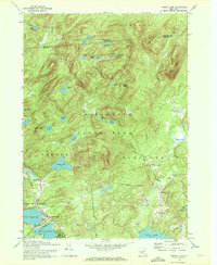
 1990 Three Ponds Mountain1990 Print · USGSThe Adirondack wilderness in the early nineties is a landscape of high peaks and scattered outposts in Hamilton County. Genealogists and hikers can trace the paths near Upper Benson, the riverside at Whitehouse, and the historic Hell Devil Dam (Site).2 unique versions available
 - 1997 Map of Three Ponds Mountain, 1999 Print
 1997 Three Ponds Mountain1999 Print · USGSHamilton County in the late 1990s is captured as a dense wilderness of the southern Adirondacks, structured by peaks and river valleys. Researchers can trace remote sites like Hell Devil Dam (Site) or the trails near Whitehouse and Silver Lake.
Showing maps 1-25 of 57
Top cities near Benson
- Gloversville historical maps
- Johnstown historical maps
- Mayfield historical maps
- Broadalbin historical maps
- Northampton historical maps
- Providence historical maps
See more
Top neighborhoods of Benson
Frequently asked questions
- What are the different types of historical maps available for Benson?
- What is the oldest map of Benson?
- Where can I purchase historical maps of Benson for my home or office?
- Where can I download high-res historical maps of Benson?
- Are there historical topographic maps available for Benson?
- Is there historical aerial imagery available for Benson?
- Where are historical maps of Benson sourced from?