Old Maps of Indian Lake, New York for Genealogy
Trace your family roots with 92 historic maps of Indian Lake. These high-res maps reveal old neighborhoods, homesites, landmarks, and streets — helping you uncover where your ancestors lived and how the area evolved over time.
- Explore historic neighborhoods: Identify where your relatives may have lived in the 1800s or 1900s.
- Compare maps over time: Trace the changes in streets, buildings, and landmarks for multi-generational research.
- Perfect for genealogy & ancestry research: Used by family historians and researchers to map out lineage and migration.
These maps are an incredible resource for exploring your personal connection to Indian Lake's past.
Indian Lake, NY maps
(92)- 1898 Map of Newcomb
 1898 Newcomb1898 Print · USGSThe Adirondack wilderness around the upper Hudson River is captured here in the late nineteenth century. Genealogists and historians can trace early settlements and sporting outposts like Aiden Lair, the Northwoods Club, and Tahawus.
 - 1898 Map of Thirteenth Lake
 1898 Thirteenth Lake1898 Print · USGSWarren County and the surrounding Adirondack peaks were defined by timber and mineral interests in the late nineteenth century. Genealogists and researchers can locate the settlement at Bakers Mills and trace the paths around Moores Mine and Thirteenth Lake.10 unique versions available
 - 1899 Map of Indian Lake
 1899 Indian Lake1899 Print · USGSHamilton County was a landscape of remote wilderness camps and logging waters at the turn of the century. You can trace early backcountry outposts like Camp Comfort and Camp Perkins or locate landmarks like Wakely Dam and the settlement of Speculator.
 - 1901 Map of Newcomb
 1901 Newcomb1901 Print · USGSThe Adirondack high country near the turn of the century is defined by the headwaters of the Hudson River and the small outposts of the New York interior. Genealogists and historians can trace the early footprint of the Northwoods Club, the settlement at Newcomb, and the remote station at Aiden Lair.9 unique versions available
 - 1902 Map of Indian Lake
 1902 Indian Lake1902 Print · USGSHamilton County at the turn of the century shows a wilderness of high peaks and sprawling waterways before the era of modern development. Researchers can trace early Adirondack outposts like Camp Perkins or locate the village of Speculator and the Hatchery on Whiskey Brook.9 unique versions available
 - 1903 Map of Raquette Lake
 1903 Raquette Lake1903 Print · USGSThe Adirondack wilderness of Hamilton County is captured here at the turn of the century, showing a remote landscape of high peaks and vast waterways. Researchers can trace early seasonal outposts like Hasbroucks and St. Hubert I. or follow the historic STEAMBOAT ROUTE across Raquette Lake.13 unique versions available
 - 1903 Map of Blue Mountain
 1903 Blue Mountain1903 Print · USGSThe Adirondack wilderness in the early 1900s centered on the waterways of Hamilton County. Trace the early tourism routes including the Steamboat Route through Blue Mountain Lake and historical stops like Forest House.11 unique versions available
 - 1950 Map of Utica, 1951 Print
 1950 Utica1951 Print · USGSCentral New York in the post-war era showcases the industrial Mohawk Valley and the pristine Adirondack interior. Researchers can trace transportation networks like the New York Central Railroad and find early Cold War sites such as Griffiss Air Force Base.
 - 1954 Map of Newcomb, 1957 Print
 1954 Newcomb1957 Print · USGSThe High Peaks wilderness of Essex and Hamilton Counties is captured here in the mid-1950s, centered on the settlement of Newcomb. Researchers can trace the Old Military Road, locate the Tahawus Club, and identify mid-century retreats like Camp Che-na-wah and Aiden Lair.5 unique versions available
 - 1954 Map of Thirteenth Lake, 1957 Print
 1954 Thirteenth Lake1957 Print · USGSThe Adirondack high country near Johnsburg and Chester was defined by its mineral wealth and rail lines in the 1950s. Trace old mountain roads to Bakers Mills, see the Delaware and Hudson rail line, or find the Lookout Tower on Gore Mtn.4 unique versions available
 - 1954 Map of Blue Mountain, 1957 Print
 1954 Blue Mountain1957 Print · USGSIn the mid-1950s, this Adirondack landscape centers on the growing recreational hubs of Long Lake and Blue Mountain Lake. Genealogists and hikers can trace the Northville-Lake Placid Trail past the Long Lake Cem and the remote Forest House.6 unique versions available
 - 1954 Map of Indian Lake, 1957 Print
 1954 Indian Lake1957 Print · USGSThe Adirondack wilderness of the mid-fifties is centered here around the long reach of INDIAN LAKE. Researchers can trace old mountain routes like Military Road or locate remote outposts such as Perkins Clearing, Sabael, and the Snowy Mountain Lookout Tower.6 unique versions available
 - 1954 Map of Raquette Lake, 1957 Print
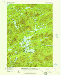 1954 Raquette Lake1957 Print · USGSDeep in the Adirondack Park during the mid-fifties, this survey reveals the remote settlements and intricate waterways of the central New York wilderness. Genealogists and historians can trace local landmarks like St Williams Ch, the Raquette Lake Sch, and family-named features such as Antlers Point.5 unique versions available
 - 1957 Map of Utica
 1957 Utica1957 Print · USGSCentral New York and the Adirondack foothills are captured here in the mid-fifties, showing a landscape defined by the Mohawk River corridor and the growing highway system. Genealogists and researchers can trace the rail lines of the New York Central and locate communities from Lowville to Gloversville.
 - 1962 Map of Utica
 1962 Utica1962 Print · USGSCentral New York and the Adirondack wilderness are captured here during the mid-century era of highway and industrial expansion. Genealogists and historians can trace the development of the New York State Thruway and local rail lines connecting Utica, Rome, and Gloversville.3 unique versions available
 - 1964 Map of Utica
 1964 Utica1964 Print · USGSCentral New York and the high wilderness of the Adirondacks are captured here during the post-war era of infrastructure expansion. Researchers can trace the development of the New York State Thruway alongside historic corridors like the Oneida Lake (Barge Canal Route) and the N. Y. Central railroad.
 - 1967 Map of Utica
 1967 Utica1967 Print · USGSCentral New York's industrial Mohawk Valley meets the Adirondack wilderness in the 1960s, showing the region's transition from manufacturing hubs to state-managed parklands. Trace historic settlements and sites like Griffiss Air Force Base, Colgate University, and the Lyons Falls Paper Mill.
 - 1985 Map of Raquette Lake, 1986 Print
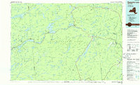 1985 Raquette Lake1986 Print · USGSThe central Adirondacks are documented here in the mid-1980s, showcasing the complex lake systems and early rail routes that defined the region. Researchers can trace historic landmarks like Sagamore, isolated stops along the Adirondack RR, and the remote layout of Old Forge.2 unique versions available
 - 1989 Map of Deerland
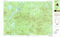 1989 Deerland1989 Print · USGSThe Adirondack wilderness of the late eighties is centered here on the long reach of Long Lake and its lakeside communities. Genealogists and hikers can trace local routes through Deerland, locate the Post Office, and find the Fire Lookout Tower on Owls Head Mountain.
 - 1989 Map of Blue Mtn Lake
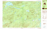 1989 Blue Mtn Lake1989 Print · USGSThe Central Adirondacks are captured here in the late 1980s, centered on the highland waters and timbered slopes of Hamilton County. Researchers can trace the development of Indian Lake and Blue Mountain Lake, locating local sites like the Forest House and Cem.
 - 1989 Map of Dutton Mountain
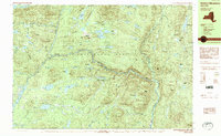 1989 Dutton Mountain1989 Print · USGSThe Adirondack High Peaks region in the late 1980s reveals a landscape of protected wilderness and established mountain retreats. Trace the winding Hudson River through Minerva past historic sporting sites like the Gooley Club and Aiden Lair.
 - 1989 Map of Raquette Lake
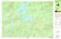 1989 Raquette Lake1989 Print · USGSHamilton County's waterways are captured here in the late 1980s, showcasing the intricate shoreline of the Adirondack Park. Local historians can trace the footprints of Great Camps at Sagamore and Pine Knot Point or locate the Raquette Lake Reservoir.2 unique versions available
 - 1990 Map of Page Mountain
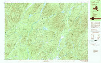 1990 Page Mountain1990 Print · USGSThe village of Speculator and the surrounding Adirondack wilderness appear here in the late twentieth century. Outdoor historians can trace old clearings like Indian Clearing and Perkins Clearing or find natural landmarks such as Austin Falls.
 - 1990 Map of Thirteenth Lake
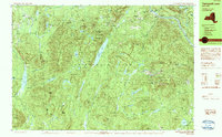 1990 Thirteenth Lake1990 Print · USGSThe Adirondack wilderness in the late twentieth century is preserved here through a dense network of peaks and high-country ponds. Genealogists and hikers can trace historic access routes like Old Farm Road or locate family-named landmarks including Edwards Hill and John Pond.2 unique versions available
 - 1990 Map of Indian Lake
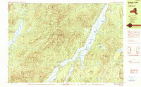 1990 Indian Lake1990 Print · USGSHamilton County's interior wilderness is captured here in the 1990s, centering on the expansive waters of Indian Lake. Local historians and hikers can locate the Indian Lake Fire Tower, trace the shoreline of Lewey Lake, and identify campsites around Sabael.
Showing maps 1-25 of 92
Top cities near Indian Lake
- Johnsburg historical maps
- Thurman historical maps
- Lake Pleasant historical maps
- Long Lake historical maps
- Minerva historical maps
- Wells historical maps
See more
Top neighborhoods of Indian Lake
Frequently asked questions
- What are the different types of historical maps available for Indian Lake?
- What is the oldest map of Indian Lake?
- Where can I purchase historical maps of Indian Lake for my home or office?
- Where can I download high-res historical maps of Indian Lake?
- Are there historical topographic maps available for Indian Lake?
- Is there historical aerial imagery available for Indian Lake?
- Where are historical maps of Indian Lake sourced from?