Old Maps of Keeseville, New York for Hiking & Exploration
Hike through history with 44 historic maps of Keeseville. Explore old trails, ghost towns, and forgotten backroads — perfect for outdoor adventurers and local explorers.
- Rediscover forgotten places: Map out old mining camps, roads, and footpaths that no longer exist on modern maps.
- Layer with modern tools: Combine with LiDAR or satellite views to plan hikes through historical terrain.
- Made for exploration: Popular among hikers, overlanders, and local history lovers.
Use these maps to find adventure and explore the hidden past of Keeseville.
Keeseville, NY maps
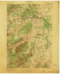
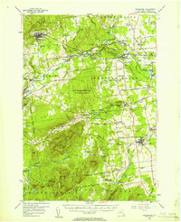
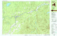
(44)- 1894 Map of Plattsburg
 1894 Plattsburg1894 Print · USGSLake Champlain was a bustling corridor of steamer routes and rail lines in the 1890s. Researchers can trace the layout of Plattsburg Barracks, find the Hotel Champlain at Bluff Point, and explore the islands of GRAND ISLE and South Hero.3 unique versions available
 - 1895 Map of Willsboro
 1895 Willsboro1895 Print · USGSLake Champlain and its late 19th-century transport networks are detailed here, showing the era when ferries and steamships linked New York and Vermont. Genealogists and historians can trace old homesteads and landings near Keeseville, the McNeil Ferry, and the tracks of the Central Vermont R. R.7 unique versions available
 - 1895 Map of Ausable
 1895 Ausable1895 Print · USGSThe Adirondack foothills come alive in the late nineteenth century as the river-and-rail economy takes hold. Trace the industrial footprint of Ausable Forks and find vanished landmarks like Towers Forge and the historic Stickney Bridge.2 unique versions available
 - 1903 Map of Ausable
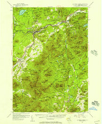
 1903 Ausable1903 Print · USGSThe Adirondack foothills come to life at the turn of the century as industrial hamlets and mountain outposts follow the river forks. Researchers can trace the D. and H. C. Co. R. R. through Ausable Forks and find family-named landmarks like Towers Forge and the Willey House.7 unique versions available
 - 1906 Map of Plattsburg
 1906 Plattsburg1906 Print · USGSLake Champlain's northern waters are captured here in the early 1900s, showing the vital maritime and rail corridors of Clinton County and the islands of Vermont. Genealogists and historians can trace the Plattsburg Barracks, find old stops like Grand Isle Sta., and locate lighthouses such as Valcour L.H..6 unique versions available
 - 1913 Map of Dannemora
 1913 Dannemora1913 Print · USGSClinton County's industrial and correctional history is frozen in time at the edge of the Adirondacks before the First World War. Trace the Chateaugay Branch rail line to the State Penitentiary or locate old schoolhouses like Grand Hill School.5 unique versions available
 - 1939 Map of Plattsburg
 1939 Plattsburg1939 Print · USGSLake Champlain was a vital corridor for rail and military activity just before the second World War. Genealogists and historians can trace the Plattsburg Barracks, the Rutland Railroad on Grand Isle, and landmarks like Hotel Champlain.
 - 1941 Map of Plattsburg
 1941 Plattsburg1941 Print · USGSLake Champlain was a critical corridor of military and transport activity in the years leading into the war. Researchers can trace the legacy of the Plattsburg Barracks, the winding Rutland rail line, and the geological site at Ausable Chasm.
 - 1941 Map of Willsboro
 1941 Willsboro1941 Print · USGSLake Champlain's shores in New York and Vermont are captured here just before the war, showing a landscape defined by lakefront landings and busy railroads. Trace the routes of the Delaware and Hudson and find local landmarks like Craterclub, Whallonsburg, and St Josephs Ch.2 unique versions available
 - 1943 Map of Willsboro
 1943 Willsboro1943 Print · USGSThe Lake Champlain shoreline in the early 1940s reveals a landscape of mountain-backed villages and vital cross-lake rail connections. Genealogists and researchers can trace local landmarks like St Josephs Ch, Lakeview Cem, and the path of the Delaware and Hudson railroad.3 unique versions available
 - 1943 Map of Plattsburg
 1943 Plattsburg1943 Print · USGSLake Champlain was a bustling corridor of rail and water traffic in the early 1940s, connecting the Adirondack foothills to the Vermont islands. Genealogists and researchers can trace the old schoolhouses of Beekmantown, the Rutland railroad stops, and historic sites like Hotel Champlain.4 unique versions available
 - 1950 Map of Lake Champlain
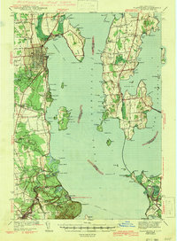
 1950 Lake Champlain1950 Print · USGSThe Lake Champlain valley and its surrounding peaks are captured in detail during the late 1940s, showing the vital rail and road connections between New York and Vermont. Researchers can trace the routes of the Central Vermont Railway or locate old industrial centers like Mineville and Witherbee.2 unique versions available
 - 1953 Map of Au Sable Forks, 1957 Print
 1953 Au Sable Forks1957 Print · USGSThe Adirondack foothills in the early fifties reveal a landscape where river industry meets mountain wilderness. Researchers can trace historic iron-working sites like Ore Mines and Soper Kiln, or locate family landmarks such as Stevens Landing and North Jay Cem.3 unique versions available
 - 1956 Map of Plattsburgh
 1956 Plattsburgh1956 Print · USGSLake Champlain and its island communities are captured here in the mid-fifties, just as the region's rail and water networks faced the rise of the jet age. Genealogists and historians can trace the foundations of Plattsburgh Air Force Base, old Vermont stations like Grand Isle Sta, and landmarks like Ausable Chasm.3 unique versions available
 - 1956 Map of Dannemora, 1957 Print
 1956 Dannemora1957 Print · USGSClinton County’s landscape in the mid-fifties centers on the institutional history of Dannemora and the timbered slopes of Terry Mountain. Genealogists and historians can trace numerous rural cemeteries like Quaker Cem and locate historic schools such as Beckwith Sch.3 unique versions available
 - 1956 Map of Willsboro, 1958 Print
 1956 Willsboro1958 Print · USGSLake Champlain and the eastern Adirondacks come alive in the mid-1950s, showing the intricate shoreline from New York to Vermont. Genealogists can trace family roots through sites like Whallon Bay Sch, Boardman Cem, and the Lady of Hope Shrine.4 unique versions available
 - 1958 Map of Lake Champlain
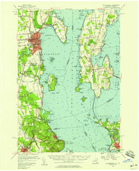
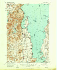
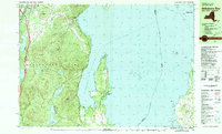
 1958 Lake Champlain1958 Print · USGSThe Champlain Valley and surrounding high peaks are captured here in the late fifties, showcasing the cross-border region from the Adirondacks to the Green Mountains. Researchers can trace historic rail routes like the Rutland Railway or locate old valley settlements such as Keeseville and Vergennes.2 unique versions available
 - 1962 Map of Lake Champlain, 1975 Print
 1962 Lake Champlain1975 Print · USGSLake Champlain and the high peaks of the Adirondacks and Green Mountains are captured here during the mid-twentieth century. Researchers can trace the industrial legacy of the Lyon Mountain Mine and the rail corridors of the Central Vermont RR and Delaware & Hudson RR.3 unique versions available
 - 1966 Map of Keeseville, 1968 Print
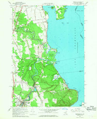 1966 Keeseville1968 Print · USGSLake Champlain's western shore in the mid-1960s reveals a mix of rugged Adirondack river gorges and quiet lakeside hamlets. Genealogists and local historians can trace the paths of the Delaware and Hudson RR through Port Kent or locate family sites near Blockhouse Cem and Ausable Chasm.2 unique versions available
 - 1966 Map of Peru, 1968 Print
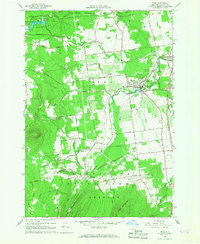 1966 Peru1968 Print · USGSClinton County's agricultural and forest lands are captured here in the mid-sixties as the region balanced traditional industry with new transit. Researchers can trace local heritage through the Mother Cabrini Shrine, the tracks of the Delaware and Hudson, and the riverside hamlet of Laphams Mills.2 unique versions available
 - 1978 Map of Au Sable Forks, 1979 Print
 1978 Au Sable Forks1979 Print · USGSIn the Adirondack mountains during the late seventies, the junction of the east and west river branches defines the local landscape. Genealogists can trace family names at Holy Name Cem and Riverview Cem while locating old industries like the Quarries and Arnold Hill mines.3 unique versions available
 - 1980 Map of Willsboro Bay, 1981 Print
 1980 Willsboro Bay1981 Print · USGSLake Champlain and the eastern edge of the Adirondacks meet in the early eighties, revealing a landscape of shoreline camps and mountain peaks. Trace the Delaware and Hudson rail line through Port Douglass or locate historic family spots near Highlands Forge Lake and Schuyler Island.2 unique versions available
 - 1986 Map of Lake Champlain South
 1986 Lake Champlain South1986 Print · USGSIn the mid-1980s, the shores of Lake Champlain linked the Adirondack high peaks with the Vermont valley. Genealogists and researchers can trace the rail lines of the Delaware & Hudson RR or locate historic settlements like Mineville and Au Sable Forks.2 unique versions available
 - 1986 Map of Lake Champlain North
 1986 Lake Champlain North1986 Print · USGSThe Lake Champlain borderlands in the mid-1980s show a mix of mountain villages and busy island shorelines. Researchers can trace the Delaware and Hudson RR through Plattsburgh or locate old rural sites like Mooers Forks and St Josephs Cem.2 unique versions available
 - 2010 Map of Peru, 2010 Print
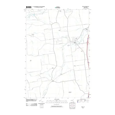 2010 Peru2010 Print · USGSCovers Keeseville, including Peru, Schuyler Falls, and other nearby areas
Showing maps 1-25 of 44
Top cities near Keeseville
- Burlington historical maps
- South Burlington historical maps
- Plattsburgh historical maps
- Colchester historical maps
- Plattsburgh historical maps
- Shelburne historical maps
See more
Frequently asked questions
- What are the different types of historical maps available for Keeseville?
- What is the oldest map of Keeseville?
- Where can I purchase historical maps of Keeseville for my home or office?
- Where can I download high-res historical maps of Keeseville?
- Are there historical topographic maps available for Keeseville?
- Is there historical aerial imagery available for Keeseville?
- Where are historical maps of Keeseville sourced from?