Old Maps of Leisher Mill, Lewis for Academic Research
Study the evolution of Leisher Mill with 14 high-resolution historic maps. Whether you're teaching, researching, or modeling changes in land use, these maps provide essential visual documentation of urban, environmental, and geographic change.
- Analyze long-term change: Track patterns in development, transportation, and natural features.
- Ideal for environmental or urban studies: Support academic projects with primary historical map data.
- Use in the classroom or lab: Educators and researchers rely on these maps to bring historical context to life.
These maps are a powerful tool for teaching, research, and visualizing how Leisher Mill has changed over the decades.
Leisher Mill, Lewis maps
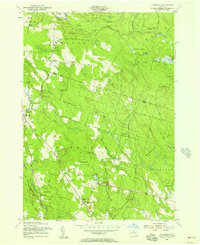
(14)- 1905 Map of Taberg
 1905 Taberg1905 Print · USGSOneida and Lewis Counties come alive at the turn of the century as a landscape of timber mills and rail junctions. Genealogists and local historians can trace family locations through named hamlets like Empeyville East Florence PO and Taberg, or follow the industrial paths of the Lehigh Valley RR.6 unique versions available
 - 1943 Map of East Florence
 1943 East Florence1943 Print · USGSThe Tug Hill region at the height of the Second World War shows a landscape of remote settlements and small school districts. Genealogists can trace family footprints across Hanifin Corners, Thomson Corners, and many rural burial grounds like Greely Cem.
 - 1950 Map of Utica, 1951 Print
 1950 Utica1951 Print · USGSCentral New York in the post-war era showcases the industrial Mohawk Valley and the pristine Adirondack interior. Researchers can trace transportation networks like the New York Central Railroad and find early Cold War sites such as Griffiss Air Force Base.
 - 1955 Map of Florence, 1957 Print
 1955 Florence1957 Print · USGSThe Tug Hill region on the Oneida and Lewis county line is shown here in the mid-fifties, dominated by state reforestation tracts and rural hamlets. Researchers can trace family roots at St Marys Ch or locate old school sites and burials like Gregory Cem and School No 1.3 unique versions available
 - 1957 Map of Utica
 1957 Utica1957 Print · USGSCentral New York and the Adirondack foothills are captured here in the mid-fifties, showing a landscape defined by the Mohawk River corridor and the growing highway system. Genealogists and researchers can trace the rail lines of the New York Central and locate communities from Lowville to Gloversville.
 - 1962 Map of Utica
 1962 Utica1962 Print · USGSCentral New York and the Adirondack wilderness are captured here during the mid-century era of highway and industrial expansion. Genealogists and historians can trace the development of the New York State Thruway and local rail lines connecting Utica, Rome, and Gloversville.3 unique versions available
 - 1964 Map of Utica
 1964 Utica1964 Print · USGSCentral New York and the high wilderness of the Adirondacks are captured here during the post-war era of infrastructure expansion. Researchers can trace the development of the New York State Thruway alongside historic corridors like the Oneida Lake (Barge Canal Route) and the N. Y. Central railroad.
 - 1967 Map of Utica
 1967 Utica1967 Print · USGSCentral New York's industrial Mohawk Valley meets the Adirondack wilderness in the 1960s, showing the region's transition from manufacturing hubs to state-managed parklands. Trace historic settlements and sites like Griffiss Air Force Base, Colgate University, and the Lyons Falls Paper Mill.
 - 1985 Map of Utica, 1986 Print
 1985 Utica1986 Print · USGSThe Mohawk Valley in the mid-eighties shows a landscape of industrial river cities and high-tech military hubs before the post-Cold War transition. Trace the development of Rome and Utica, the operations at Griffiss Air Force Base, and the lakeside activity at Oneida Lake.2 unique versions available
 - 2010 Map of Florence, 2010 Print
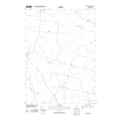 2010 Florence2010 Print · USGSCovers Leisher Mill, including Camden, Annsville, and other nearby areas
 - 2013 Map of Florence, 2013 Print
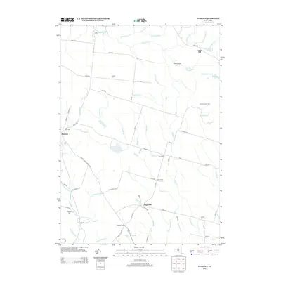 2013 Florence2013 Print · USGSCovers Leisher Mill, including Camden, Annsville, and other nearby areas
 - 2016 Map of Florence, 2016 Print
 2016 Florence2016 Print · USGSCovers Leisher Mill, including Camden, Annsville, and other nearby areas
 - 2019 Map of Florence, 2019 Print
 2019 Florence2019 Print · USGSCovers Leisher Mill, including Camden, Annsville, and other nearby areas
 - 2023 Map of Florence, 2023 Print
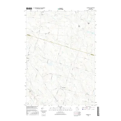
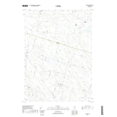
 2023 Florence2023 Print · USGSThe rural border of Oneida and Lewis counties comes into focus in this recent survey. Researchers can trace family history through several burial sites including River Cem and Davis Cem, or locate the historic Leisher Mill along the Salmon River.
End of results
Showing maps 1-14 of 14
Top cities near Leisher Mill
- Rome historical maps
- Lee historical maps
- Vienna historical maps
- Camden historical maps
- Lake Delta historical maps
- Annsville historical maps
See more
Frequently asked questions
- What are the different types of historical maps available for Leisher Mill?
- What is the oldest map of Leisher Mill?
- Where can I purchase historical maps of Leisher Mill for my home or office?
- Where can I download high-res historical maps of Leisher Mill?
- Are there historical topographic maps available for Leisher Mill?
- Is there historical aerial imagery available for Leisher Mill?
- Where are historical maps of Leisher Mill sourced from?