Old Maps of Lowville, New York for Genealogy
Trace your family roots with 22 historic maps of Lowville. These high-res maps reveal old neighborhoods, homesites, landmarks, and streets — helping you uncover where your ancestors lived and how the area evolved over time.
- Explore historic neighborhoods: Identify where your relatives may have lived in the 1800s or 1900s.
- Compare maps over time: Trace the changes in streets, buildings, and landmarks for multi-generational research.
- Perfect for genealogy & ancestry research: Used by family historians and researchers to map out lineage and migration.
These maps are an incredible resource for exploring your personal connection to Lowville's past.
Lowville, NY maps
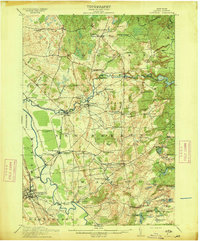
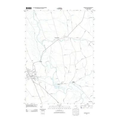
(22)- 1902 Map of Carthage
 1902 Carthage1902 Print · USGSUpper New York at the turn of the century shows a landscape of river-powered industry and sprawling hill farms. Genealogists can trace family names and old crossroads from Champion Huddle to Gardners Corners, while rail historians can follow the R. W. and O. Div. through the Black River valley.
 - 1904 Map of Carthage
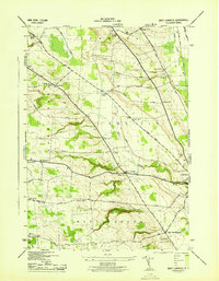
 1904 Carthage1904 Print · USGSJefferson and Lewis Counties at the turn of the century show a landscape defined by the Black River valley and its busy rail lines. Genealogists can trace early homesteads in rural outposts like Champion Huddle, Windecker, and Gardners Corners.6 unique versions available
 - 1911 Map of Lowville, 1959 Print
 1911 Lowville1959 Print · USGSLewis County at the start of the 1910s reveals a thriving network of river-powered hamlets and rural school districts. Genealogists can locate family landmarks like Bushes Landing, Kirchnerville, and the Wisner School along the Black River valley.2 unique versions available
 - 1913 Map of Lowville
 1913 Lowville1913 Print · USGSLewis County in the early twentieth century is captured here as a landscape of river-powered industry and dispersed rural settlements. Genealogists can locate family-named landmarks like Petries Corners, trace the Lowville and Utica Line, and find dozens of local schools including Henry School and Osson School.5 unique versions available
 - 1943 Map of West Lowville
 1943 West Lowville1943 Print · USGSLewis County rural life comes into focus in the 1940s, showing a landscape of family farms and local school districts. Researchers can find numerous numbered schoolhouses and cemeteries such as Gallup Cem, Fairview Cem, and the small settlement of Windecker.3 unique versions available
 - 1950 Map of Utica, 1951 Print
 1950 Utica1951 Print · USGSCentral New York in the post-war era showcases the industrial Mohawk Valley and the pristine Adirondack interior. Researchers can trace transportation networks like the New York Central Railroad and find early Cold War sites such as Griffiss Air Force Base.
 - 1957 Map of Utica
 1957 Utica1957 Print · USGSCentral New York and the Adirondack foothills are captured here in the mid-fifties, showing a landscape defined by the Mohawk River corridor and the growing highway system. Genealogists and researchers can trace the rail lines of the New York Central and locate communities from Lowville to Gloversville.
 - 1962 Map of Utica
 1962 Utica1962 Print · USGSCentral New York and the Adirondack wilderness are captured here during the mid-century era of highway and industrial expansion. Genealogists and historians can trace the development of the New York State Thruway and local rail lines connecting Utica, Rome, and Gloversville.3 unique versions available
 - 1964 Map of Utica
 1964 Utica1964 Print · USGSCentral New York and the high wilderness of the Adirondacks are captured here during the post-war era of infrastructure expansion. Researchers can trace the development of the New York State Thruway alongside historic corridors like the Oneida Lake (Barge Canal Route) and the N. Y. Central railroad.
 - 1966 Map of Lowville, 1970 Print
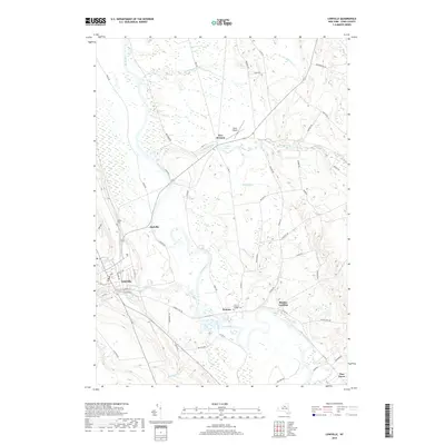
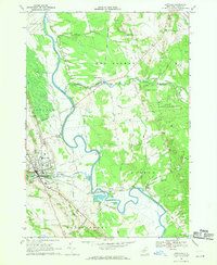 1966 Lowville1970 Print · USGSThe Black River Valley in the mid-1960s shows a landscape defined by the winding BLACK RIVER and the bustling village of Lowville. Genealogists and local historians can trace family roots through sites like Beaches Bridge Cem, St Peters Ch, and the old PENN CENTRAL rail corridor.2 unique versions available
 - 1967 Map of Utica
 1967 Utica1967 Print · USGSCentral New York's industrial Mohawk Valley meets the Adirondack wilderness in the 1960s, showing the region's transition from manufacturing hubs to state-managed parklands. Trace historic settlements and sites like Griffiss Air Force Base, Colgate University, and the Lyons Falls Paper Mill.
 - 1985 Map of Watertown, 1986 Print
 1985 Watertown1986 Print · USGSThe Black River Valley and the western Adirondacks are captured here in the mid-1980s, from the urban streets of Watertown to the remote Stillwater Reservoir. Researchers can trace the Conrail lines through Carthage or locate family landmarks in Lowville, Boonville, and Old Forge.2 unique versions available
 - 2010 Map of West Lowville, 2010 Print
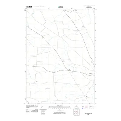 2010 West Lowville2010 Print · USGSCovers Lowville, including Denmark, Martinsburg, and other nearby areas
 - 2010 Map of Lowville, 2010 Print
 2010 Lowville2010 Print · USGSCovers Lowville, including New Bremen, Denmark, and other nearby areas
 - 2013 Map of West Lowville, 2013 Print
 2013 West Lowville2013 Print · USGSCovers Lowville, including Denmark, Martinsburg, and other nearby areas
 - 2013 Map of Lowville, 2013 Print
 2013 Lowville2013 Print · USGSCovers Lowville, including New Bremen, Denmark, and other nearby areas
 - 2016 Map of West Lowville, 2016 Print
 2016 West Lowville2016 Print · USGSCovers Lowville, including Denmark, Martinsburg, and other nearby areas
 - 2016 Map of Lowville, 2016 Print
 2016 Lowville2016 Print · USGSCovers Lowville, including New Bremen, Denmark, and other nearby areas
 - 2019 Map of West Lowville, 2019 Print
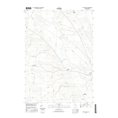
 2019 West Lowville2019 Print · USGSCovers Lowville, including Denmark, Martinsburg, and other nearby areas
 - 2019 Map of Lowville, 2019 Print
 2019 Lowville2019 Print · USGSCovers Lowville, including New Bremen, Denmark, and other nearby areas
 - 2023 Map of West Lowville, 2023 Print
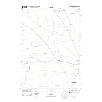
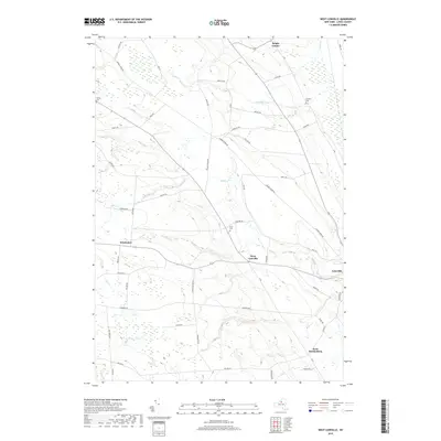
 2023 West Lowville2023 Print · USGSThe Lewis County uplands near West Lowville are shown here as they appeared in the early 2020s, reflecting a landscape of high-elevation farming and isolated hamlets. Genealogists can find landmarks like West Lowville Rural Cem and the crossroads at Briggs Corner.
 - 2023 Map of Lowville, 2023 Print
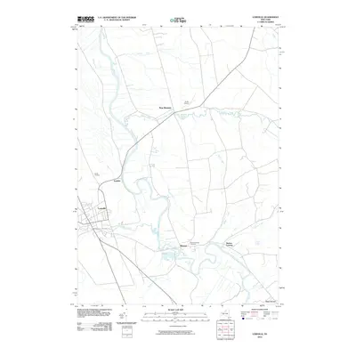
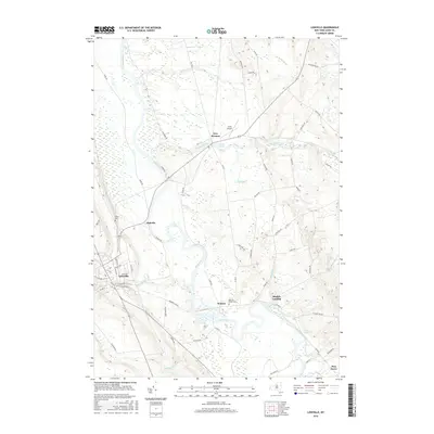
 2023 Lowville2023 Print · USGSThe Black River valley and the village of Lowville are documented in this contemporary survey of Lewis County. Trace local genealogy and landmarks from the Lewis County Courthouse to Beaches Bridge Cem and the settlement of New Bremen.
End of results
Showing maps 1-22 of 22
Top cities near Lowville
- Le Ray historical maps
- Wilna historical maps
- Champion historical maps
- Lowville historical maps
- Carthage historical maps
- Croghan historical maps
See more
Top neighborhoods of Lowville
Frequently asked questions
- What are the different types of historical maps available for Lowville?
- What is the oldest map of Lowville?
- Where can I purchase historical maps of Lowville for my home or office?
- Where can I download high-res historical maps of Lowville?
- Are there historical topographic maps available for Lowville?
- Is there historical aerial imagery available for Lowville?
- Where are historical maps of Lowville sourced from?