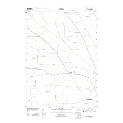
2013 Map of West Lowville
USGS Topo · Published 2013About this map
Harrisburg and West Lowville anchor this agricultural landscape in Lewis County, where a network of rural roads connects multi-generational farmsteads and small crossroads communities. The terrain is defined by the drainage patterns of Mill Cr and Negro Cr, which carve through the plateau towards the Black River valley to the east. Local history is etched into the land at Gallup Cem and Rural Cem, while active agriculture continues at named properties such as Northern Quest Farm and Riverjack Ranch. The map captures the quiet transition between the Tug Hill region and the valley floor, evidenced by the scattered settlements of Windecker and Briggs Corner. This survey provides a clear view of the rural infrastructure, including the reach of Number Three Rd and the recreational grounds of the Cedars Golf Course near the northern boundary.
Find a feature on this map
61 named features on this map. Tap any name to fly to it.
Don’t see what you’re looking for? This feature index may not catch every label — zoom into the map to look around manually.
Map Details
Editions of this 2013 West Lowville Map
This is the sole edition of this map. No revisions or reprints were ever made.
Other maps of this area

1902 · Carthage
USGS Topo · 1:62,500

1904 · Carthage
USGS Topo · 1:62,500

1905 · Port Leyden
USGS Topo · 1:62,500

1906 · Highmarket
USGS Topo · 1:62,500

1907 · Port Leyden
USGS Topo · 1:62,500

1911 · Lowville
USGS Topo · 1:62,500

1913 · Lowville
USGS Topo · 1:62,500

1940 · Port Leyden
USGS Topo · 1:62,500

1942 · Copenhagen
USGS Topo · 1:24,000

1943 · Copenhagen
USGS Topo · 1:31,680