1900s (20th Century) Maps of Livingston County, New York
Explore 72 historic maps of Livingston County from the 1900s (20th Century). These maps offer a rare glimpse into what life looked like during the 1900s — showing old roads, neighborhoods, homes, and landmarks that have changed or disappeared over time.
Whether you're researching your family's past, planning a metal detecting trip, or studying how Livingston County's landscape evolved across the 1900s, these high-resolution maps are a powerful tool for exploring the history of this region.
- Focus on a specific era: All maps on this page are from the 1900s, giving you a focused view of this time period.
- See what’s changed: Compare century-old streets, trails, and buildings to today's modern landscape using overlays and satellite layers.
- Research with precision: Use these maps for genealogy, historical research, land use analysis, or educational projects.
- View, download, or print: Maps are fully viewable online in high resolution, and can be downloaded or printed for your own records.
Start exploring Livingston County's history through authentic maps from the 1900s. This is your window into the past.
Livingston County, NY maps
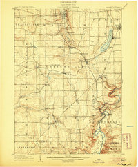
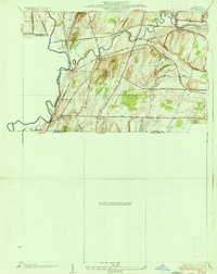
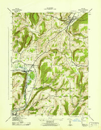
(72)- 1900 Map of Naples, 1956 Print
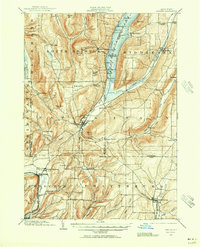 1900 Naples1956 Print · USGSCovers Livingston County, including Richmond, Naples, and other nearby areas2 unique versions available
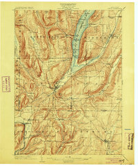
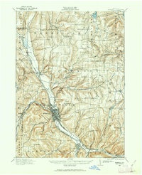
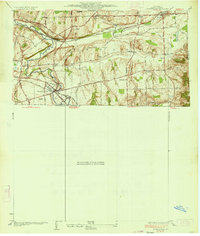
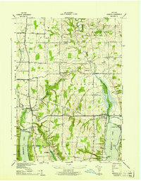
 - 1901 Map of Honeoye, 1954 Print
 1901 Honeoye1954 Print · USGSCovers Livingston County, including Geneseo, Mendon, and other nearby areas
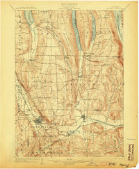
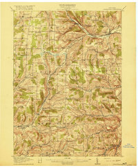
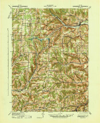
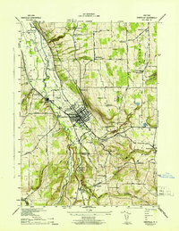
 - 1902 Map of Wayland, 1954 Print
 1902 Wayland1954 Print · USGSCovers Livingston County, including North Dansville, Dansville, and other nearby areas
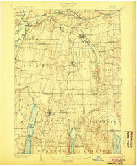
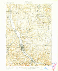
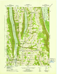
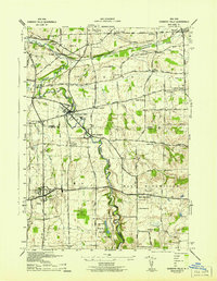
 - 1903 Map of Naples
 1903 Naples1903 Print · USGSCovers Livingston County, including Richmond, Naples, and other nearby areas7 unique versions available
 - 1904 Map of Wayland
 1904 Wayland1904 Print · USGSCovers Livingston County, including North Dansville, Dansville, and other nearby areas7 unique versions available
 - 1904 Map of Caledonia
 1904 Caledonia1904 Print · USGSCovers Livingston County, including Geneseo, LeRoy, and other nearby areas6 unique versions available
 - 1904 Map of Honeoye
 1904 Honeoye1904 Print · USGSCovers Livingston County, including Geneseo, Mendon, and other nearby areas6 unique versions available
 - 1905 Map of Portage
 1905 Portage1905 Print · USGSCovers Livingston County, including Perry, Warsaw, and other nearby areas6 unique versions available
 - 1905 Map of Nunda
 1905 Nunda1905 Print · USGSCovers Livingston County, including Perry, Mount Morris, and other nearby areas6 unique versions available
 - 1913 Map of Naples
 1913 Naples1913 Print · USGSCovers Livingston County, including Richmond, Naples, and other nearby areas
 - 1915 Map of Hornell, 1962 Print
 1915 Hornell1962 Print · USGSCovers Livingston County, including Hornell, Alfred, and other nearby areas
 - 1916 Map of Canaseraga
 1916 Canaseraga1916 Print · USGSCovers Livingston County, including Alfred, Alfred, and other nearby areas4 unique versions available
 - 1918 Map of Hornell
 1918 Hornell1918 Print · USGSCovers Livingston County, including Hornell, Alfred, and other nearby areas6 unique versions available
 - 1934 Map of Rush
 1934 Rush1934 Print · USGSCovers Livingston County, including Mendon, Avon, and other nearby areas2 unique versions available
 - 1934 Map of Honeoye Falls
 1934 Honeoye Falls1934 Print · USGSCovers Livingston County, including Mendon, Lima, and other nearby areas
 - 1940 Map of Canaseraga
 1940 Canaseraga1940 Print · USGSCovers Livingston County, including Alfred, Alfred, and other nearby areas2 unique versions available
 - 1942 Map of Springwater
 1942 Springwater1942 Print · USGSCovers Livingston County, including Richmond, Conesus, and other nearby areas5 unique versions available
 - 1942 Map of Wayland
 1942 Wayland1942 Print · USGSCovers Livingston County, including Wayland, Springwater, and other nearby areas
 - 1942 Map of Naples
 1942 Naples1942 Print · USGSCovers Livingston County, including Naples, Springwater, and other nearby areas4 unique versions available
 - 1942 Map of Honeoye
 1942 Honeoye1942 Print · USGSCovers Livingston County, including Livonia, Lima, and other nearby areas
 - 1942 Map of Dansville
 1942 Dansville1942 Print · USGSCovers Livingston County, including North Dansville, Dansville, and other nearby areas5 unique versions available
 - 1942 Map of Bristol Springs
 1942 Bristol Springs1942 Print · USGSCovers Livingston County, including Richmond, Naples, and other nearby areas
 - 1942 Map of Conesus
 1942 Conesus1942 Print · USGSCovers Livingston County, including Conesus, Groveland, and other nearby areas
 - 1942 Map of Honeoye Falls
 1942 Honeoye Falls1942 Print · USGSCovers Livingston County, including Mendon, Lima, and other nearby areas
 - 1942 Map of Livonia
 1942 Livonia1942 Print · USGSCovers Livingston County, including Geneseo, Livonia, and other nearby areas
Showing maps 1-25 of 72
Top cities of Livingston County
- Geneseo historical maps
- Livonia historical maps
- Avon historical maps
- North Dansville historical maps
- Mount Morris historical maps
- Lima historical maps
See more
Frequently asked questions
- What are the different types of historical maps available for Livingston County?
- What is the oldest map of Livingston County?
- Where can I purchase historical maps of Livingston County for my home or office?
- Where can I download high-res historical maps of Livingston County?
- Are there historical topographic maps available for Livingston County?
- Is there historical aerial imagery available for Livingston County?
- Where are historical maps of Livingston County sourced from?