1950s Maps of Groveland, New York
Explore 6 historic maps of Groveland from the 1950s. These maps offer a rare glimpse into what life looked like during the 1950s — showing old roads, neighborhoods, homes, and landmarks that have changed or disappeared over time.
Whether you're researching your family's past, planning a metal detecting trip, or studying how Groveland's landscape evolved across the 1950s, these high-resolution maps are a powerful tool for exploring the history of this region.
- Focus on a specific era: All maps on this page are from the 1950s, giving you a focused view of this time period.
- See what’s changed: Compare century-old streets, trails, and buildings to today's modern landscape using overlays and satellite layers.
- Research with precision: Use these maps for genealogy, historical research, land use analysis, or educational projects.
- View, download, or print: Maps are fully viewable online in high resolution, and can be downloaded or printed for your own records.
Start exploring Groveland's history through authentic maps from the 1950s. This is your window into the past.
Groveland, NY maps
(6)- 1950 Map of Elmira
 1950 Elmira1950 Print · USGSThe Finger Lakes region thrived in the late 1940s as a hub of industry and transport. Trace family roots and vanished landmarks near Seneca Lake or explore the rail lines of the Erie RR and the sprawling Seneca Ordnance Depot.2 unique versions available
 - 1950 Map of Geneseo, 1952 Print
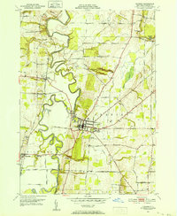 1950 Geneseo1952 Print · USGSMid-century Livingston County centers on the winding Genesee River and the expanding village of Geneseo. Genealogists and local historians can trace legacy sites like Temple Hill Cemetery, the State Teachers College, and the rail lines serving the Salt Mines (Inactive).4 unique versions available
 - 1951 Map of Livonia, 1952 Print
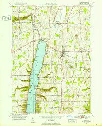 1951 Livonia1952 Print · USGSLakeside life and rail travel meet in the early fifties as the shores of Conesus Lake begin to fill with cottages and landings. Researchers can trace family sites near Livonia Center or locate rural landmarks like Mt Pleasant Cem and the Erie RR line.4 unique versions available
 - 1951 Map of Caledonia, 1956 Print
 1951 Caledonia1956 Print · USGSThe Genesee Valley flourished as a rail crossroads in the early fifties, where five major lines converged near the river. Local historians can trace family-named corners and rural institutions like St Columbus Ch, Machpelah Cem, and Retsof Central Sch.2 unique versions available
 - 1957 Map of Conesus
 1957 Conesus1957 Print · USGSMid-century Livingston County comes to life here as the Finger Lakes region balances lakeside recreation with deep-rooted agricultural life. Trace historic family sites and district schoolhouses from St Michaels Mission down to Websters Crossing and the Lakeview Cem shoreline.
 - 1958 Map of Elmira
 1958 Elmira1958 Print · USGSThe New York Finger Lakes during the late fifties reveal a complex landscape of glacial geology and industrial growth. Researchers can trace historic transport corridors like the Erie Canal and Erie RR, or locate institutional landmarks like Cornell University.2 unique versions available
End of results
Showing maps 1-6 of 6
Top cities near Groveland
- Geneseo historical maps
- Geneseo historical maps
- Livonia historical maps
- Avon historical maps
- Perry historical maps
- North Dansville historical maps
See more
Top neighborhoods of Groveland
- Maple Beach historical maps
- East Groveland historical maps
- Groveland Corners historical maps
- Sonyea historical maps
- Cottonwood Point historical maps
Frequently asked questions
- What are the different types of historical maps available for Groveland?
- What is the oldest map of Groveland?
- Where can I purchase historical maps of Groveland for my home or office?
- Where can I download high-res historical maps of Groveland?
- Are there historical topographic maps available for Groveland?
- Is there historical aerial imagery available for Groveland?
- Where are historical maps of Groveland sourced from?