1900s (20th Century) Maps of Cazenovia, New York
Explore 26 historic maps of Cazenovia from the 1900s (20th Century). These maps offer a rare glimpse into what life looked like during the 1900s — showing old roads, neighborhoods, homes, and landmarks that have changed or disappeared over time.
Whether you're researching your family's past, planning a metal detecting trip, or studying how Cazenovia's landscape evolved across the 1900s, these high-resolution maps are a powerful tool for exploring the history of this region.
- Focus on a specific era: All maps on this page are from the 1900s, giving you a focused view of this time period.
- See what’s changed: Compare century-old streets, trails, and buildings to today's modern landscape using overlays and satellite layers.
- Research with precision: Use these maps for genealogy, historical research, land use analysis, or educational projects.
- View, download, or print: Maps are fully viewable online in high resolution, and can be downloaded or printed for your own records.
Start exploring Cazenovia's history through authentic maps from the 1900s. This is your window into the past.
Cazenovia, NY maps
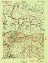
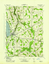
(26)- 1902 Map of Chittenango
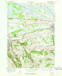
 1902 Chittenango1902 Print · USGSMadison and Onondaga Counties are shown at a peak of rail and canal activity in the early 1900s. Genealogists and historians can trace the path of the Erie Canal through Canastota or locate smaller locales like Fyler Settlement and Quality Hill.7 unique versions available
 - 1942 Map of Oran, 1957 Print
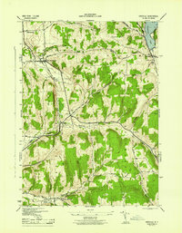
 1942 Oran1957 Print · USGSUpper Onondaga County during the early 1940s is mapped here with a focus on its steep ravines and rural school districts. Genealogists and hikers can trace old property boundaries near Delphi Falls, locate the Indian Hill Memorial, or find family plots like Sharp Cem.
 - 1943 Map of Manlius
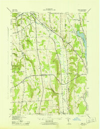
 1943 Manlius1943 Print · USGSOnondaga County in the early 1940s reveals a landscape where historic waterways meet modern rail and air infrastructure. Researchers can trace the paths of the Old Erie Canal, locate the Manlius Academy, and explore rural sites like Fyler Settlement.2 unique versions available
 - 1943 Map of Oran
 1943 Oran1943 Print · USGSOnondaga County's rural landscape is captured during the war years, showing a network of small schoolhouses and family cemeteries across the uplands. Genealogists and local historians can trace legacy landmarks like Indian Hill Memorial, Southwell Cem, and the old Manlius Sch.2 unique versions available
 - 1943 Map of De Ruyter, 1958 Print
 1943 De Ruyter1958 Print · USGSUpper New York State’s high country at the start of the 1940s shows a landscape of ridge-top farms and valley rail lines. Trace the Lehigh Valley Railroad corridor past De Ruyter Reservoir and find vanished district sites like School No 11 and Cowles Settlement.4 unique versions available
 - 1943 Map of Cazenovia, 1958 Print
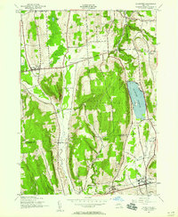
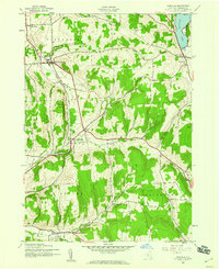
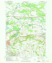
 1943 Cazenovia1958 Print · USGSMadison County at the height of the 1940s reveals a landscape of thriving crossroads and lakeside life. Genealogists and historians can trace family-named sites like Abell Corners, local landmarks like Copstine Bridge, and the historic Welsh Ch.4 unique versions available
 - 1943 Map of Erieville, 1960 Print
 1943 Erieville1960 Print · USGSMadison County's rural landscapes and railroad villages are frozen in time during the early 1940s. Genealogists can trace family roots through landmarks like Quaker Settlement, Allard Cem, and the old depot at Delphi Sta.2 unique versions available
 - 1944 Map of Erieville
 1944 Erieville1944 Print · USGSMadison County's rolling hills and rail-dependent hamlets are captured here during the 1940s. Genealogists and local historians can trace the Lehigh Valley line through Delphi Station or locate family roots near Quaker Settlement and Allard Cem.
 - 1944 Map of Cazenovia
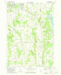
 1944 Cazenovia1944 Print · USGSMadison County's rolling farmland and lakefront properties are meticulously captured in the mid-1940s. Genealogists and historians can trace family locations at Rowan Corners, locate rural burial sites like Ballou Cem, and explore the grounds of Chittenango Falls State Park.
 - 1944 Map of De Ruyter
 1944 De Ruyter1944 Print · USGSCentral New York during the mid-forties reveals a rural landscape shaped by upland ridges and the Lehigh Valley RR. Genealogists can locate family names at Burdick Cem and trace district schoolhouses from Cowles Settlement to Vincent Corners.
 - 1946 Map of Canastota
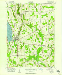
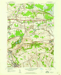
 1946 Canastota1946 Print · USGSMadison County at the close of the war reveals a landscape shaped by three generations of canal and rail transit. Genealogists and local historians can trace the paths of the Old Erie (Abandoned) Canal and the Lehigh Valley railroad near Chittenango and Perryville.2 unique versions available
 - 1948 Map of Binghamton, 1980 Print
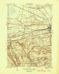
 1948 Binghamton1980 Print · USGSCentral New York and the Southern Tier thrive in the late 1940s as a hub of rail traffic and mountain industry. Researchers can trace historic transit lines like the Erie Railroad through Binghamton or find old valley settlements near Oneonta and Delhi.
 - 1950 Map of Binghamton
 1950 Binghamton1950 Print · USGSBinghamton and the surrounding Southern Tier are shown in the mid-century era, highlighting the intricate rail and river networks that drove local industry. Researchers can trace the path of the Erie Railroad and locate landmarks from Otsego Lake to Sidney Mountain.2 unique versions available
 - 1950 Map of Utica, 1951 Print
 1950 Utica1951 Print · USGSCentral New York in the post-war era showcases the industrial Mohawk Valley and the pristine Adirondack interior. Researchers can trace transportation networks like the New York Central Railroad and find early Cold War sites such as Griffiss Air Force Base.
 - 1957 Map of Utica
 1957 Utica1957 Print · USGSCentral New York and the Adirondack foothills are captured here in the mid-fifties, showing a landscape defined by the Mohawk River corridor and the growing highway system. Genealogists and researchers can trace the rail lines of the New York Central and locate communities from Lowville to Gloversville.
 - 1957 Map of Canastota, 1959 Print
 1957 Canastota1959 Print · USGSMadison County in the late fifties shows a landscape shaped by water and iron, from the valley floor to the southern uplands. Researchers can trace the dual paths of the Erie Canal and New York Central Railroad through Canastota and Chittenango Springs.3 unique versions available
 - 1957 Map of Manlius, 1959 Print
 1957 Manlius1959 Print · USGSCentral New York is captured here during the mid-century suburban expansion across the Onondaga and Madison county line. You can trace the remnants of the Old Erie Canal alongside the New York State Thruway and find vanished local landmarks like Bennett Airport and Fyler Settlement.2 unique versions available
 - 1958 Map of Binghamton
 1958 Binghamton1958 Print · USGSCentral New York in the late fifties was a network of manufacturing cities and river valleys connected by vital rail lines. Genealogists and historians can trace family roots in Oneonta, Norwich, and Cooperstown or locate long-standing farms along Schoharie Creek.
 - 1962 Map of Utica
 1962 Utica1962 Print · USGSCentral New York and the Adirondack wilderness are captured here during the mid-century era of highway and industrial expansion. Genealogists and historians can trace the development of the New York State Thruway and local rail lines connecting Utica, Rome, and Gloversville.3 unique versions available
 - 1963 Map of Binghamton
 1963 Binghamton1963 Print · USGSThe Southern Tier and Catskill peaks are shown in the early sixties as new reservoirs reshaped the valleys. Trace historic rail corridors like the Erie Lackawanna RR and explore lakeside settlements such as Cooperstown and Oneonta.
 - 1964 Map of Utica
 1964 Utica1964 Print · USGSCentral New York and the high wilderness of the Adirondacks are captured here during the post-war era of infrastructure expansion. Researchers can trace the development of the New York State Thruway alongside historic corridors like the Oneida Lake (Barge Canal Route) and the N. Y. Central railroad.
 - 1967 Map of Utica
 1967 Utica1967 Print · USGSCentral New York's industrial Mohawk Valley meets the Adirondack wilderness in the 1960s, showing the region's transition from manufacturing hubs to state-managed parklands. Trace historic settlements and sites like Griffiss Air Force Base, Colgate University, and the Lyons Falls Paper Mill.
 - 1973 Map of Oran, 1975 Print
 1973 Oran1975 Print · USGSSoutheast of Syracuse in the 1970s, the rural landscapes of Manlius and Pompey reveal a network of upland farms and deep wooded gulfs. Genealogists and local historians can trace family-named crossroads like Clough Corners, visit Pratts Falls Co Park, or follow the Old Railroad Grade through Oran.2 unique versions available
 - 1973 Map of Manlius, 1975 Print
 1973 Manlius1975 Print · USGSOnondaga County in the early seventies shows the intersection of historic canal routes and modern suburban growth. Genealogists and historians can locate family landmarks like Fyler Settlement, Tuscarora Cem, and the path of the Old Erie Canal.4 unique versions available
 - 1985 Map of Utica, 1986 Print
 1985 Utica1986 Print · USGSThe Mohawk Valley in the mid-eighties shows a landscape of industrial river cities and high-tech military hubs before the post-Cold War transition. Trace the development of Rome and Utica, the operations at Griffiss Air Force Base, and the lakeside activity at Oneida Lake.2 unique versions available
Showing maps 1-25 of 26
Top cities near Cazenovia
- Syracuse historical maps
- Manlius historical maps
- Cicero historical maps
- DeWitt historical maps
- De Witt historical maps
- Sullivan historical maps
See more
Top neighborhoods of Cazenovia
- Union historical maps
- Abell Corners historical maps
- Ballina historical maps
- North Cazenovia historical maps
- Rippleton historical maps
- New Woodstock historical maps
See more
Frequently asked questions
- What are the different types of historical maps available for Cazenovia?
- What is the oldest map of Cazenovia?
- Where can I purchase historical maps of Cazenovia for my home or office?
- Where can I download high-res historical maps of Cazenovia?
- Are there historical topographic maps available for Cazenovia?
- Is there historical aerial imagery available for Cazenovia?
- Where are historical maps of Cazenovia sourced from?