Old Maps of Ransomville, New York for Hiking & Exploration
Hike through history with 29 historic maps of Ransomville. Explore old trails, ghost towns, and forgotten backroads — perfect for outdoor adventurers and local explorers.
- Rediscover forgotten places: Map out old mining camps, roads, and footpaths that no longer exist on modern maps.
- Layer with modern tools: Combine with LiDAR or satellite views to plan hikes through historical terrain.
- Made for exploration: Popular among hikers, overlanders, and local history lovers.
Use these maps to find adventure and explore the hidden past of Ransomville.
Ransomville, NY maps
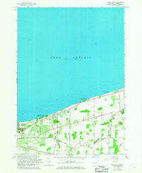
(29)- 1894 Map of Wilson
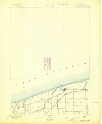 1894 Wilson1894 Print · USGSNiagara County's lakefront comes alive in the late nineteenth century as a thriving coastal and rail corridor. Genealogists can trace family lands near Wilson, North Wilson, and the Rome Watertown and Ogdensburg Station.2 unique versions available
 - 1897 Map of Tonawanda
 1897 Tonawanda1897 Print · USGSNiagara and Erie counties thrived at the close of the nineteenth century as vital corridors of commerce. Genealogists and historians can trace the early rail networks through Pekin or locate riverside landmarks like Sour Spring Grove and the Erie Canal.
 - 1899 Map of Niagara
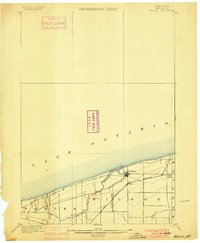
 1899 Niagara1899 Print · USGSThe Niagara Frontier is mapped here in the late nineteenth century as a bustling corridor of trade and transport. Researchers can trace the path of the Erie Canal through Lockport or locate early rural settlements like Ransomville and the Tuscarora Indian Reservation.6 unique versions available
 - 1900 Map of Wilson
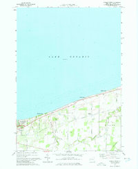
 1900 Wilson1900 Print · USGSNiagara County's shoreline at the turn of the century shows a landscape of established orchards and quiet lakefront ports. Genealogists can trace the early layout of Wilson and North Wilson or locate the Rome Watertown and Ogdensburg Station along the rail line.5 unique versions available
 - 1900 Map of Tonawanda
 1900 Tonawanda1900 Print · USGSNiagara County and northern Erie County are shown at the turn of the century as the Erie Canal and heavy rail lines drove the growth of the North Tonawanda lumber and shipping hub. Genealogists can trace family footprints in outlying hamlets like Bergholtz, Ransomville, and Martinsville.
 - 1901 Map of Tonawanda
 1901 Tonawanda1901 Print · USGSAt the turn of the century, the Niagara Frontier was a powerhouse of canal and rail transit. Genealogists can trace family footprints in settlements like Sanborn, Martinsville, and Bergholtz, or follow the original path of the ERIE CANAL through Tonawanda.7 unique versions available
 - 1948 Map of Tonawanda, 1953 Print
 1948 Tonawanda1953 Print · USGSNiagara and Erie counties are shown here just after the war, where the Niagara River meets the historic Erie Canal. Genealogists and local historians can trace the early layout of North Tonawanda or locate family sites at Molyneaux Corners and Colonial Village.3 unique versions available
 - 1948 Map of Wilson, 1956 Print
 1948 Wilson1956 Print · USGSNiagara County's Lake Ontario shoreline comes alive in the late 1940s, showcasing a network of summer beach colonies and inland farming hamlets. Trace family roots at Greenwood Cem, locate the old School No 8, or follow the New York Central tracks through Wilson.2 unique versions available
 - 1949 Map of Sixmile Creek
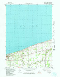
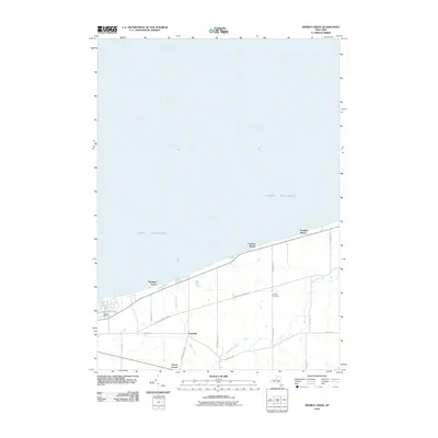
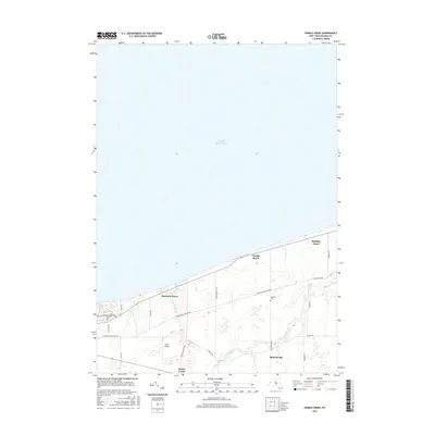
 1949 Sixmile Creek1949 Print · USGSThe Lake Ontario shoreline in Niagara County remained a mix of quiet fruit orchards and summer beaches in the years following World War II. Genealogists and local historians can trace the rural landscape through Filmore Chapel Cem, family-named tracts like Harrison Grove, and old routes like Braley Road.
 - 1950 Map of Ransomville
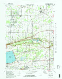
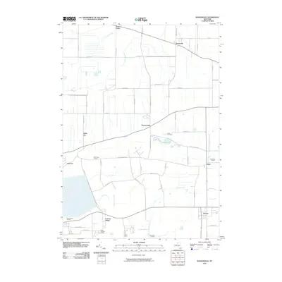
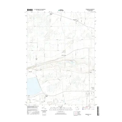
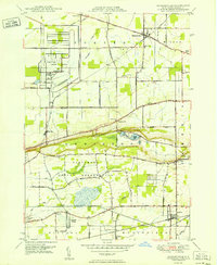 1950 Ransomville1950 Print · USGSMid-century Niagara County is captured here at a time when the Tuscarora Indian Reservation and the New York Central Railroad defined the local landscape. Genealogists can trace family footprints through numerous rural landmarks like St Michaels Cem, Model City, and School No 11.
 - 1952 Map of Toronto, 1954 Print
 1952 Toronto1954 Print · USGSLake Ontario and the international border define this mid-century landscape of rapid industrial and suburban growth. Researchers can trace the vital shipping and rail corridors of the era, from the Welland Canal to the New York Central Railroad.
 - 1962 Map of Toronto, 1982 Print
 1962 Toronto1982 Print · USGSThe Golden Horseshoe and the Niagara Frontier meet in this early 1960s study of a growing international border region. Trace the path of the Welland Canal and locate land marks like the Scarborough Bluffs and Tuscarora Indian Reservation.
 - 1965 Map of Toronto
 1965 Toronto1965 Print · USGSThe Golden Horseshoe and Niagara Frontier are shown in detail during the early sixties, highlighting the international shipping and transit networks. Trace the path of the Erie Canal, the Welland Canal, and rail lines connecting Toronto and Niagara Falls.2 unique versions available
 - 1965 Map of Ransomville, 1968 Print
 1965 Ransomville1968 Print · USGSNiagara County was undergoing a steady transition in the 1960s as local industry and suburban growth met long-standing farming communities. Genealogists and historians can trace the borders of the Tuscarora Indian Reservation or locate family sites near Model City and Sanborn.
 - 1965 Map of Sixmile Creek, 1968 Print
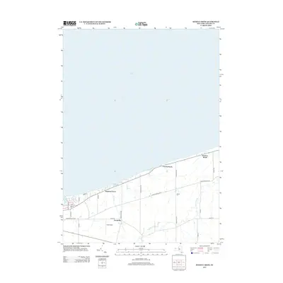
 1965 Sixmile Creek1968 Print · USGSThe Niagara County shoreline meets the southern reaches of Lake Ontario during the mid-sixties, showing a landscape shaped by rural roads and quiet lakeside retreats. Researchers can locate family landmarks like Oakland Cem, Filmore Chapel, and the small community at Uneeda Beach.
 - 1973 Map of Sixmile Creek, 1975 Print
 1973 Sixmile Creek1975 Print · USGSThe Niagara County shoreline meets the southern reaches of Lake Ontario in the early seventies, showcasing a landscape of seasonal beaches and rural townships. Researchers can trace family history through sites like Oakland Cem, explore the early boundaries of Porter, or locate the Penn Central rail line near Braley.
 - 1974 Map of Sixmile Creek, 1980 Print
 1974 Sixmile Creek1980 Print · USGSNiagara County's northern shoreline comes into focus in the mid-1970s, showing the intersection of coastal recreation and agricultural life. Researchers can trace local lineage through Filmore Chapel and Halsted Cem, or explore the development of Harrison Grove and Uneeda Beach.
 - 1980 Map of Ransomville
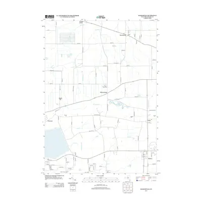
 1980 Ransomville1980 Print · USGSNiagara County's agricultural and industrial character is preserved here in the early eighties, from the Lake Ontario plains to the Tuscarora escarpment. Trace local family roots and historical land use through landmarks like Mt Hope Cem, the settlement at Model City, and the Tuscarora Indian Reservation.2 unique versions available
 - 1984 Map of Lockport, 1985 Print
 1984 Lockport1985 Print · USGSWestern New York in the 1980s shows a landscape of lakefront parks, industrial rail corridors, and vast protected wetlands. Genealogists and historians can trace the legacy of local families through sites like Acacia Park Cem or the Tuscarora Indian Reservation.2 unique versions available
 - 2010 Map of Ransomville, 2010 Print
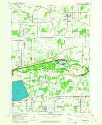
 2010 Ransomville2010 Print · USGSCovers Ransomville, including Wheatfield, Lewiston, and other nearby areas
 - 2010 Map of Sixmile Creek, 2010 Print
 2010 Sixmile Creek2010 Print · USGSCovers Ransomville, including Porter, Wilson, and other nearby areas
 - 2013 Map of Ransomville, 2013 Print
 2013 Ransomville2013 Print · USGSCovers Ransomville, including Wheatfield, Lewiston, and other nearby areas
 - 2013 Map of Sixmile Creek, 2013 Print
 2013 Sixmile Creek2013 Print · USGSCovers Ransomville, including Porter, Wilson, and other nearby areas
 - 2016 Map of Sixmile Creek, 2016 Print
 2016 Sixmile Creek2016 Print · USGSCovers Ransomville, including Porter, Wilson, and other nearby areas
 - 2016 Map of Ransomville, 2016 Print
 2016 Ransomville2016 Print · USGSCovers Ransomville, including Wheatfield, Lewiston, and other nearby areas
Showing maps 1-25 of 29
Top cities near Ransomville
- Amherst historical maps
- Tonawanda historical maps
- Niagara Falls historical maps
- Clarence historical maps
- North Tonawanda historical maps
- Grand Island historical maps
See more
Frequently asked questions
- What are the different types of historical maps available for Ransomville?
- What is the oldest map of Ransomville?
- Where can I purchase historical maps of Ransomville for my home or office?
- Where can I download high-res historical maps of Ransomville?
- Are there historical topographic maps available for Ransomville?
- Is there historical aerial imagery available for Ransomville?
- Where are historical maps of Ransomville sourced from?