2020s Maps of Ransomville, New York
Explore 2 historic maps of Ransomville from the 2020s. These maps offer a rare glimpse into what life looked like during the 2020s — showing old roads, neighborhoods, homes, and landmarks that have changed or disappeared over time.
Whether you're researching your family's past, planning a metal detecting trip, or studying how Ransomville's landscape evolved across the 2020s, these high-resolution maps are a powerful tool for exploring the history of this region.
- Focus on a specific era: All maps on this page are from the 2020s, giving you a focused view of this time period.
- See what’s changed: Compare century-old streets, trails, and buildings to today's modern landscape using overlays and satellite layers.
- Research with precision: Use these maps for genealogy, historical research, land use analysis, or educational projects.
- View, download, or print: Maps are fully viewable online in high resolution, and can be downloaded or printed for your own records.
Start exploring Ransomville's history through authentic maps from the 2020s. This is your window into the past.
Ransomville, NY maps
(2)- 2023 Map of Sixmile Creek, 2023 Print
 2023 Sixmile Creek2023 Print · USGSNiagara County's northern shore meets the Great Lakes in the early twenty-first century, showing a landscape of small coastal hamlets and inland creek valleys. Researchers can trace local landmarks from Ransomville up to the shoreline at Uneeda Beach and Harrison Grove.
 - 2023 Map of Ransomville, 2023 Print
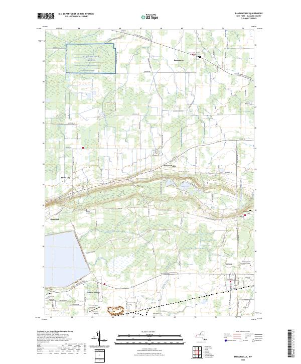 2023 Ransomville2023 Print · USGSNiagara County's rural landscape comes into focus in this contemporary survey of the hamlets and farms north of the Niagara Escarpment. Researchers can locate early burial sites like Mount Hope Cem and trace the development of Model City and Sanborn.
End of results
Showing maps 1-2 of 2
Top cities near Ransomville
- Amherst historical maps
- Tonawanda historical maps
- Niagara Falls historical maps
- Clarence historical maps
- North Tonawanda historical maps
- Grand Island historical maps
See more
Frequently asked questions
- What are the different types of historical maps available for Ransomville?
- What is the oldest map of Ransomville?
- Where can I purchase historical maps of Ransomville for my home or office?
- Where can I download high-res historical maps of Ransomville?
- Are there historical topographic maps available for Ransomville?
- Is there historical aerial imagery available for Ransomville?
- Where are historical maps of Ransomville sourced from?