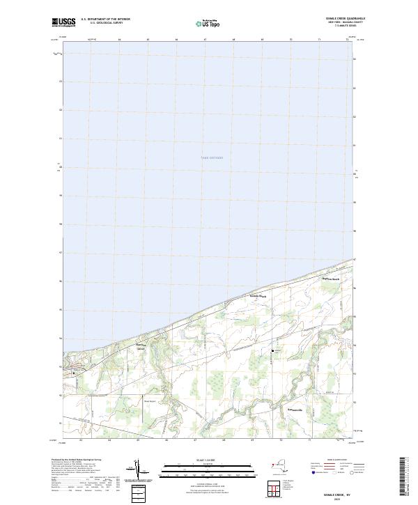
2023 Map of Sixmile Creek
USGS Topo · Published 2023About this map
Lake Ontario defines the northern horizon of this Niagara County landscape, where the shoreline is punctuated by small coastal settlements like Uneeda Beach and Hopkins Beach. Moving inland, the terrain is shaped by the southward reach of Sixmile Creek and Twelvemile Creek, which cut through a predominantly agricultural and residential region. The hamlet of Ransomville serves as a local hub in the southeastern corner, connected to the lakefront by a grid of rural roads such as Ransomville Rd and Dickersonville Rd.
Find a feature on this map
28 named features on this map. Tap any name to fly to it.
Don’t see what you’re looking for? This feature index may not catch every label — zoom into the map to look around manually.
Map Details
Editions of this 2023 Sixmile Creek Map
This is the sole edition of this map. No revisions or reprints were ever made.
Other maps of this area

1894 · Niagara Falls
USGS Topo · 1:62,500

1894 · Wilson
USGS Topo · 1:62,500

1896 · Niagara Falls
USGS Topo · 1:62,500

1897 · Tonawanda
USGS Topo · 1:62,500

1899 · Niagara
USGS Topo · 1:125,000

1900 · Wilson
USGS Topo · 1:62,500

1900 · Tonawanda
USGS Topo · 1:62,500

1900 · Niagara Falls
USGS Topo · 1:62,500

1901 · Niagara Falls
USGS Topo · 1:62,500

1901 · Tonawanda
USGS Topo · 1:62,500