Old Maps of Rome, New York for Metal Detecting
Plan your next treasure hunt with 65 historic maps of Rome. Find old homesites, ghost towns, trails, and gathering spots that may be lost to time — perfect for identifying promising metal detecting locations.
- Locate forgotten sites: Uncover places like long-lost settlements, abandoned rail lines, or gathering spots.
- Plan better hunts: Use map overlays combined with LiDAR or satellite views to narrow in on historically rich areas.
- Made for detectorists: Thousands of hobbyists use these maps to discover relics, coins, and hidden history.
Use these historic maps to boost your research and find new opportunities beneath the surface of Rome.
Rome, NY maps
(65)- 1895 Map of Oriskany
 1895 Oriskany1895 Print · USGSOneida County at the end of the nineteenth century reveals a landscape defined by the great Mohawk valley canals and emerging industrial hamlets. Researchers can trace the path of the Erie Canal, find the Franklin Iron Works, and locate early educational landmarks like College Hill.
 - 1895 Map of Oneida
 1895 Oneida1895 Print · USGSIn the 1890s, the landscape around Oneida was a busy hub of canal engineering and railway expansion. Genealogists and historians can trace the evolution of the Erie Canal, find the storied Oneida Community, or locate the historic site of Fort Bull.
 - 1898 Map of Oneida
 1898 Oneida1898 Print · USGSCentral New York at the end of the nineteenth century served as a vital crossroads of early American industry and canal technology. Genealogists and historians can trace the footprint of the Oneida Community, the fortifications of Fort Bull, and the intricate paths of the Erie Canal and Old Oneida Lake Canal.
 - 1898 Map of Oriskany
 1898 Oriskany1898 Print · USGSOneida County at the close of the nineteenth century reveals a landscape defined by the intersection of the Erie Canal and major rail lines. Genealogists can trace family homes in Spencer Settlement, locate industrial sites like Hecla Works, or find the historic Oriskany Battle Monument.10 unique versions available
 - 1902 Map of Oneida
 1902 Oneida1902 Print · USGSMadison and Oneida Counties at the turn of the century show a landscape defined by utopian heritage and a complex network of waterways. Genealogists and historians can trace the foundations of the Oneida Community, the path of the Erie Canal, and landmarks like Fort Bull.6 unique versions available
 - 1904 Map of Boonville
 1904 Boonville1904 Print · USGSOneida County at the start of the twentieth century was defined by its water and rail networks, dominated by the Black River Canal and the N. Y. C. and H. R. R. R. Trace the early layout of Boonville and rural settlements like Westernville or North Western.6 unique versions available
 - 1905 Map of Taberg
 1905 Taberg1905 Print · USGSOneida and Lewis Counties come alive at the turn of the century as a landscape of timber mills and rail junctions. Genealogists and local historians can trace family locations through named hamlets like Empeyville East Florence PO and Taberg, or follow the industrial paths of the Lehigh Valley RR.6 unique versions available
 - 1939 Map of Oneida
 1939 Oneida1939 Print · USGSMadison and Oneida Counties are shown during a period of transition for New York's vital inland waterways and rail lines. Genealogists and historians can trace the paths of the Erie Canal and Old Oneida Lake Canal through settlements like Oneida Castle, Durhamville, and Verona.
 - 1943 Map of Camden East
 1943 Camden East1943 Print · USGSOneida County at the height of the Second World War reveals a landscape of thriving rural hamlets and intricate river systems. Genealogists and historians can trace local families through many rural schoolhouses and cemeteries like St Johns Cem and the Old Protestant Cem.
 - 1943 Map of Lee Center
 1943 Lee Center1943 Print · USGSOneida County in the early 1940s reveals a landscape of small hamlets and rural school districts connected by the winding Fish Creek. Genealogists can trace family homesteads near Lee Center, Taberg, and numerous historic burials like Hall Cem and Link Cem.
 - 1946 Map of Oneida, 1952 Print
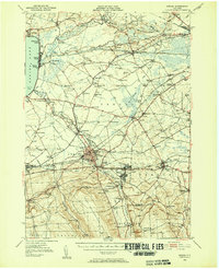 1946 Oneida1952 Print · USGSIn the mid-1940s, the corridor between Oneida Lake and the Erie Canal was a landscape of manufacturing towns and lakeside resorts. Genealogists and historians can trace the foundations of local communities through named landmarks like Oneida Castle, Irish Ridge Ch, and the Indian Sch.3 unique versions available
 - 1947 Map of Sylvan Beach
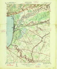 1947 Sylvan Beach1947 Print · USGSThe eastern shores of Oneida Lake in the late 1940s showcase a landscape of canal towns and lakefront resorts. Genealogists can trace family names through landmarks like Irish Ridge Ch, Grove Cem, and numerous schoolhouses including Maple Grove Sch.
 - 1947 Map of Westernville
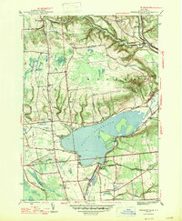 1947 Westernville1947 Print · USGSThe Mohawk River valley in the late 1940s centers on the Delta Reservoir and the community of Westernville. Researchers can locate several family-named landmarks and local burial grounds like Rogers Cem and Polish Cem.2 unique versions available
 - 1947 Map of Rome, 1952 Print
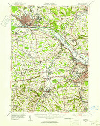 1947 Rome1952 Print · USGSMid-century Oneida County is captured here during the height of its industrial and military significance. Researchers can trace the paths of the Old Erie Canal, locate family roots near St Johns Cem, or study the grounds of Hamilton College.3 unique versions available
 - 1948 Map of Verona
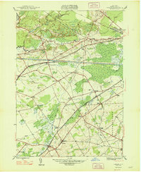 1948 Verona1948 Print · USGSOneida County in the late 1940s reveals a landscape defined by the transition between old and new transit corridors. You can trace family homesteads near Stacy Basin, locate local schools like Sand Hill Sch, and follow the path of the Erie Canal (Abandoned).
 - 1949 Map of Oriskany
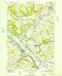 1949 Oriskany1949 Print · USGSOneida County in the late 1940s reveals a landscape shaped by the Mohawk River and the historic canal systems. Local historians can trace the paths of the Erie Canal, find family burial sites at Townsend Cem, and locate the Oriskany Battle Mon.
 - 1949 Map of Rome
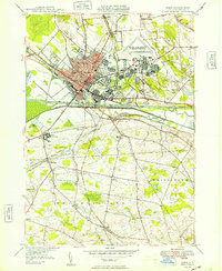 1949 Rome1949 Print · USGSRome was a bustling transportation and military hub in the late 1940s, where the Mohawk River valley met the industrial age. Local historians can trace the massive Rome Air Depot, the path of the BARGE CANAL, and long-standing family locales like Wright Settlement.
 - 1950 Map of Utica, 1951 Print
 1950 Utica1951 Print · USGSCentral New York in the post-war era showcases the industrial Mohawk Valley and the pristine Adirondack interior. Researchers can trace transportation networks like the New York Central Railroad and find early Cold War sites such as Griffiss Air Force Base.
 - 1955 Map of Westernville, 1957 Print
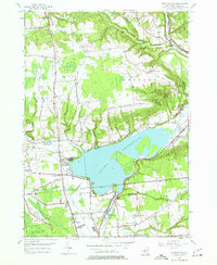 1955 Westernville1957 Print · USGSOneida County in the mid-fifties is captured here as a landscape of highland farms and state forests surrounding the expansive Delta Reservoir. Genealogists and local historians can trace rural schoolhouses like Lorena Sch, family cemeteries such as Welsh Cem, and the early footprint of the Jervis Test Site.5 unique versions available
 - 1955 Map of Verona, 1957 Print
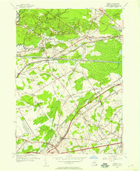 1955 Verona1957 Print · USGSOneida County's mid-century landscape is captured here as the modern thruway era begins to reshape traditional canal and rail corridors. Genealogists and historians can trace family-named crossroads like Cagwin Corners or locate the Sand Plains Chapel and Hazard Cem.3 unique versions available
 - 1955 Map of Camden East, 1957 Print
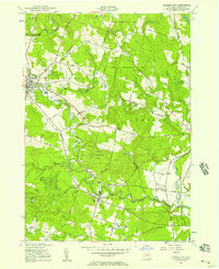 1955 Camden East1957 Print · USGSOneida County in the mid-fifties shows a landscape of growing villages and managed woodlands along the West Branch Fish Cr. Researchers can trace old family roads and schools or locate ancestral sites at Forest Park Cem, Old Protestant Cem, or the rural crossing at Blenness Corner.3 unique versions available
 - 1955 Map of Rome, 1957 Print
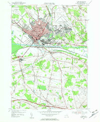 1955 Rome1957 Print · USGSMid-century Rome and its surrounding Oneida County townships are shown here during a period of significant military and industrial expansion. Genealogists and historians can trace local landmarks like Ft Stanwix, the sprawling Griffiss Air Force Base, and rural communities such as Spencer Settlement.4 unique versions available
 - 1955 Map of Lee Center, 1957 Print
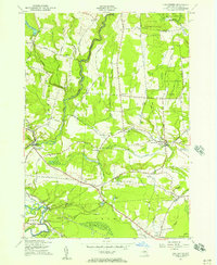 1955 Lee Center1957 Print · USGSMid-century Oneida County comes to life in this mid-fifties survey of the countryside north of Rome. Researchers can trace rural life through numerous numbered schoolhouses, the Griffiss Air Force Base boundary, and old hamlets like Glenmore and Becks Grove.3 unique versions available
 - 1955 Map of Oriskany, 1957 Print
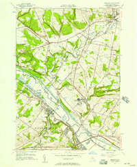 1955 Oriskany1957 Print · USGSThe Mohawk Valley in the mid-1950s shows a dense intersection of industrial history and Cold War-era expansion. Local historians can trace the path of the Erie Canal past Oriskany or locate the U S Mil Res Floyd Test Site and the State Hospital.2 unique versions available
 - 1955 Map of Sylvan Beach, 1958 Print
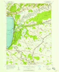 1955 Sylvan Beach1958 Print · USGSOneida Lake’s eastern shore comes to life mid-century, where the Erie Canal and Fish Creek intersect near growing resort communities. Genealogists and researchers can trace family landmarks like Stone Sch, Irish Ridge Ch, and the grounds of Verona Beach State Park.4 unique versions available
Showing maps 1-25 of 65
Top cities near Rome
- Utica historical maps
- New Hartford historical maps
- Whitestown historical maps
- Oneida historical maps
- Kirkland historical maps
- Marcy historical maps
See more
Top neighborhoods of Rome
- Liberty Gardens historical maps
- Lynch Tract historical maps
- Mohawk Gardens historical maps
- Ridge Mills historical maps
- Riverdale historical maps
- Bloomfield Park historical maps
See more
Frequently asked questions
- What are the different types of historical maps available for Rome?
- What is the oldest map of Rome?
- Where can I purchase historical maps of Rome for my home or office?
- Where can I download high-res historical maps of Rome?
- Are there historical topographic maps available for Rome?
- Is there historical aerial imagery available for Rome?
- Where are historical maps of Rome sourced from?