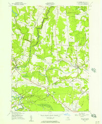
1955 Map of Lee Center
USGS Topo · Published 1957About this map
Lee Center and the surrounding townships of Annsville and Lee define this 1955 landscape, where a transition from upland reforestation to valley farming is clearly visible. The State Reforestation Area dominates the northern heights, while the lower elevations are marked by a dense network of country roads like Military Road and Old Railroad Grade. This map documents a robust rural educational and spiritual infrastructure before the consolidation of the late 20th century, featuring numerous numbered schoolhouses such as School No 1 and School No 9, alongside local landmarks like St Joseph's Church. On the southern edge, the map captures the early footprint of Griffiss Air Force Base and the Becks Grove Airstrip, signaling the Cold War era military expansion that would significantly impact the local economy and geography of Rome.
Find a feature on this map
75 named features on this map. Tap any name to fly to it.
Don’t see what you’re looking for? This feature index may not catch every label — zoom into the map to look around manually.
Map Details
Editions of this 1955 Lee Center Map
3 editions found
Other maps of this area

1895 · Oriskany
USGS Topo · 1:62,500

1895 · Oneida
USGS Topo · 1:62,500

1898 · Oneida
USGS Topo · 1:62,500

1898 · Oriskany
USGS Topo · 1:62,500

1902 · Oneida
USGS Topo · 1:62,500

1904 · Boonville
USGS Topo · 1:62,500

1905 · Taberg
USGS Topo · 1:62,500

1939 · Oneida
USGS Topo · 1:62,500

1943 · East Florence
USGS Topo · 1:31,680

1943 · Camden East
USGS Topo · 1:31,680