1940s Maps of Schroeppel, New York
Explore 7 historic maps of Schroeppel from the 1940s. These maps offer a rare glimpse into what life looked like during the 1940s — showing old roads, neighborhoods, homes, and landmarks that have changed or disappeared over time.
Whether you're researching your family's past, planning a metal detecting trip, or studying how Schroeppel's landscape evolved across the 1940s, these high-resolution maps are a powerful tool for exploring the history of this region.
- Focus on a specific era: All maps on this page are from the 1940s, giving you a focused view of this time period.
- See what’s changed: Compare century-old streets, trails, and buildings to today's modern landscape using overlays and satellite layers.
- Research with precision: Use these maps for genealogy, historical research, land use analysis, or educational projects.
- View, download, or print: Maps are fully viewable online in high resolution, and can be downloaded or printed for your own records.
Start exploring Schroeppel's history through authentic maps from the 1940s. This is your window into the past.
Schroeppel, NY maps
(7)- 1940 Map of Brewerton
 1940 Brewerton1940 Print · USGSThe northern reaches of Onondaga County are captured here just before the war, centered on the historic Oneida River and canal systems. Researchers can trace the era's rural infrastructure through Woodard Sta, the Peat Swamp, and old landmarks like Morgan Ch.
 - 1943 Map of Brewerton
 1943 Brewerton1943 Print · USGSDuring the early 1940s, the rural landscape between Oneida Lake and North Syracuse was a network of small hamlets and water-based transit. Genealogists can trace family footprints at Dutch Settlement, find old schoolhouses like Baker Sch, or locate the Pine Plains Cem.2 unique versions available
 - 1943 Map of Pennellville
 1943 Pennellville1943 Print · USGSOswego County is captured here during the Second World War, showing a rural landscape organized around the New York Ontario and Western Railroad. Genealogists can trace family names at Farley Corners and Bowen Corners, or locate long-gone schoolhouses like School No 5.
 - 1943 Map of Baldwinsville
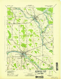 1943 Baldwinsville1943 Print · USGSCentral New York’s river-and-rail economy is on full display during the war years at the meeting of the Seneca and Oneida Rivers. Genealogists can trace local roots through numerous family cemeteries and numbered schoolhouses like School No 2 and Riverside Cem.
 - 1943 Map of Central Square
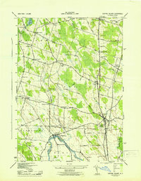 1943 Central Square1943 Print · USGSOswego County's rural crossroads and riverfront communities are captured here in the early 1940s. Genealogists can trace family footprints through numerous numbered schools and local landmarks like Hillside Cem, Peat Corners, and Caughdenoy.
 - 1948 Map of Baldwinsville
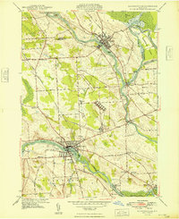 1948 Baldwinsville1948 Print · USGSThe confluence of the Seneca, Oneida, and Oswego Rivers defines this late 1940s landscape of central New York. Genealogists can locate family landmarks like Rouse Cem, St Marys Cem, and several local schoolhouses from Belgium to Phoenix.
 - 1949 Map of Central Square
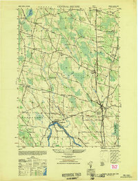 1949 Central Square1949 Print · USGSCentral Square and the Oneida River valley appear here in the late 1940s as a landscape of rural crossroads and riverfront hamlets. Researchers can trace the legacy of local families and industry at Russes Mill, Peacock Corners, and the Hillside Cem.
End of results
Showing maps 1-7 of 7
Top cities near Schroeppel
- Syracuse historical maps
- Clay historical maps
- Salina historical maps
- Cicero historical maps
- DeWitt historical maps
- De Witt historical maps
See more
Top neighborhoods of Schroeppel
- Pennellville historical maps
- Roosevelt Corners historical maps
- Bowen Corners historical maps
- Gilbert Mills historical maps
- Phoenix historical maps
- Sand Ridge historical maps
Frequently asked questions
- What are the different types of historical maps available for Schroeppel?
- What is the oldest map of Schroeppel?
- Where can I purchase historical maps of Schroeppel for my home or office?
- Where can I download high-res historical maps of Schroeppel?
- Are there historical topographic maps available for Schroeppel?
- Is there historical aerial imagery available for Schroeppel?
- Where are historical maps of Schroeppel sourced from?