
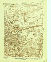
1940 Map of Brewerton
USGS Topo · Published 1940About this map
The Oneida River and Barge Canal define the northern corridor of this landscape, where engineering and agriculture intersect. Surveyed just before the mid-century, the area shows a transition from rural crossroads like Dutch Settlement and Euclid toward the growing footprint of North Syracuse. The infrastructure of the era is remarkably clear, from the operational Lock 23 on the canal to the path of the Syracuse Northern Electric Railway. Genealogists will find a wealth of local landmarks including Morgan Ch, Pine Plains Cem, and numerous numbered schoolhouses such as School No 14 and Mud Mill Sch. The central portion of the map is dominated by the sprawling Peat Swamp, a significant natural feature that dictated the placement of roads like Caughdenoy Road and the New York Central Railroad near Woodard Sta.
Find a feature on this map
84 named features on this map. Tap any name to fly to it.
Don’t see what you’re looking for? This feature index may not catch every label — zoom into the map to look around manually.
Map Details
Editions of this 1940 Brewerton Map
This is the sole edition of this map. No revisions or reprints were ever made.
Other maps of this area

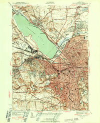
1895 · Syracuse
USGS Topo · 1:62,500

1898 · Syracuse
USGS Topo · 1:62,500

1900 · Baldwinsville
USGS Topo · 1:62,500

1900 · Fulton
USGS Topo · 1:62,500

1905 · Mexico
USGS Topo · 1:62,500
1938 · Syracuse East
USGS Topo · 1:24,000
1939 · Syracuse West
USGS Topo · 1:24,000

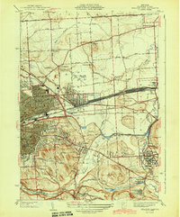
1940 · Cicero
USGS Topo · 1:24,000
1943 · Syracuse East
USGS Topo · 1:31,680

1943 · Mallory
USGS Topo · 1:31,680