1900s (20th Century) Maps of Cherryplain, Berlin
Explore 16 historic maps of Cherryplain from the 1900s (20th Century). These maps offer a rare glimpse into what life looked like during the 1900s — showing old roads, neighborhoods, homes, and landmarks that have changed or disappeared over time.
Whether you're researching your family's past, planning a metal detecting trip, or studying how Cherryplain's landscape evolved across the 1900s, these high-resolution maps are a powerful tool for exploring the history of this region.
- Focus on a specific era: All maps on this page are from the 1900s, giving you a focused view of this time period.
- See what’s changed: Compare century-old streets, trails, and buildings to today's modern landscape using overlays and satellite layers.
- Research with precision: Use these maps for genealogy, historical research, land use analysis, or educational projects.
- View, download, or print: Maps are fully viewable online in high resolution, and can be downloaded or printed for your own records.
Start exploring Cherryplain's history through authentic maps from the 1900s. This is your window into the past.
Cherryplain, Berlin maps
(16)- 1900 Map of Taconic
 1900 Taconic1900 Print · USGSThe tri-state border region of the Taconic Mountains thrived at the turn of the century as a hub of rail travel and valley industry. Genealogists and historians can trace the early footprints of Hoosick Falls, Bennington, and the winding path of the Rutland R.R.4 unique versions available
 - 1944 Map of Berlin, 1958 Print
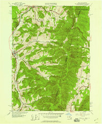 1944 Berlin1958 Print · USGSRensselaer County at the close of World War II shows a high-country landscape where the Rutland railroad and the Little Hoosic River defined local life. Genealogists and hikers can trace old valley settlements like Center Berlin and Cherryplain, or find historic trails leading toward Berlin Mtn.
 - 1948 Map of Berlin
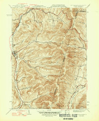 1948 Berlin1948 Print · USGSThe Taconic Mountains meet the New York and Massachusetts border in this post-war landscape of ridges and deep hollows. Researchers can trace the Rutland rail line through the valley or locate early landmarks like East Hollow Sch and Cherryplain.2 unique versions available
 - 1948 Map of Albany, 1951 Print
 1948 Albany1951 Print · USGSThe Hudson and Connecticut River valleys are captured here in the late 1940s, showing the vital rail and water corridors of the Northeast. You can trace the Boston and Maine tracks past Mt Greylock or locate early settlements like Great Barrington and Bennington.
 - 1956 Map of Albany, 1968 Print
 1956 Albany1968 Print · USGSThe industrial heart of the Northeast is revealed in the mid-1950s, from the Hudson Valley to the Connecticut River. Researchers can trace the legacy of the Quabbin Reservoir, locate Westover Air Force Base, or follow the Rutland RR through the Green Mountains.2 unique versions available
 - 1957 Map of Albany
 1957 Albany1957 Print · USGSThe Tri-State region and Connecticut River Valley are captured here during a period of significant postwar growth and infrastructure expansion. Genealogists and historians can trace the rail-and-river economy through landmarks like the Boston and Maine railroad, Quabbin Reservoir, and Westover Air Force Base.
 - 1959 Map of Albany
 1959 Albany1959 Print · USGSThe Hudson and Connecticut River valleys are captured here during the late fifties, showing the region's dense rail networks and massive water projects. Researchers can trace the New York State Thruway or locate local landmarks like Mt Greylock and the Quabbin Reservoir.
 - 1960 Map of Berlin, 1961 Print
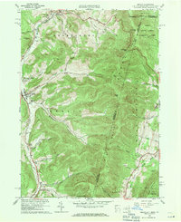 1960 Berlin1961 Print · USGSRensselaer County at the start of the sixties reveals a valley life shaped by the Taconic Range and the winding Little Hoosic River. Genealogists can trace family heritage through numerous hillside burial grounds like Brimmer Cem and Weaver Cem, or locate landmarks like the Carmelite Novitiate.2 unique versions available
 - 1962 Map of Albany
 1962 Albany1962 Print · USGSThe Hudson and Connecticut River valleys meet the Green Mountains and Berkshires in this mid-century overview of the Northeast. Genealogists and historians can trace the industrial hearts of Albany and Springfield or locate features like Quabbin Reservoir and Westover Air Force Base.
 - 1973 Map of Berlin, 1975 Print
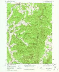 1973 Berlin1975 Print · USGSRensselaer County’s eastern border comes to life in the early 1970s as small valley towns sit beneath the high peaks of the Taconic Range. Genealogists and local historians can trace family-named sites like Moses Cem, Browns Cem, and the various hollows of Petersburg and Berlin.4 unique versions available
 - 1975 Map of Berlin, 1981 Print
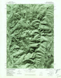 1975 Berlin1981 Print · USGSThe Rensselaer County highlands are captured in detail in the mid-1970s, showing the agricultural patterns and valley settlements of the Taconic region. Local historians can trace the development of Berlin and Petersburg along the Little Hoosic River.
 - 1986 Map of Albany
 1986 Albany1986 Print · USGSThe Capital District and the tri-state highlands come into focus during the mid-eighties as urban growth meets the edge of the Green Mountains. Researchers can trace historic industrial sites and landmarks like the Watervliet Arsenal, the Bennington Battle Monument, and the grounds of Rensselaer Polytechnic Institute.
 - 1988 Map of Berlin
 1988 Berlin1988 Print · USGSThe Rensselaer County highlands meet the borders of Massachusetts and Vermont in the late 1980s. Researchers can trace the Little Hoosic River valley settlements, find the Cherry Plain Sch, and locate remote sites like The Snow Hole or Moses Cem.
 - 1989 Map of Albany
 1989 Albany1989 Print · USGSThe tri-state intersection of New York, Vermont, and Massachusetts comes alive in the late 1980s, centered on the historic river confluence of the Capital District. Researchers can trace the extensive rail lines of the D & H RR and explore high peaks like Mount Greylock or the reaches of the Tomhannock Reservoir.2 unique versions available
 - 1997 Map of Berlin, 2000 Print
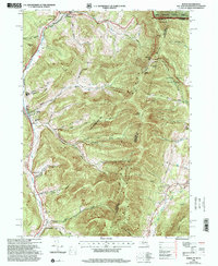 1997 Berlin2000 Print · USGSRensselaer County, New York, sits at the intersection of three states in the late nineties, where valley towns follow the Hoosic River. You can trace the Boston and Maine RR line past Meadow Lawn Cem, Cherryplain Sch, and the high ridges of the Petersburg Range.
 - 1998 Map of Berlin, 2001 Print
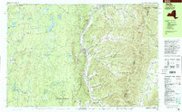 1998 Berlin2001 Print · USGSThe Little Hoosic River valley and the high Taconic ridges define this portion of Rensselaer County in the late 1990s. Researchers can trace rural lineages through family-named landmarks like Satterlee Hollow and several burial grounds including Fifty-Six Cem and Moses Cem.
End of results
Showing maps 1-16 of 16
Top cities near Cherryplain
- Pittsfield historical maps
- North Adams historical maps
- Brunswick historical maps
- Bennington historical maps
- Sand Lake historical maps
- Adams historical maps
See more
Frequently asked questions
- What are the different types of historical maps available for Cherryplain?
- What is the oldest map of Cherryplain?
- Where can I purchase historical maps of Cherryplain for my home or office?
- Where can I download high-res historical maps of Cherryplain?
- Are there historical topographic maps available for Cherryplain?
- Is there historical aerial imagery available for Cherryplain?
- Where are historical maps of Cherryplain sourced from?