Old Maps of Schodack, New York for Hiking & Exploration
Hike through history with 66 historic maps of Schodack. Explore old trails, ghost towns, and forgotten backroads — perfect for outdoor adventurers and local explorers.
- Rediscover forgotten places: Map out old mining camps, roads, and footpaths that no longer exist on modern maps.
- Layer with modern tools: Combine with LiDAR or satellite views to plan hikes through historical terrain.
- Made for exploration: Popular among hikers, overlanders, and local history lovers.
Use these maps to find adventure and explore the hidden past of Schodack.
Schodack, NY maps
(66)- 1893 Map of Troy
 1893 Troy1893 Print · USGSThe Hudson River valley at the end of the nineteenth century was a bustling hub of commerce where the Erie Canal met the Troy waterfront. Researchers can trace the early rail networks of the Boston and Albany Railroad or locate vanished sites like Schodack Depot and the industrial hamlet of Glass House.
 - 1893 Map of Coxsackie
 1893 Coxsackie1893 Print · USGSThe Hudson River valley at the close of the 19th century shows a landscape defined by waterborne trade and expanding rail networks. Genealogists and local historians can trace family-named landmarks like Stanton Hill, ferry landings at Nuttenhook, and rail hubs like Coeyman Junction.
 - 1893 Map of Albany
 1893 Albany1893 Print · USGSThe Hudson River valley at the close of the nineteenth century reveals a complex landscape of island commerce and growing rail hubs. Genealogists and historians can trace defunct railroad stops and family-named hamlets like French Mills, Meadowdale, and The Abbey.2 unique versions available
 - 1894 Map of Coxsackie
 1894 Coxsackie1894 Print · USGSThe Hudson River valley at the close of the 19th century was a hub of rail and river transit between Greene and Columbia counties. Genealogists can trace family names at Stanton Hill and Stephensville or locate long-lost stops like New Baltimore Sta. and Coxsackie Station.8 unique versions available
 - 1895 Map of Troy
 1895 Troy1895 Print · USGSThe Hudson River valley at the close of the nineteenth century was a bustling nexus of river, rail, and canal traffic. Genealogists and historians can trace family-named hills and early hamlets from Troy to the lakes of Sand Lake, including Glass House and Sliter.
 - 1895 Map of Albany
 1895 Albany1895 Print · USGSThe Hudson River valley and the rising Helderberg escarpment are captured here in the 1890s, revealing a landscape defined by steam-era railroads and river islands. Genealogists can trace family homesteads near Shakers, Voorheesville, and the many hamlets of Bethlehem.
 - 1898 Map of Albany
 1898 Albany1898 Print · USGSThe capital region in the late nineteenth century is defined by its massive rail yards and the busy Hudson riverfront. Genealogists can trace family names at Town House Corner or locate vanished landmarks like The Abbey (Gleason) and the community at Shakers.8 unique versions available
 - 1898 Map of Troy
 1898 Troy1898 Print · USGSThe Hudson River valley at the turn of the century shows a bustling corridor of industry and rail before modern expansion transformed the capital region. Researchers can trace historic riverfront districts like Greenbush and Bath or locate vanished rail stops such as Schodack Depot and the Erie Canal route.8 unique versions available
 - 1903 Map of Kinderhook
 1903 Kinderhook1903 Print · USGSColumbia County at the turn of the century shows a landscape defined by the intersection of water power and rail. Trace the industrial heritage of Stuyvesant Falls and White Mills or locate ancestral homes in Old Chatham and Valatie.6 unique versions available
 - 1925 Map of Troy
 1925 Troy1925 Print · USGSRensselaer County at the mid-twenties shows a landscape of established mill towns and developing lakefront retreats. Genealogists can trace family roots through numerous sites like St Josephs Cemetery, Teller Mill, and early schoolhouses from Albia to Hoags Corners.
 - 1927 Map of Albany
 1927 Albany1927 Print · USGSThe Albany riverfront and the Helderberg escarpment define this mid-1920s portrait of New York's capital region. Genealogists can trace a dense network of country schoolhouses and old settlements like Feura Bush, Loudonville, and the Bethlehem Church.5 unique versions available
 - 1928 Map of Troy
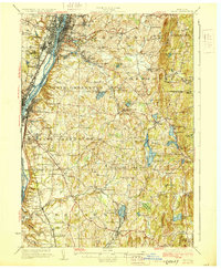 1928 Troy1928 Print · USGSThe Hudson River valley at the height of its industrial era features the dense centers of Troy and Watervliet. Researchers can trace old neighborhoods near Rensselaer Polytechnic Institute or locate family plots in St Agnes Cemetery and St Marys Cemetery.5 unique versions available
 - 1929 Map of Coxsackie
 1929 Coxsackie1929 Print · USGSThe Hudson River valley in the late twenties was a bustling corridor of rail lines and river landings between Albany and Catskill. Genealogists and historians can trace family locations through dozens of numbered schoolhouses, the industrial works at Stottville, and the transit hubs of Schodack Landing and West Coxsackie.4 unique versions available
 - 1933 Map of Kinderhook
 1933 Kinderhook1933 Print · USGSColumbia County in the early thirties is a landscape of thriving mill towns and rail junctions. Genealogists and historians can locate family-named schoolhouses like Woltermire Sch or trace the grounds of the Martin Van Buren Homestead.3 unique versions available
 - 1947 Map of Albany, 1965 Print
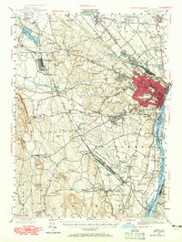 1947 Albany1965 Print · USGSThe Albany capital region is captured here shortly after the war, showing the city's transition into suburban Delmar and Loudonville. Researchers can trace the massive Voorheesville Army Sub Depot, the Albany Airport, and old landmarks like Graceland Cemetery.
 - 1948 Map of Albany, 1951 Print
 1948 Albany1951 Print · USGSThe Hudson and Connecticut River valleys are captured here in the late 1940s, showing the vital rail and water corridors of the Northeast. You can trace the Boston and Maine tracks past Mt Greylock or locate early settlements like Great Barrington and Bennington.
 - 1949 Map of Kinderhook
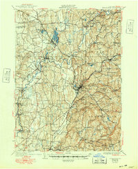 1949 Kinderhook1949 Print · USGSColumbia County’s landscape is captured here during the post-war era, showing a region shaped by both rail-borne industry and early American history. Genealogists and historians can trace the Boston and Albany tracks to landmarks like the Martin Van Buren Homestead and the Ichabod Crane Sch.
 - 1950 Map of Albany
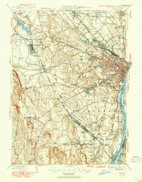 1950 Albany1950 Print · USGSMid-century Albany and its burgeoning suburbs are captured here at a peak of rail and river commerce. Genealogy and local history researchers can trace the New York Central lines to the Selkirk Yards or find family landmarks like Keefers Corners and Bethlehem Church.
 - 1950 Map of Troy
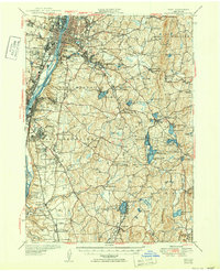 1950 Troy1950 Print · USGSThe Hudson River valley and the Rensselaer hills are shown here just after the war, capturing a landscape of dense industrial riverfronts and rural upland hamlets. Genealogists can trace family sites at Albany Rural Cemetery, identify early landmarks like Draper School No 9, or locate rail stops at East Greenbush Station.
 - 1953 Map of Delmar, 1954 Print
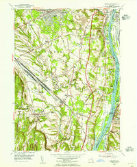 1953 Delmar1954 Print · USGSThe Albany suburbs meet the industrial Hudson Valley in the early fifties, just as the New York State Thruway was being cut through the landscape. Genealogists can trace family names at Bethlehem Cem and Elmwood Cem, or explore the massive rail operations at Selkirk Yards.5 unique versions available
 - 1953 Map of Ravena, 1955 Print
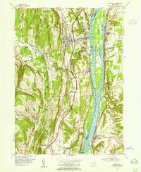 1953 Ravena1955 Print · USGSThe Hudson River valley at the dawn of the interstate era shows a landscape where historic riverfront villages meet modern infrastructure. Trace the early New York State Thruway past sites like Schodack Landing, Deans Mill, and Waldron Cem.3 unique versions available
 - 1953 Map of Nassau, 1955 Print
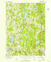 1953 Nassau1955 Print · USGSRensselaer County in the early fifties shows a landscape of upland lakes and small crossroads settlements during a period of growing lakeside recreation. Genealogists and local historians can trace old family sites at Sliters and Hoag Corners or locate the YMCA Camp and Totem Lodge.4 unique versions available
 - 1953 Map of Kinderhook, 1955 Print
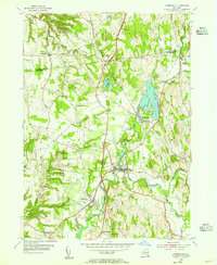 1953 Kinderhook1955 Print · USGSColumbia County in the early fifties shows a landscape of established villages and working waterways at the height of the rail era. Genealogists can trace family footprints near the House of History, Kinderhook Lake, and Muitzes Kill.2 unique versions available
 - 1953 Map of East Chatham, 1955 Print
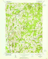 1953 East Chatham1955 Print · USGSColumbia County’s rural landscape is preserved in this mid-century survey as the New York Central railroad still wound through the valley. Researchers can trace ancestral roots at The Maples Cem or locate the Shaker Museum and Riders Mills Sch in their original settings.3 unique versions available
 - 1953 Map of East Greenbush, 1956 Print
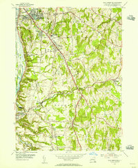 1953 East Greenbush1956 Print · USGSRensselaer County’s landscape along the Hudson is captured here in the early fifties, showing the growth of the eastern suburbs. Researchers can trace old rail stops and local infrastructure, from Van Hoesen Sta to the Red Mill Sch and the Moordener Kill.4 unique versions available
Showing maps 1-25 of 66
Top cities near Schodack
- Albany historical maps
- Colonie historical maps
- Troy historical maps
- Guilderland historical maps
- Bethlehem historical maps
- Rotterdam historical maps
See more
Top neighborhoods of Schodack
- Schodack Landing historical maps
- Braeside historical maps
- North Schodack historical maps
- Stony Point historical maps
- East Schodack historical maps
- Schodack Center historical maps
See more
Frequently asked questions
- What are the different types of historical maps available for Schodack?
- What is the oldest map of Schodack?
- Where can I purchase historical maps of Schodack for my home or office?
- Where can I download high-res historical maps of Schodack?
- Are there historical topographic maps available for Schodack?
- Is there historical aerial imagery available for Schodack?
- Where are historical maps of Schodack sourced from?