Old Maps of Newton Falls, Clifton for Academic Research
Study the evolution of Newton Falls with 15 high-resolution historic maps. Whether you're teaching, researching, or modeling changes in land use, these maps provide essential visual documentation of urban, environmental, and geographic change.
- Analyze long-term change: Track patterns in development, transportation, and natural features.
- Ideal for environmental or urban studies: Support academic projects with primary historical map data.
- Use in the classroom or lab: Educators and researchers rely on these maps to bring historical context to life.
These maps are a powerful tool for teaching, research, and visualizing how Newton Falls has changed over the decades.
Newton Falls, Clifton maps
(15)- 1919 Map of Cranberry Lake, 1959 Print
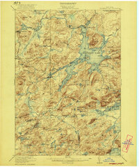
 1919 Cranberry Lake1959 Print · USGSThe northern Adirondack wilderness is captured here just after the Great War, showing a landscape defined by timber, mining, and the winding Oswegatchie River. Trace the early development of Benson Mines, the State Ranger School, and the remote landing at Wanakena.3 unique versions available
 - 1921 Map of Cranberry Lake
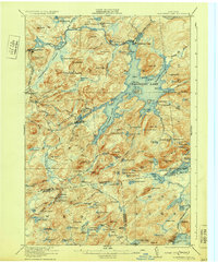
 1921 Cranberry Lake1921 Print · USGSIn the early 1920s, this area of the Adirondacks was a nexus of wilderness and industry, from the waters of Cranberry Lake to the iron operations at Benson Mines. Researchers can trace the early grounds of the State Ranger School and follow the New York Central RR through Wanakena.7 unique versions available
 - 1931 Map of Cranberry Lake
 1931 Cranberry Lake1931 Print · USGSThe Adirondack wilderness around Cranberry Lake is captured here in the early thirties, showcasing a landscape of logging, mining, and remote rail travel. Genealogists and historians can trace the industrial footprints of Benson Mines, the State Ranger School, and the New York Central line.
 - 1948 Map of Ogdensburg, 1973 Print
 1948 Ogdensburg1973 Print · USGSThe international border along the St Lawrence River comes to life in the late 1940s, showing the vital rail and water connections between New York and Ontario. Researchers can trace the grounds of St Lawrence University, the massive Camp Drum military reservation, and the historic Rideau River and Canal.2 unique versions available
 - 1951 Map of Ogdensburg
 1951 Ogdensburg1951 Print · USGSThe St. Lawrence frontier and the North Country are captured here during the post-war era, from the river ports to the high Adirondacks. Genealogists and historians can trace the rail-and-river economy through Ogdensburg, the Rutland rail lines, and Potsdam.
 - 1953 Map of Ogdensburg
 1953 Ogdensburg1953 Print · USGSThe North Country and St. Lawrence Valley are shown here in the early fifties, just as the region’s rail-and-river economy remained in full swing. Genealogists and historians can trace family-named corners and rural hubs along the Rutland railroad or locate heritage sites near Ogdensburg, Potsdam, and the St Regis Indian Reservation.
 - 1961 Map of Ogdensburg
 1961 Ogdensburg1961 Print · USGSThe St. Lawrence valley and the Adirondack high country meet in this early sixties survey during a peak era for rail and river commerce. Genealogists and historians can trace the paths of the New York Central railroad through remote settlements like Wanakena, Conifer, and Piercefield.
 - 1968 Map of Newton Falls, 1971 Print
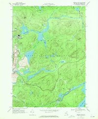 1968 Newton Falls1971 Print · USGSNewton Falls and Wanakena are pictured here in the late sixties, a period when Adirondack industrial mining operated alongside protected forest reserves. Researchers can trace the Penn Central rail line, find the local Cem, and locate the Strip Mine and Cook Corners settlement.2 unique versions available
 - 1985 Map of Tupper Lake, 1986 Print
 1985 Tupper Lake1986 Print · USGSThe Adirondacks in the mid-1980s reveal a network of mountain villages and timber-connected outposts. Researchers can trace the Adirondack RR through Saranac Lake or locate old industrial hamlets like Newton Falls and Gleasons Mill.2 unique versions available
 - 1999 Map of Newton Falls, 2001 Print
 1999 Newton Falls2001 Print · USGSThe St. Lawrence County highlands near the turn of the millennium reveal a landscape shaped by both Adirondack wilderness and industrial extraction. Local historians can trace the development of Newton Falls and Wanakena, locating the State Ranger Sch, mining operations, and the remote Cook Corners settlement.
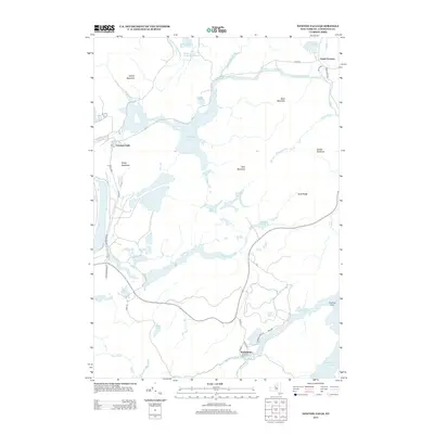
 - 2010 Map of Newton Falls, 2010 Print
 2010 Newton Falls2010 Print · USGSCovers Newton Falls, including Fine, Clifton, and other nearby areas
 - 2013 Map of Newton Falls, 2013 Print
 2013 Newton Falls2013 Print · USGSCovers Newton Falls, including Fine, Clifton, and other nearby areas
 - 2016 Map of Newton Falls, 2016 Print
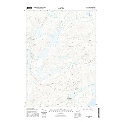 2016 Newton Falls2016 Print · USGSCovers Newton Falls, including Fine, Clifton, and other nearby areas
 - 2019 Map of Newton Falls, 2019 Print
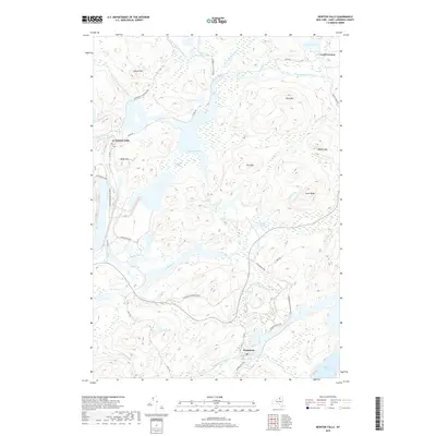 2019 Newton Falls2019 Print · USGSCovers Newton Falls, including Fine, Clifton, and other nearby areas
 - 2023 Map of Newton Falls, 2023 Print
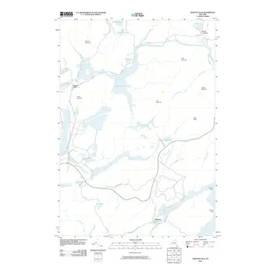
 2023 Newton Falls2023 Print · USGSThe northern Adirondack wilderness is captured here in the early twenty-first century, centered on the Oswegatchie River corridor. Genealogists and hikers can trace the streets of Newton Falls and Wanakena or follow paths like the Peavine Swamp Ski Trl.
End of results
Showing maps 1-15 of 15
Top cities near Newton Falls
- Oswegatchie historical maps
- Croghan historical maps
- Russell historical maps
- Watson historical maps
- Webb historical maps
- Diana historical maps
See more
Frequently asked questions
- What are the different types of historical maps available for Newton Falls?
- What is the oldest map of Newton Falls?
- Where can I purchase historical maps of Newton Falls for my home or office?
- Where can I download high-res historical maps of Newton Falls?
- Are there historical topographic maps available for Newton Falls?
- Is there historical aerial imagery available for Newton Falls?
- Where are historical maps of Newton Falls sourced from?