2020s Maps of Macomb, New York
Explore 7 historic maps of Macomb from the 2020s. These maps offer a rare glimpse into what life looked like during the 2020s — showing old roads, neighborhoods, homes, and landmarks that have changed or disappeared over time.
Whether you're researching your family's past, planning a metal detecting trip, or studying how Macomb's landscape evolved across the 2020s, these high-resolution maps are a powerful tool for exploring the history of this region.
- Focus on a specific era: All maps on this page are from the 2020s, giving you a focused view of this time period.
- See what’s changed: Compare century-old streets, trails, and buildings to today's modern landscape using overlays and satellite layers.
- Research with precision: Use these maps for genealogy, historical research, land use analysis, or educational projects.
- View, download, or print: Maps are fully viewable online in high resolution, and can be downloaded or printed for your own records.
Start exploring Macomb's history through authentic maps from the 2020s. This is your window into the past.
Macomb, NY maps
(7)- 2023 Map of Richville, 2023 Print
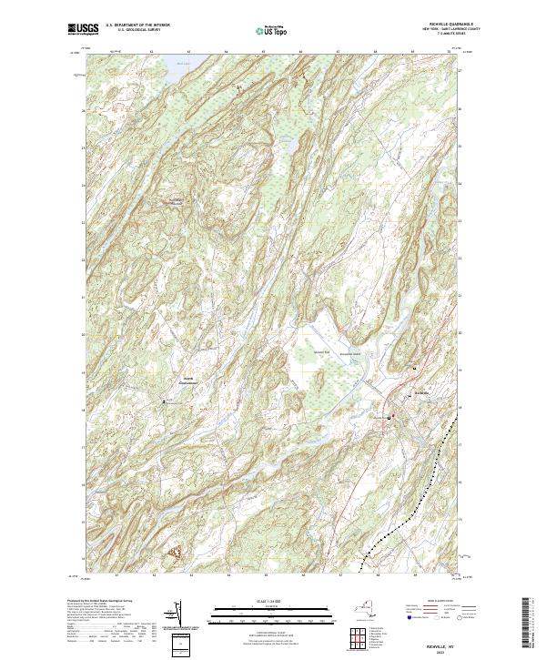 2023 Richville2023 Print · USGSSt. Lawrence County’s rural character is on full display in this modern survey of the Oswegatchie River valley and its surrounding highlands. Genealogists and historians can trace family locations near North Gouverneur, Richville, and the Wayside Cem.
 - 2023 Map of Hammond, 2023 Print
 2023 Hammond2023 Print · USGSSt. Lawrence County is mapped here in the early 2020s, showing a landscape shaped by the Indian River and the hamlets of the North Country. Researchers can trace local lineage at Fineview Cem or explore the shores of Black Lake and its many islands like Watch Island.
 - 2023 Map of Natural Dam, 2023 Print
 2023 Natural Dam2023 Print · USGSThe St. Lawrence and Jefferson County borderlands come into focus in this contemporary survey of rural upstate New York. Genealogists and local historians can trace the roads connecting Wegatchie and Spragueville, or locate family sites near the Spragueville Cem.
 - 2023 Map of Edwardsville, 2023 Print
 2023 Edwardsville2023 Print · USGSSt. Lawrence County is depicted in the modern era along the Canadian border, where river and lake dominate the landscape. Genealogists can locate small settlements like Edwardsville and Galilee, or trace land features like Snake Island.
 - 2023 Map of Muskellunge Lake, 2023 Print
 2023 Muskellunge Lake2023 Print · USGSThe Indian River valley at the Jefferson and St. Lawrence county line remains a landscape of deep glacial lakes and quiet river bends. Genealogists and local historians can trace the environs of Oxbow and Riverside, locating Saint Patricks Cem and old routes like Lead Mine Rd.
 - 2023 Map of Pope Mills, 2023 Print
 2023 Pope Mills2023 Print · USGSThe rural landscape of St. Lawrence County remains largely defined by its intricate waterways and small hamlets in the early twenty-first century. Researchers can trace family history at Oldsville Cem or explore the jagged shoreline of Black Lake near Pope Mills.
 - 2023 Map of Heuvelton, 2023 Print
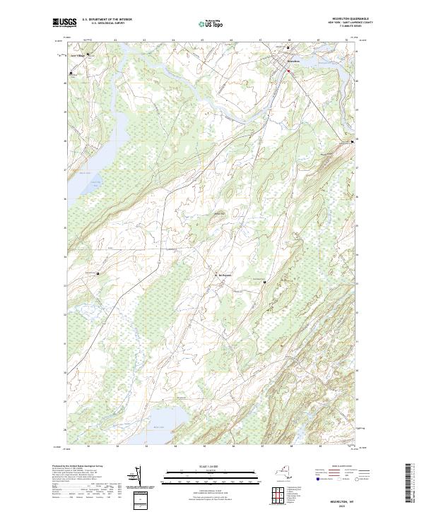 2023 Heuvelton2023 Print · USGSSt. Lawrence County comes into focus in this contemporary survey of the Oswegatchie River valley and the eastern reaches of Black Lake. Researchers can locate numerous rural burial sites like Purmort Cem and trace the roads connecting Heuvelton to De Peyster.
End of results
Showing maps 1-7 of 7
Top cities near Macomb
- Canton historical maps
- Gouverneur historical maps
- Lisbon historical maps
- Oswegatchie historical maps
- Alexandria historical maps
- Gouverneur historical maps
See more
Top neighborhoods of Macomb
Frequently asked questions
- What are the different types of historical maps available for Macomb?
- What is the oldest map of Macomb?
- Where can I purchase historical maps of Macomb for my home or office?
- Where can I download high-res historical maps of Macomb?
- Are there historical topographic maps available for Macomb?
- Is there historical aerial imagery available for Macomb?
- Where are historical maps of Macomb sourced from?