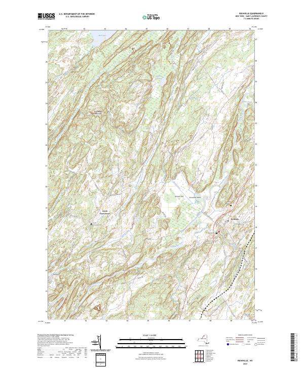
2023 Map of Richville
USGS Topo · Published 2023About this map
The Oswegatchie River carves a winding path through this corner of St. Lawrence County, shaping a landscape defined by its wetlands and elevation changes. In the village of Richville, the local road network centers on Main St and Depot St, where Maple Grove Cem and Wayside Cem mark the community's long-established boundaries. To the northwest, the terrain rises toward Huckleberry Mountain, surrounded by the drainage basins of Beaver Creek and the South Branch Beaver Creek.
Find a feature on this map
55 named features on this map. Tap any name to fly to it.
Don’t see what you’re looking for? This feature index may not catch every label — zoom into the map to look around manually.
Map Details
Editions of this 2023 Richville Map
This is the sole edition of this map. No revisions or reprints were ever made.
Other maps of this area

1904 · Ogdensburg
USGS Topo · 1:62,500

1905 · Ogdensburg
USGS Topo · 1:62,500

1906 · Brier Hill
USGS Topo · 1:62,500

1912 · Hammond
USGS Topo · 1:62,500

1915 · Gouverneur
USGS Topo · 1:62,500

1937 · Gouverneur
USGS Topo · 1:62,500

1943 · Rensselaer Falls
USGS Topo · 1:31,680

1943 · Edwardsville
USGS Topo · 1:31,680
1943 · Heuvelton
USGS Topo · 1:31,680

1944 · Hammond
USGS Topo · 1:62,500