Old Maps of Charlton, New York for Metal Detecting
Plan your next treasure hunt with 36 historic maps of Charlton. Find old homesites, ghost towns, trails, and gathering spots that may be lost to time — perfect for identifying promising metal detecting locations.
- Locate forgotten sites: Uncover places like long-lost settlements, abandoned rail lines, or gathering spots.
- Plan better hunts: Use map overlays combined with LiDAR or satellite views to narrow in on historically rich areas.
- Made for detectorists: Thousands of hobbyists use these maps to discover relics, coins, and hidden history.
Use these historic maps to boost your research and find new opportunities beneath the surface of Charlton.
Charlton, NY maps
(36)- 1893 Map of Schenectady
 1893 Schenectady1893 Print · USGSSchenectady and its surrounding Saratoga County townships are captured here in the 1890s, a period when canal traffic and steam rail dominated the Mohawk Valley. Genealogists can trace family lines through villages like Niskayuna and Rexford Flats or locate historic crossings like Vischer Ferry.
 - 1895 Map of Schenectady
 1895 Schenectady1895 Print · USGSSchenectady and its surrounding river towns thrive in the 1890s as the railroad and canal networks reach their peak. Genealogists and historians can trace old homesteads near Vischer Ferry, explore the rail lines of the Fitchburg Railroad, or locate early structures in Rexford Flats and Scotia.
 - 1895 Map of Amsterdam
 1895 Amsterdam1895 Print · USGSThe Mohawk River valley thrives in the late nineteenth century as a corridor of heavy rail and canal traffic. Trace the historic paths of the Erie Canal and West Shore R.R. past Amsterdam and the old Hoffman Ferry crossing.7 unique versions available
 - 1898 Map of Schenectady
 1898 Schenectady1898 Print · USGSSchenectady and the Mohawk Valley are shown in the 1890s, when the river and rail lines drove a booming industrial economy. Local historians can trace the original path of the Erie Canal and locate historic crossings like Vischer Ferry and Rexford Flats.8 unique versions available
 - 1930 Map of Schenectady
 1930 Schenectady1930 Print · USGSThe Mohawk Valley and southern Saratoga County are caught in a moment of transition in the late twenties, balancing industrial river life with rural farmsteads. Genealogists and historians can trace the Erie Canal (Abandoned) path and locate old family landmarks like Harmony Corners or Vischer Ferry.5 unique versions available
 - 1931 Map of Amsterdam
 1931 Amsterdam1931 Print · USGSThe Mohawk Valley thrives at the height of its rail and canal era in the late twenties and early thirties. Genealogists can trace family names through dozens of rural schools and churches, from St Marys Ch to the quiet hamlets of Mariaville and Scotch Bush.3 unique versions available
 - 1947 Map of Schenectady, 1954 Print
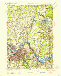 1947 Schenectady1954 Print · USGSThe Schenectady region in the late 1940s reveals a powerful industrial hub at the intersection of rail, river, and canal. Researchers can trace the legacy of the Erie Canal, find rural district schools, and locate old family crossroads like Groom Corners and Vischer Ferry.2 unique versions available
 - 1947 Map of Amsterdam, 1963 Print
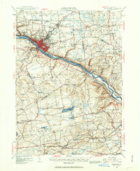 1947 Amsterdam1963 Print · USGSThe Mohawk Valley and its surrounding uplands are captured here in the late 1940s, highlighting the heavy industrial and transit hubs of the day. Researchers can trace the legacy of the Erie Canal, find numerous rural schoolhouses like Log City Sch, and locate the Duanesburg Churches.3 unique versions available
 - 1948 Map of Schenectady
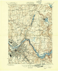 1948 Schenectady1948 Print · USGSSchenectady and its surrounding Saratoga County townships are captured here in the late 1940s as industrial rail hubs and rural hamlets met. Genealogists and local historians can trace family-named sites like Groom Corners, the Erie Canal (Abandoned), and Vischer Ferry.
 - 1948 Map of Albany, 1951 Print
 1948 Albany1951 Print · USGSThe Hudson and Connecticut River valleys are captured here in the late 1940s, showing the vital rail and water corridors of the Northeast. You can trace the Boston and Maine tracks past Mt Greylock or locate early settlements like Great Barrington and Bennington.
 - 1948 Map of Binghamton, 1980 Print
 1948 Binghamton1980 Print · USGSCentral New York and the Southern Tier thrive in the late 1940s as a hub of rail traffic and mountain industry. Researchers can trace historic transit lines like the Erie Railroad through Binghamton or find old valley settlements near Oneonta and Delhi.
 - 1949 Map of Amsterdam
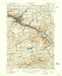 1949 Amsterdam1949 Print · USGSThe Mohawk Valley corridor thrives in the late 1940s as a vital artery for rail, canal, and industry. Researchers can trace the legacy of local education and faith at Duanesburg Churches, School No 7, and the Montgomery County Sanatorium.2 unique versions available
 - 1949 Map of Schenectady
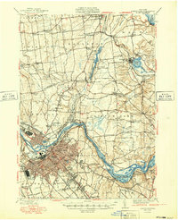 1949 Schenectady1949 Print · USGSSchenectady and its surrounding Saratoga County townships are captured here in the late 1940s as the riverfront industry and rail networks remained in full swing. Genealogists can locate family landmarks in old hamlets like Maltaville and Groom Corners or trace the historic Erie Canal (Abandoned).
 - 1950 Map of Binghamton
 1950 Binghamton1950 Print · USGSBinghamton and the surrounding Southern Tier are shown in the mid-century era, highlighting the intricate rail and river networks that drove local industry. Researchers can trace the path of the Erie Railroad and locate landmarks from Otsego Lake to Sidney Mountain.2 unique versions available
 - 1954 Map of Pattersonville, 1956 Print
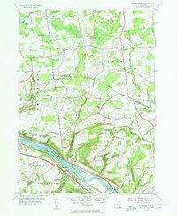 1954 Pattersonville1956 Print · USGSThe Mohawk River valley near Pattersonville was a bustling corridor of rail and water transit in the mid-1950s. Researchers can trace family history through sites like Woestina Cem and early landmarks like the abandoned Erie Canal and Hoffmans.2 unique versions available
 - 1954 Map of Burnt Hills, 1956 Print
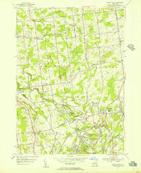 1954 Burnt Hills1956 Print · USGSThe Saratoga and Schenectady county borderlands show a blend of rural hamlets and post-war suburban growth during the mid-1950s. Trace the evolution of Burnt Hills, East Glenville, and Charlton, or locate vanished schoolhouses like Industrial Farm Sch.5 unique versions available
 - 1954 Map of Schenectady, 1957 Print
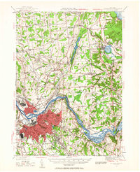 1954 Schenectady1957 Print · USGSThe Mohawk Valley's industrial and transit networks are in full view at mid-century, from the rail yards of Schenectady to the waters of the Erie Canal. Genealogists can locate legacy sites like Vischer Ferry, Pine Grove Cem, and numerous rural schoolhouses.
 - 1956 Map of Albany, 1968 Print
 1956 Albany1968 Print · USGSThe industrial heart of the Northeast is revealed in the mid-1950s, from the Hudson Valley to the Connecticut River. Researchers can trace the legacy of the Quabbin Reservoir, locate Westover Air Force Base, or follow the Rutland RR through the Green Mountains.2 unique versions available
 - 1957 Map of Albany
 1957 Albany1957 Print · USGSThe Tri-State region and Connecticut River Valley are captured here during a period of significant postwar growth and infrastructure expansion. Genealogists and historians can trace the rail-and-river economy through landmarks like the Boston and Maine railroad, Quabbin Reservoir, and Westover Air Force Base.
 - 1958 Map of Binghamton
 1958 Binghamton1958 Print · USGSCentral New York in the late fifties was a network of manufacturing cities and river valleys connected by vital rail lines. Genealogists and historians can trace family roots in Oneonta, Norwich, and Cooperstown or locate long-standing farms along Schoharie Creek.
 - 1959 Map of Albany
 1959 Albany1959 Print · USGSThe Hudson and Connecticut River valleys are captured here during the late fifties, showing the region's dense rail networks and massive water projects. Researchers can trace the New York State Thruway or locate local landmarks like Mt Greylock and the Quabbin Reservoir.
 - 1962 Map of Albany
 1962 Albany1962 Print · USGSThe Hudson and Connecticut River valleys meet the Green Mountains and Berkshires in this mid-century overview of the Northeast. Genealogists and historians can trace the industrial hearts of Albany and Springfield or locate features like Quabbin Reservoir and Westover Air Force Base.
 - 1963 Map of Binghamton
 1963 Binghamton1963 Print · USGSThe Southern Tier and Catskill peaks are shown in the early sixties as new reservoirs reshaped the valleys. Trace historic rail corridors like the Erie Lackawanna RR and explore lakeside settlements such as Cooperstown and Oneonta.
 - 1985 Map of Amsterdam, 1986 Print
 1985 Amsterdam1986 Print · USGSUpstate New York in the mid-1980s reveals a landscape defined by historic river valleys and expanding interstate corridors. Researchers can trace family sites near Stone Arabia Cemetery or explore the civic centers of Amsterdam and Cooperstown near Otsego Lake.2 unique versions available
 - 1986 Map of Albany
 1986 Albany1986 Print · USGSThe Capital District and the tri-state highlands come into focus during the mid-eighties as urban growth meets the edge of the Green Mountains. Researchers can trace historic industrial sites and landmarks like the Watervliet Arsenal, the Bennington Battle Monument, and the grounds of Rensselaer Polytechnic Institute.
Showing maps 1-25 of 36
Top cities near Charlton
- Albany historical maps
- Colonie historical maps
- Schenectady historical maps
- Clifton Park historical maps
- Guilderland historical maps
- Rotterdam historical maps
See more
Top neighborhoods of Charlton
- Tucker Heights historical maps
- Komar Park historical maps
- West Charlton historical maps
- Harmony Corners historical maps
- Holbrook Corners historical maps
Frequently asked questions
- What are the different types of historical maps available for Charlton?
- What is the oldest map of Charlton?
- Where can I purchase historical maps of Charlton for my home or office?
- Where can I download high-res historical maps of Charlton?
- Are there historical topographic maps available for Charlton?
- Is there historical aerial imagery available for Charlton?
- Where are historical maps of Charlton sourced from?