Old Maps of Clifton Park, New York for Academic Research
Study the evolution of Clifton Park with 39 high-resolution historic maps. Whether you're teaching, researching, or modeling changes in land use, these maps provide essential visual documentation of urban, environmental, and geographic change.
- Analyze long-term change: Track patterns in development, transportation, and natural features.
- Ideal for environmental or urban studies: Support academic projects with primary historical map data.
- Use in the classroom or lab: Educators and researchers rely on these maps to bring historical context to life.
These maps are a powerful tool for teaching, research, and visualizing how Clifton Park has changed over the decades.
Clifton Park, NY maps
(39)- 1893 Map of Schenectady
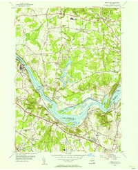
 1893 Schenectady1893 Print · USGSSchenectady and its surrounding Saratoga County townships are captured here in the 1890s, a period when canal traffic and steam rail dominated the Mohawk Valley. Genealogists can trace family lines through villages like Niskayuna and Rexford Flats or locate historic crossings like Vischer Ferry.
 - 1895 Map of Schenectady
 1895 Schenectady1895 Print · USGSSchenectady and its surrounding river towns thrive in the 1890s as the railroad and canal networks reach their peak. Genealogists and historians can trace old homesteads near Vischer Ferry, explore the rail lines of the Fitchburg Railroad, or locate early structures in Rexford Flats and Scotia.
 - 1898 Map of Schenectady
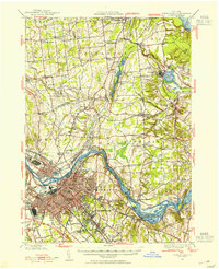
 1898 Schenectady1898 Print · USGSSchenectady and the Mohawk Valley are shown in the 1890s, when the river and rail lines drove a booming industrial economy. Local historians can trace the original path of the Erie Canal and locate historic crossings like Vischer Ferry and Rexford Flats.8 unique versions available
 - 1930 Map of Schenectady
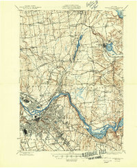
 1930 Schenectady1930 Print · USGSThe Mohawk Valley and southern Saratoga County are caught in a moment of transition in the late twenties, balancing industrial river life with rural farmsteads. Genealogists and historians can trace the Erie Canal (Abandoned) path and locate old family landmarks like Harmony Corners or Vischer Ferry.5 unique versions available
 - 1947 Map of Schenectady, 1954 Print
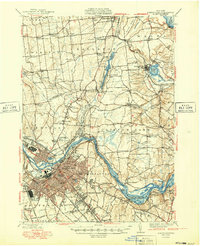
 1947 Schenectady1954 Print · USGSThe Schenectady region in the late 1940s reveals a powerful industrial hub at the intersection of rail, river, and canal. Researchers can trace the legacy of the Erie Canal, find rural district schools, and locate old family crossroads like Groom Corners and Vischer Ferry.2 unique versions available
 - 1948 Map of Schenectady
 1948 Schenectady1948 Print · USGSSchenectady and its surrounding Saratoga County townships are captured here in the late 1940s as industrial rail hubs and rural hamlets met. Genealogists and local historians can trace family-named sites like Groom Corners, the Erie Canal (Abandoned), and Vischer Ferry.
 - 1948 Map of Albany, 1951 Print
 1948 Albany1951 Print · USGSThe Hudson and Connecticut River valleys are captured here in the late 1940s, showing the vital rail and water corridors of the Northeast. You can trace the Boston and Maine tracks past Mt Greylock or locate early settlements like Great Barrington and Bennington.
 - 1949 Map of Schenectady
 1949 Schenectady1949 Print · USGSSchenectady and its surrounding Saratoga County townships are captured here in the late 1940s as the riverfront industry and rail networks remained in full swing. Genealogists can locate family landmarks in old hamlets like Maltaville and Groom Corners or trace the historic Erie Canal (Abandoned).
 - 1954 Map of Round Lake, 1956 Print
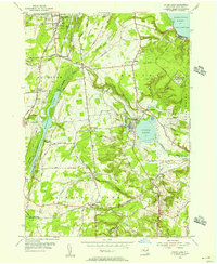 1954 Round Lake1956 Print · USGSSaratoga County's southern corridor appears here in the mid-fifties, centered on the historic villages and lakeside communities of the region. Researchers can trace family sites near East Line Union Cem, find early schools like Sch No 8, and locate the Malta Test Station.3 unique versions available
 - 1954 Map of Niskayuna, 1956 Print
 1954 Niskayuna1956 Print · USGSThe Mohawk River valley in the mid-1950s shows the shifting landscape of upstate New York as suburban growth meets traditional canal routes. Trace the old waterway path through Vischer Ferry, locate family plots at Most Holy Redeemer Cemetery, or explore the early layout of Albany Municipal Airport.4 unique versions available
 - 1954 Map of Burnt Hills, 1956 Print
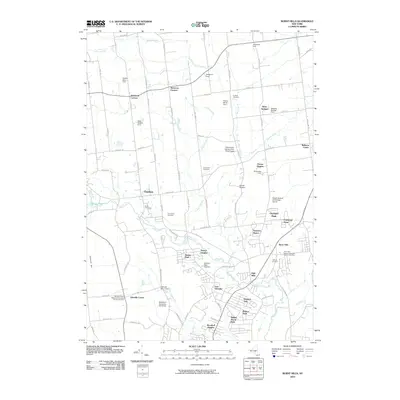
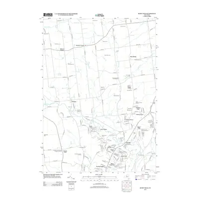
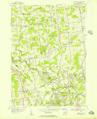 1954 Burnt Hills1956 Print · USGSThe Saratoga and Schenectady county borderlands show a blend of rural hamlets and post-war suburban growth during the mid-1950s. Trace the evolution of Burnt Hills, East Glenville, and Charlton, or locate vanished schoolhouses like Industrial Farm Sch.5 unique versions available
 - 1954 Map of Schenectady, 1957 Print
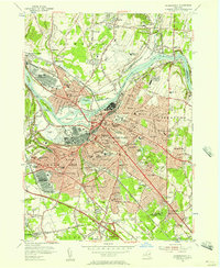 1954 Schenectady1957 Print · USGSSchenectady and the Mohawk River valley appear here at a mid-century peak of industrial and military activity. Researchers can trace historic family burial sites at Vale Cemetery, follow the old Erie Canal, or locate vanished neighborhoods near the U S Mil Res Schenectady General Depot.4 unique versions available
 - 1954 Map of Schenectady, 1957 Print
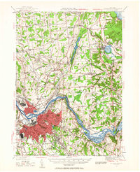 1954 Schenectady1957 Print · USGSThe Mohawk Valley's industrial and transit networks are in full view at mid-century, from the rail yards of Schenectady to the waters of the Erie Canal. Genealogists can locate legacy sites like Vischer Ferry, Pine Grove Cem, and numerous rural schoolhouses.
 - 1956 Map of Albany, 1968 Print
 1956 Albany1968 Print · USGSThe industrial heart of the Northeast is revealed in the mid-1950s, from the Hudson Valley to the Connecticut River. Researchers can trace the legacy of the Quabbin Reservoir, locate Westover Air Force Base, or follow the Rutland RR through the Green Mountains.2 unique versions available
 - 1957 Map of Albany
 1957 Albany1957 Print · USGSThe Tri-State region and Connecticut River Valley are captured here during a period of significant postwar growth and infrastructure expansion. Genealogists and historians can trace the rail-and-river economy through landmarks like the Boston and Maine railroad, Quabbin Reservoir, and Westover Air Force Base.
 - 1959 Map of Albany
 1959 Albany1959 Print · USGSThe Hudson and Connecticut River valleys are captured here during the late fifties, showing the region's dense rail networks and massive water projects. Researchers can trace the New York State Thruway or locate local landmarks like Mt Greylock and the Quabbin Reservoir.
 - 1962 Map of Albany
 1962 Albany1962 Print · USGSThe Hudson and Connecticut River valleys meet the Green Mountains and Berkshires in this mid-century overview of the Northeast. Genealogists and historians can trace the industrial hearts of Albany and Springfield or locate features like Quabbin Reservoir and Westover Air Force Base.
 - 1986 Map of Albany
 1986 Albany1986 Print · USGSThe Capital District and the tri-state highlands come into focus during the mid-eighties as urban growth meets the edge of the Green Mountains. Researchers can trace historic industrial sites and landmarks like the Watervliet Arsenal, the Bennington Battle Monument, and the grounds of Rensselaer Polytechnic Institute.
 - 1989 Map of Albany
 1989 Albany1989 Print · USGSThe tri-state intersection of New York, Vermont, and Massachusetts comes alive in the late 1980s, centered on the historic river confluence of the Capital District. Researchers can trace the extensive rail lines of the D & H RR and explore high peaks like Mount Greylock or the reaches of the Tomhannock Reservoir.2 unique versions available
 - 2010 Map of Burnt Hills, 2010 Print
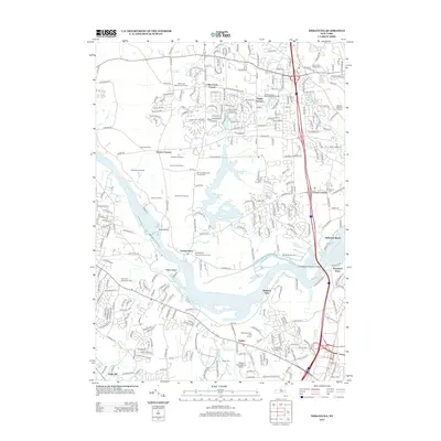
 2010 Burnt Hills2010 Print · USGSCovers Clifton Park, including Glenville, Milton, and other nearby areas
 - 2010 Map of Schenectady, 2010 Print
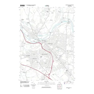 2010 Schenectady2010 Print · USGSCovers Clifton Park, including Colonie, Schenectady, and other nearby areas
 - 2010 Map of Round Lake, 2010 Print
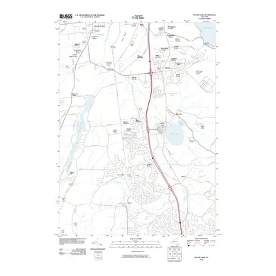 2010 Round Lake2010 Print · USGSCovers Clifton Park, including Halfmoon, Milton, and other nearby areas
 - 2010 Map of Niskayuna, 2010 Print
 2010 Niskayuna2010 Print · USGSCovers Clifton Park, including Colonie, Halfmoon, and other nearby areas
 - 2013 Map of Niskayuna, 2013 Print
 2013 Niskayuna2013 Print · USGSCovers Clifton Park, including Colonie, Halfmoon, and other nearby areas
 - 2013 Map of Burnt Hills, 2013 Print
 2013 Burnt Hills2013 Print · USGSCovers Clifton Park, including Glenville, Milton, and other nearby areas
Showing maps 1-25 of 39
Top cities near Clifton Park
- Albany historical maps
- Colonie historical maps
- Schenectady historical maps
- Troy historical maps
- Guilderland historical maps
- Bethlehem historical maps
See more
Top neighborhoods of Clifton Park
- Groom Corners historical maps
- Groom Corners historical maps
- Jonesville historical maps
- Ballston Lake historical maps
- Flagler Corners historical maps
- Clifton Park Center historical maps
See more
Frequently asked questions
- What are the different types of historical maps available for Clifton Park?
- What is the oldest map of Clifton Park?
- Where can I purchase historical maps of Clifton Park for my home or office?
- Where can I download high-res historical maps of Clifton Park?
- Are there historical topographic maps available for Clifton Park?
- Is there historical aerial imagery available for Clifton Park?
- Where are historical maps of Clifton Park sourced from?