1950s Maps of Staten Island, New York
Explore 10 historic maps of Staten Island from the 1950s. These maps offer a rare glimpse into what life looked like during the 1950s — showing old roads, neighborhoods, homes, and landmarks that have changed or disappeared over time.
Whether you're researching your family's past, planning a metal detecting trip, or studying how Staten Island's landscape evolved across the 1950s, these high-resolution maps are a powerful tool for exploring the history of this region.
- Focus on a specific era: All maps on this page are from the 1950s, giving you a focused view of this time period.
- See what’s changed: Compare century-old streets, trails, and buildings to today's modern landscape using overlays and satellite layers.
- Research with precision: Use these maps for genealogy, historical research, land use analysis, or educational projects.
- View, download, or print: Maps are fully viewable online in high resolution, and can be downloaded or printed for your own records.
Start exploring Staten Island's history through authentic maps from the 1950s. This is your window into the past.
Staten Island, NY maps
(10)- 1954 Map of Keyport, 1956 Print
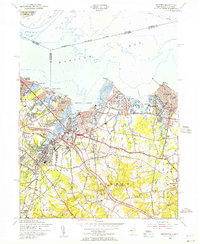 1954 Keyport1956 Print · USGSMonmouth County's northern bayshore is caught in a moment of rapid postwar growth as the Garden State Parkway begins to reshape the landscape. Trace ancestral roots through detailed renderings of Keyport, Matawan, and Keansburg, or locate family sites near Rose Hill Cem and Van Marters Corner.4 unique versions available
 - 1954 Map of Sandy Hook, 1956 Print
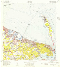 1954 Sandy Hook1956 Print · USGSCoastal New Jersey's bayshore and peninsula are captured here in the mid-1950s, showcasing a landscape of military reservations and harbor towns. Researchers can trace the legacy of Fort Hancock and the Sandy Hook Lighthouse or locate family roots near St Marys Sch and Harmony Cem.6 unique versions available
 - 1954 Map of South Amboy, 1957 Print
 1954 South Amboy1957 Print · USGSMid-century Middlesex County is captured here during a period of rapid suburban and industrial expansion along the Raritan Bay. Researchers can trace family sites from Sayreville to Old Bridge, finding local landmarks like the Sacred Heart Sch and the Auto Race Track.6 unique versions available
 - 1955 Map of Arthur Kill, 1957 Print
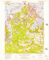
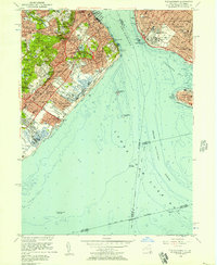
 1955 Arthur Kill1957 Print · USGSStaten Island and the industrial New Jersey shore are captured here in the mid-fifties, just as suburban expansion began to accelerate. Researchers can trace historic institutions and neighborhoods from Sea View Hospital to the Staten Island Rapid Transit line and the Linden Airport.2 unique versions available
 - 1955 Map of The Narrows, 1957 Print
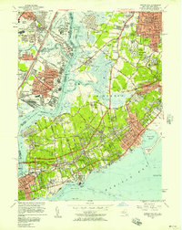
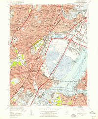
 1955 The Narrows1957 Print · USGSStaten Island and Brooklyn face each other across the water in the mid-1950s, a period of significant suburban growth and established maritime defense. Researchers can trace the Staten Island Rapid Transit line or locate local landmarks like Wagner Memorial College and the Old Austen House.2 unique versions available
 - 1955 Map of Elizabeth, 1958 Print
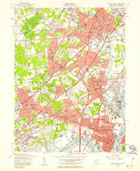
 1955 Elizabeth1958 Print · USGSGreater Newark and Elizabeth are shown here at a peak of industrial and transit development during the mid-fifties. Genealogists and urban historians can trace local parish schools like St Marys Sch, the vast Evergreen Cemetery, and the early layout of Newark Airport.2 unique versions available
 - 1955 Map of Jersey City, 1958 Print
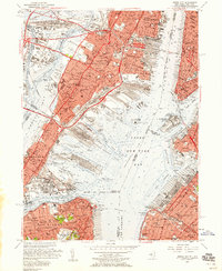 1955 Jersey City1958 Print · USGSMid-century Jersey City and the New York Harbor waterfront appear at their industrial peak, showcasing a landscape of massive rail yards and active piers. Researchers can trace the sprawling Greenville Yards, the Naval Reservation Bayonne Supply Depot, and local landmarks like Roosevelt Stadium.2 unique versions available
 - 1956 Map of Newark
 1956 Newark1956 Print · USGSThe industrial heart of the Mid-Atlantic is captured here at the dawn of the highway era, tracing the dense corridors between Newark and Philadelphia. Genealogists and local historians can map the rail networks of the Reading RR or locate mid-century military life at Fort Dix Military Reservation.2 unique versions available
 - 1956 Map of Perth Amboy, 1958 Print
 1956 Perth Amboy1958 Print · USGSMiddlesex County emerges as a suburban and industrial powerhouse in the mid-fifties as major highways reshape the landscape. Local researchers can trace family roots through numerous numbered schools and parish sites like St Cecilias Sch or the Edison Memorial Tower.6 unique versions available
 - 1957 Map of Newark
 1957 Newark1957 Print · USGSThe industrial and military heart of the Mid-Atlantic is mapped during its post-war suburban boom. Genealogists and historians can trace the intricate rail corridors of the Reading Railroad and locate key landmarks from Princeton University to Fort Hancock.
End of results
Showing maps 1-10 of 10
Frequently asked questions
- What are the different types of historical maps available for Staten Island?
- What is the oldest map of Staten Island?
- Where can I purchase historical maps of Staten Island for my home or office?
- Where can I download high-res historical maps of Staten Island?
- Are there historical topographic maps available for Staten Island?
- Is there historical aerial imagery available for Staten Island?
- Where are historical maps of Staten Island sourced from?