1990s Maps of Staten Island, New York
Explore 6 historic maps of Staten Island from the 1990s. These maps offer a rare glimpse into what life looked like during the 1990s — showing old roads, neighborhoods, homes, and landmarks that have changed or disappeared over time.
Whether you're researching your family's past, planning a metal detecting trip, or studying how Staten Island's landscape evolved across the 1990s, these high-resolution maps are a powerful tool for exploring the history of this region.
- Focus on a specific era: All maps on this page are from the 1990s, giving you a focused view of this time period.
- See what’s changed: Compare century-old streets, trails, and buildings to today's modern landscape using overlays and satellite layers.
- Research with precision: Use these maps for genealogy, historical research, land use analysis, or educational projects.
- View, download, or print: Maps are fully viewable online in high resolution, and can be downloaded or printed for your own records.
Start exploring Staten Island's history through authentic maps from the 1990s. This is your window into the past.
Staten Island, NY maps
(6)- 1995 Map of Elizabeth, 1998 Print
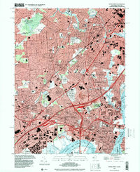
 1995 Elizabeth1998 Print · USGSNorthern New Jersey and Staten Island show their dense urban and industrial character in the 1990s. Trace local history through institutions like Seton Hall Univ or find family landmarks in Evergreen Cemetery and Rose Hill Cemetery.
 - 1995 Map of Keyport, 2000 Print
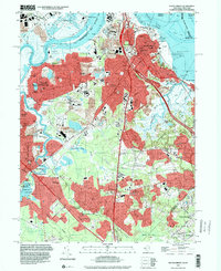
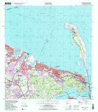
 1995 Keyport2000 Print · USGSThe Monmouth County coastline and Raritan Bay shore are captured in the mid-nineties, showing the dense suburban development of Keyport and Hazlet. Genealogists can locate family landmarks like Hendrickson Corners and Rose Hill Cem, or trace the historic New York and Long Branch RR.
 - 1995 Map of South Amboy, 2000 Print
 1995 South Amboy2000 Print · USGSThe Raritan Bay waterfront and industrial hubs of Middlesex County are on full display in the mid-1990s. Researchers can locate numerous family landmarks, from St Marys Cem and Sacred Heart Sch to the grounds of DeVitte Military Academy.
 - 1995 Map of Perth Amboy, 2000 Print
 1995 Perth Amboy2000 Print · USGSMiddlesex County emerges as a vital transportation hub in the late twentieth century, showing the dense growth of Perth Amboy and Edison. Trace local genealogy and infrastructure through sites like the Edison Memorial Tower, Metuchen Colonial Cemetery, and the State Prison.
 - 1998 Map of The Narrows, 2001 Print
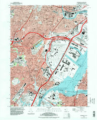
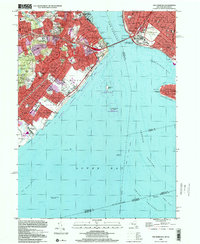 1998 The Narrows2001 Print · USGSStaten Island and Brooklyn meet at the harbor entrance during the late nineties, featuring a fully developed network of residential neighborhoods and coastal parks. Genealogists and local historians can locate Moravian Cemetery, St Marys Cem, and the historic transit line through New Dorp.
 - 1998 Map of Sandy Hook, 2001 Print
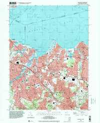
 1998 Sandy Hook2001 Print · USGSThe Monmouth County coastline at the turn of the millennium shows a landscape of strategic maritime defense and dense residential growth. Researchers can trace historic shore sites like Fort Hancock, the Sandy Hook Lighthouse, and Twin Lights State Historic Site.
End of results
Showing maps 1-6 of 6
Frequently asked questions
- What are the different types of historical maps available for Staten Island?
- What is the oldest map of Staten Island?
- Where can I purchase historical maps of Staten Island for my home or office?
- Where can I download high-res historical maps of Staten Island?
- Are there historical topographic maps available for Staten Island?
- Is there historical aerial imagery available for Staten Island?
- Where are historical maps of Staten Island sourced from?