Old Maps of Steuben County, New York for Academic Research
Study the evolution of Steuben County with 288 high-resolution historic maps. Whether you're teaching, researching, or modeling changes in land use, these maps provide essential visual documentation of urban, environmental, and geographic change.
- Analyze long-term change: Track patterns in development, transportation, and natural features.
- Ideal for environmental or urban studies: Support academic projects with primary historical map data.
- Use in the classroom or lab: Educators and researchers rely on these maps to bring historical context to life.
These maps are a powerful tool for teaching, research, and visualizing how Steuben County has changed over the decades.
Steuben County, NY maps
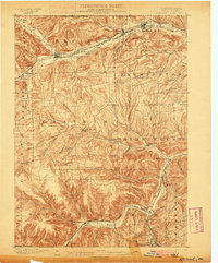
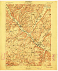
(288)- 1895 Map of Elmira
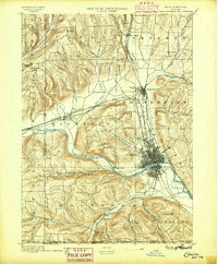 1895 Elmira1895 Print · USGSChemung County and the northern Pennsylvania border appear as a thriving rail hub in the 1890s. Genealogists and local historians can trace the early grids of Elmira, the important rail junctions at State Line Junction, and family-named landmarks like Hawley Hill.10 unique versions available
 - 1898 Map of Watkins Glen, 1961 Print
 1898 Watkins Glen1961 Print · USGSSteamboat routes and competing rail lines define the Schuyler County landscape at the close of the nineteenth century. Researchers can trace the early rail stops at Rock Stream Station, the heights of Watkins Hill, and vanished post offices like Barnes P. O.
 - 1899 Map of Gaines, 1960 Print
 1899 Gaines1960 Print · USGSPotter and Tioga Counties are seen here at the end of the nineteenth century, as the logging and rail industries reached into every deep hollow. Genealogists and historians can trace family lands near Harrison Valley, Sabinsville, and the remote Loucks Mills.2 unique versions available
 - 1900 Map of Gaines
 1900 Gaines1900 Print · USGSThe Cowanesque River valley at the turn of the century shows a landscape defined by new rail lines and remote timbering settlements. Genealogists can trace family holdings near Sunderlinville, Harrison Valley, and the rural crossroads of Mixtown and Lansing.5 unique versions available
 - 1900 Map of Tioga
 1900 Tioga1900 Print · USGSTioga County at the turn of the century shows a landscape defined by the busy river corridors and the arrival of major rail networks. Researchers can trace the early footprints of Lawrenceville, Mansfield, and Tioga, or locate rural landmarks like Jackson Summit and Canoe Camp.
 - 1900 Map of Elkland
 1900 Elkland1900 Print · USGSTioga County at the turn of the century is defined by its deep river valleys and the expanding rail networks of the Cowanesque River. Genealogists and local historians can trace the early footprints of Knoxville, Academy Corners, and the rail junction at Stokesdale Junc.5 unique versions available
 - 1900 Map of Naples, 1956 Print
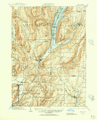 1900 Naples1956 Print · USGSThe Finger Lakes region at the turn of the century shows a landscape of steep ridges and rail-dependent valley towns. Genealogists and historians can trace the vanished tracks of the Kanona and Prattsburg R.R. or locate old community centers like Barker Church and Ingleside.2 unique versions available
 - 1901 Map of Watkins
 1901 Watkins1901 Print · USGSSchuyler County at the turn of the century centered on the bustling rail-and-canal nexus of the southern Finger Lakes. Genealogists and historians can trace the exact 1901 locations of Watkins, Montour Falls, and rural post offices like Barnes P. O.10 unique versions available
 - 1902 Map of Tioga
 1902 Tioga1902 Print · USGSNorthern Tioga County at the turn of the century shows a landscape dominated by the convergence of major rail lines and river valleys. Genealogists can trace family roots in riverside settlements like Canoe Camp or explore vanished rail stops like Tompkins and Hammond.5 unique versions available
 - 1902 Map of Wayland, 1954 Print
 1902 Wayland1954 Print · USGSThe Finger Lakes region at the turn of the century shows a landscape of steep ridges and critical rail junctions. Genealogists and historians can trace the paths of the Erie RR through Dansville or locate smaller settlements like Perkinsville and Springwater.
 - 1903 Map of Naples
 1903 Naples1903 Print · USGSThe Finger Lakes region at the turn of the century shows a landscape defined by deep valleys and essential transit routes. Trace the old STEAMBOAT ROUTE on Canandaigua Lake or locate early industrial sites like the Naples Tannery and Barker Church.7 unique versions available
 - 1903 Map of Penn Yan
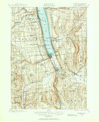
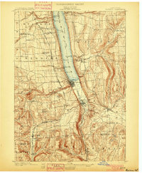
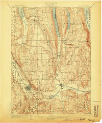
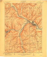
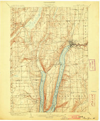 1903 Penn Yan1903 Print · USGSThe Finger Lakes region thrives at the turn of the century, centered on the busy steamboat and rail docks of Penn Yan. Trace early industry along the Keuka Lake Outlet or locate family roots in Branchport, Milo Center, and Keuka Park.7 unique versions available
 - 1903 Map of Hammondsport
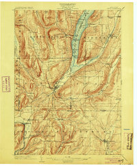
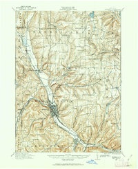
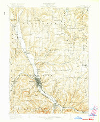
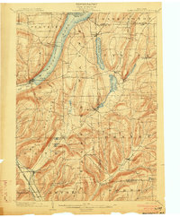 1903 Hammondsport1903 Print · USGSThe Finger Lakes region at the dawn of the twentieth century is defined here by the busy docks of Hammondsport and the deep waters of Keuka Lake. Researchers can trace the early Steamboat Route and a dense network of upland hamlets like Catawba and Wayne Four Corners.8 unique versions available
 - 1904 Map of Wayland
 1904 Wayland1904 Print · USGSThe western Finger Lakes region in the early 1900s was a bustling corridor of industry and rail. Genealogists and historians can trace the early grid of Dansville, the milling operations at Stones Falls Mill, and the shores of Hemlock Lake.7 unique versions available
 - 1905 Map of Watkins Glen
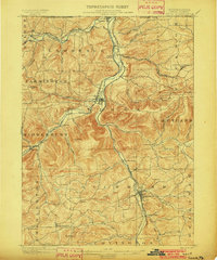
 1905 Watkins Glen1905 Print · USGSThe Finger Lakes and Southern Tier regions are captured at the start of the century, showing a landscape defined by deep glens and heavy rail. Genealogists and historians can trace the paths of the Northern Central RR through Watkins or locate family sites near Burdett and Horseheads.4 unique versions available
 - 1910 Map of Bath
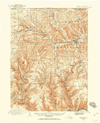
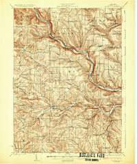
 1910 Bath1910 Print · USGSSteuben County was a bustling corridor of rail and river commerce in the early twentieth century. Researchers can trace the lineage of local institutions like the State Soldiers and Sailors Home or find vanished schoolhouses such as Bucks School and Whites School.4 unique versions available
 - 1913 Map of Naples
 1913 Naples1913 Print · USGSThe Finger Lakes region at the start of the twentieth century shows a landscape of deep waters and steep ridges connected by steam and rail. Trace the historic Steamboat Route on Canandaigua Lake and follow the rail lines to Naples or Prattsburg.
 - 1914 Map of Corning
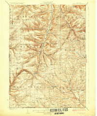
 1914 Corning1914 Print · USGSSteuben County is a thriving rail and river hub during the early twentieth century, centered on the strategic confluence at Painted Post. Genealogists and local historians can locate dozens of neighborhood landmarks, including French's Mill, Lumber City School, and the remote Liberty Pole School.6 unique versions available
 - 1915 Map of Hornell, 1962 Print
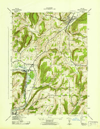
 1915 Hornell1962 Print · USGSSteuben County was a bustling rail hub when this survey was conducted, featuring a dense network of steam and electric lines. Genealogists can locate dozens of country schoolhouses like Babcock School and Eells School, alongside rural settlements such as Arkport and Haskinville.
 - 1918 Map of Hornell
 1918 Hornell1918 Print · USGSThe rail-and-river corridor of Steuben County comes alive in the years following the Great War. Genealogists can trace family footprints across dozens of country school sites like Dutch Street School and rail hubs from Arkport to Canisteo.6 unique versions available
 - 1924 Map of Woodhull
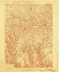
 1924 Woodhull1924 Print · USGSSteuben County in the mid-twenties is a landscape of high ridges and school-centered rural districts. Genealogists can trace family names and local hubs from Cameron Mills to Rathbone, including the Eight Square School and the Erie RR line.
 - 1926 Map of Woodhull
 1926 Woodhull1926 Print · USGSSteuben County rural life in the mid-1920s is defined by the Canisteo River valley and a network of hilltop school districts. Researchers can trace family-named landmarks like Kinners Knob or locate vanished local hubs like Hedgesville and Cameron Mills.4 unique versions available
 - 1926 Map of Greenwood
 1926 Greenwood1926 Print · USGSSteuben County during the mid-1920s reveals a landscape defined by the deep valleys of Bennetts Creek and the hills of West Union. Genealogists and historians can trace numerous rural schoolhouses and vanished hamlets like Rough and Ready and Barney Mills.4 unique versions available
 - 1942 Map of Wayland
 1942 Wayland1942 Print · USGSThe intersection of the Erie and Delaware Lackawanna railroads in the early 1940s highlights this busy valley corridor. Genealogists can trace family roots through a dozen numbered schools and named cemeteries like Ashley Cem and St Josephs Cem.
 - 1942 Map of Naples
 1942 Naples1942 Print · USGSSteuben County was a hub of rail traffic and valley farming in the early 1940s. Researchers can trace rural lineages through numerous local landmarks, including Flint Hill Cem, the Flischman Ch, and the dual lines of the Erie RR and D L & W RR.4 unique versions available
Showing maps 1-25 of 288
Top cities of Steuben County
- Bath historical maps
- Corning historical maps
- Hornell historical maps
- Erwin historical maps
- Corning historical maps
- Hornellsville historical maps
See more
Frequently asked questions
- What are the different types of historical maps available for Steuben County?
- What is the oldest map of Steuben County?
- Where can I purchase historical maps of Steuben County for my home or office?
- Where can I download high-res historical maps of Steuben County?
- Are there historical topographic maps available for Steuben County?
- Is there historical aerial imagery available for Steuben County?
- Where are historical maps of Steuben County sourced from?