2020s Maps of Troupsburg, New York
Explore 6 historic maps of Troupsburg from the 2020s. These maps offer a rare glimpse into what life looked like during the 2020s — showing old roads, neighborhoods, homes, and landmarks that have changed or disappeared over time.
Whether you're researching your family's past, planning a metal detecting trip, or studying how Troupsburg's landscape evolved across the 2020s, these high-resolution maps are a powerful tool for exploring the history of this region.
- Focus on a specific era: All maps on this page are from the 2020s, giving you a focused view of this time period.
- See what’s changed: Compare century-old streets, trails, and buildings to today's modern landscape using overlays and satellite layers.
- Research with precision: Use these maps for genealogy, historical research, land use analysis, or educational projects.
- View, download, or print: Maps are fully viewable online in high resolution, and can be downloaded or printed for your own records.
Start exploring Troupsburg's history through authentic maps from the 2020s. This is your window into the past.
Troupsburg, NY maps
(6)- 2023 Map of Harrison Valley, 2023 Print
 2023 Harrison Valley2023 Print · USGSHarrison Valley and the high ridges of Potter County are mapped here just south of the New York state line. Researchers can trace rural lineages through the English Family Cem, locate the small settlement of Mills, and follow the headwaters of the Genesee River.
 - 2023 Map of Knoxville, 2023 Print
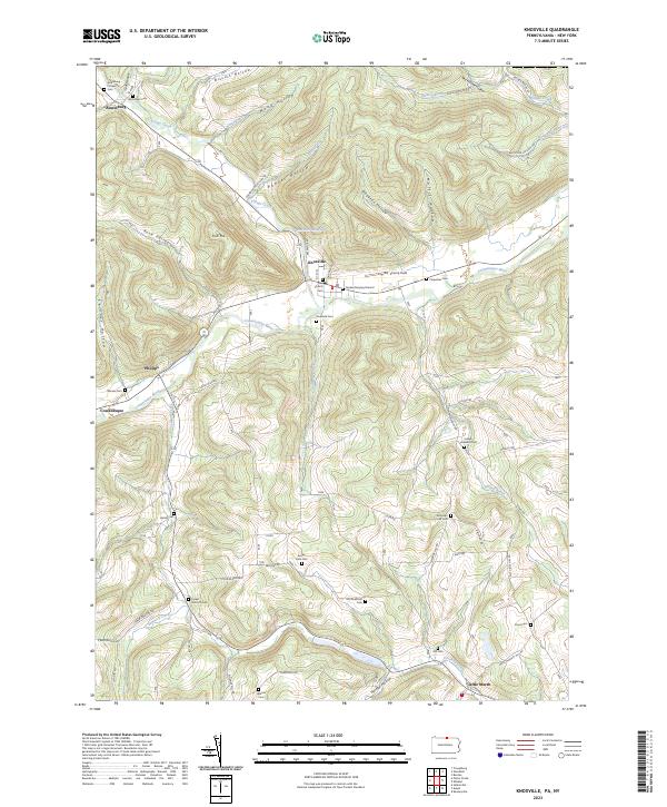 2023 Knoxville2023 Print · USGSKnoxville and the Cowanesque River valley are depicted here in contemporary detail, showing the integration of small settlements within a landscape of steep hollows. Researchers can trace family history through numerous rural burial sites like Quaker Burying Ground and Old Shellman Cem.
 - 2023 Map of Potter Brook, 2023 Print
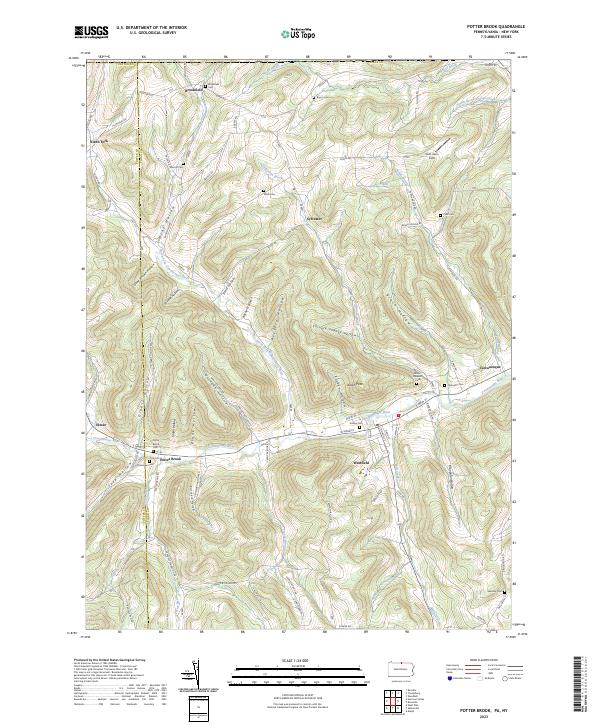 2023 Potter Brook2023 Print · USGSThe Cowanesque River valley in Tioga County serves as a focal point for this contemporary survey of northern Pennsylvania. Researchers can pinpoint historic family plots like Potter Brook Cem and trace the winding paths of Crance Brook and Teed Hollow.
 - 2023 Map of Rexville, 2023 Print
 2023 Rexville2023 Print · USGSSteuben County’s high ridges and hollows are documented here, showing the rural character of the New York-Pennsylvania borderlands. Genealogists can trace family names through the Rough And Ready Cem, Saint Marys Cem, and settlements like Barney Mills.
 - 2023 Map of Troupsburg, 2023 Print
 2023 Troupsburg2023 Print · USGSSteuben County’s rural valleys come into focus in this contemporary survey of the Troups Creek watershed. Genealogists can locate family burial sites such as Mount Hope Cem and Murdock Cem near historic hamlets like Young Hickory and Alice.
 - 2023 Map of Woodhull, 2023 Print
 2023 Woodhull2023 Print · USGSSteuben County's rural uplands are meticulously detailed here as they appeared in the early twenty-first century. Researchers can trace family history through several remote burial sites, including Red Cem and Norway Ridge Cem, while exploring landmarks like Earl Beatty Hill.
End of results
Showing maps 1-6 of 6
Top cities near Troupsburg
- Bath historical maps
- Alfred historical maps
- Canisteo historical maps
- Canisteo historical maps
- Woodhull historical maps
- Andover historical maps
See more
Top neighborhoods of Troupsburg
- Lila historical maps
- South Troupsburg historical maps
- Alice historical maps
- Young Hickory historical maps
Frequently asked questions
- What are the different types of historical maps available for Troupsburg?
- What is the oldest map of Troupsburg?
- Where can I purchase historical maps of Troupsburg for my home or office?
- Where can I download high-res historical maps of Troupsburg?
- Are there historical topographic maps available for Troupsburg?
- Is there historical aerial imagery available for Troupsburg?
- Where are historical maps of Troupsburg sourced from?