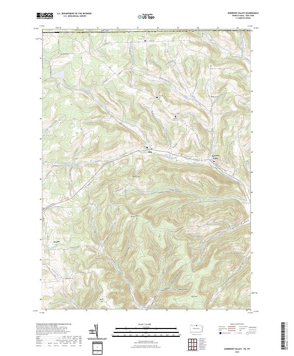
2023 Map of Harrison Valley
USGS Topo · Published 2023About this map
Harrison Valley sits at the junction of the Cowanesque River and several drainage hollows in this northern section of Potter County. The landscape is characterized by narrow river valleys and high, flat-topped ridges like Big Level and White Knoll. Settlement patterns follow the water, with the communities of Mills and Ulysses anchored near the banks of the Cowanesque River and the upper reaches of the Genesee River.
Find a feature on this map
68 named features on this map. Tap any name to fly to it.
Don’t see what you’re looking for? This feature index may not catch every label — zoom into the map to look around manually.
Map Details
Editions of this 2023 Harrison Valley Map
This is the sole edition of this map. No revisions or reprints were ever made.
Other maps of this area

1899 · Gaines
USGS Topo · 1:62,500

1900 · Gaines
USGS Topo · 1:62,500

1926 · Wellsville
USGS Topo · 1:62,500

1926 · Greenwood
USGS Topo · 1:62,500

1932 · Genesee
USGS Topo · 1:62,500

1937 · Genesee
USGS Topo · 1:62,500

1950 · Elmira
USGS Topo · 1:250,000

1954 · Williamsport
USGS Topo · 1:250,000

1954 · Troupsburg
USGS Topo · 1:24,000
1957 · Potter Brook
USGS Topo · 1:24,000