Old Maps of Troupsburg, New York for Metal Detecting
Plan your next treasure hunt with 54 historic maps of Troupsburg. Find old homesites, ghost towns, trails, and gathering spots that may be lost to time — perfect for identifying promising metal detecting locations.
- Locate forgotten sites: Uncover places like long-lost settlements, abandoned rail lines, or gathering spots.
- Plan better hunts: Use map overlays combined with LiDAR or satellite views to narrow in on historically rich areas.
- Made for detectorists: Thousands of hobbyists use these maps to discover relics, coins, and hidden history.
Use these historic maps to boost your research and find new opportunities beneath the surface of Troupsburg.
Troupsburg, NY maps
(54)- 1899 Map of Gaines, 1960 Print
 1899 Gaines1960 Print · USGSPotter and Tioga Counties are seen here at the end of the nineteenth century, as the logging and rail industries reached into every deep hollow. Genealogists and historians can trace family lands near Harrison Valley, Sabinsville, and the remote Loucks Mills.2 unique versions available
 - 1900 Map of Gaines
 1900 Gaines1900 Print · USGSThe Cowanesque River valley at the turn of the century shows a landscape defined by new rail lines and remote timbering settlements. Genealogists can trace family holdings near Sunderlinville, Harrison Valley, and the rural crossroads of Mixtown and Lansing.5 unique versions available
 - 1900 Map of Elkland
 1900 Elkland1900 Print · USGSTioga County at the turn of the century is defined by its deep river valleys and the expanding rail networks of the Cowanesque River. Genealogists and local historians can trace the early footprints of Knoxville, Academy Corners, and the rail junction at Stokesdale Junc.5 unique versions available
 - 1924 Map of Woodhull
 1924 Woodhull1924 Print · USGSSteuben County in the mid-twenties is a landscape of high ridges and school-centered rural districts. Genealogists can trace family names and local hubs from Cameron Mills to Rathbone, including the Eight Square School and the Erie RR line.
 - 1926 Map of Woodhull
 1926 Woodhull1926 Print · USGSSteuben County rural life in the mid-1920s is defined by the Canisteo River valley and a network of hilltop school districts. Researchers can trace family-named landmarks like Kinners Knob or locate vanished local hubs like Hedgesville and Cameron Mills.4 unique versions available
 - 1926 Map of Greenwood
 1926 Greenwood1926 Print · USGSSteuben County during the mid-1920s reveals a landscape defined by the deep valleys of Bennetts Creek and the hills of West Union. Genealogists and historians can trace numerous rural schoolhouses and vanished hamlets like Rough and Ready and Barney Mills.4 unique versions available
 - 1944 Map of Woodhull
 1944 Woodhull1944 Print · USGSSteuben County rural life during the 1940s is centered on the Erie RR corridor and a network of hill-country farm roads. Researchers can locate dozens of district schoolhouses like Eight Square Sch and Cameron Hill Sch alongside old hamlets such as Cameron Mills and Hedgesville.
 - 1950 Map of Elmira
 1950 Elmira1950 Print · USGSThe Finger Lakes region thrived in the late 1940s as a hub of industry and transport. Trace family roots and vanished landmarks near Seneca Lake or explore the rail lines of the Erie RR and the sprawling Seneca Ordnance Depot.2 unique versions available
 - 1953 Map of Woodhull, 1954 Print
 1953 Woodhull1954 Print · USGSSteuben County farmland and ridge country are meticulously detailed in this mid-century survey just north of the Pennsylvania line. Researchers can trace rural school districts like Owlville Sch and Chenango Sch or locate the Norway Ridge Cem and the small hamlet of Five Corners.2 unique versions available
 - 1954 Map of Williamsport
 1954 Williamsport1954 Print · USGSNorth-central Pennsylvania in the mid-fifties is defined by the winding West Branch Susquehanna River and its industrial valley. Local historians can trace the massive Susquehanna Ordnance Depot and the extensive rail networks of the Pennsylvania Railroad.
 - 1954 Map of Knoxville, 1956 Print
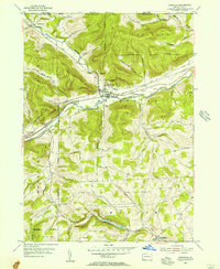 1954 Knoxville1956 Print · USGSNorthern Tioga County in the mid-1950s is defined by its deep river valleys and the dual rail lines serving Knoxville. Genealogists can trace family sites like Woodlawn Cem and Academy Corners or locate the rural Jemison Valley Ch.3 unique versions available
 - 1954 Map of Troupsburg, 1956 Print
 1954 Troupsburg1956 Print · USGSThe rural borderlands of Steuben County come to life in this mid-fifties survey of the Troups Creek valley. Genealogists can locate family burial sites at Mt Vernon Cem or Card Cem and trace the old homesteads around Young Hickory and Alice.2 unique versions available
 - 1957 Map of Potter Brook, 1958 Print
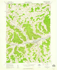 1957 Potter Brook1958 Print · USGSThe Cowanesque River valley in northern Tioga County was a busy crossroads of rail and road at the dawn of the 1960s. Family historians can trace ancestral sites through Westfield and Brookfield, identifying locations like Pleasant Cemetery and Champlin Cem.6 unique versions available
 - 1957 Map of Harrison Valley, 1958 Print
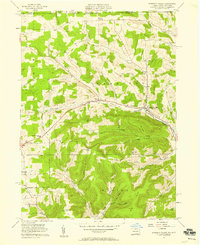 1957 Harrison Valley1958 Print · USGSPotter County communities along the Cowanesque River are documented here in the late fifties as the regional landscape transitioned from its rail-heavy past. Local researchers can trace family landmarks like Schofield Cem, the Northern Tier Childrens Home, and the OLD RAILROAD GRADE.3 unique versions available
 - 1958 Map of Elmira
 1958 Elmira1958 Print · USGSThe New York Finger Lakes during the late fifties reveal a complex landscape of glacial geology and industrial growth. Researchers can trace historic transport corridors like the Erie Canal and Erie RR, or locate institutional landmarks like Cornell University.2 unique versions available
 - 1960 Map of Williamsport
 1960 Williamsport1960 Print · USGSNorth-central Pennsylvania in the mid-twentieth century was a vital corridor of rail and river industry stretching from the New York line to the coal regions. Genealogists can trace the rail networks of the Pennsylvania RR and Lehigh Valley RR connecting towns like Williamsport, Towanda, and Lock Haven.
 - 1962 Map of Williamsport, 1966 Print
 1962 Williamsport1966 Print · USGSNorth-central Pennsylvania was a landscape of industrial river hubs and vast state woodlands in the early sixties. Researchers can trace the path of the Pennsylvania Railroad through Williamsport and explore the remote reaches of Bucktail State Park.5 unique versions available
 - 1962 Map of Elmira, 1969 Print
 1962 Elmira1969 Print · USGSThe Finger Lakes region and Southern Tier are captured here during a period of industrial maturity and highway expansion. Researchers can trace the path of the Erie Canal, the footprint of the Seneca Army Depot, and legacy rail lines through Elmira and Ithaca.4 unique versions available
 - 1965 Map of Elmira
 1965 Elmira1965 Print · USGSThe Finger Lakes and Southern Tier regions are captured in the mid-sixties, showcasing a landscape of deep glacial valleys and heavy rail infrastructure. Trace old railroad corridors like the Pennsylvania RR or visit landmarks like Letchworth State Park and the Seneca Army Depot.
 - 1965 Map of Williamsport
 1965 Williamsport1965 Print · USGSNorth-central Pennsylvania in the mid-1960s is defined by the industrial river towns and vast timberlands of the Allegheny Plateau. Researchers can trace historic rail lines like the Erie Lackawanna and Reading as they thread through Williamsport, Lock Haven, and Jersey Shore.
 - 1965 Map of Rexville, 1967 Print
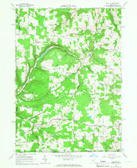 1965 Rexville1967 Print · USGSSouthern Steuben County in the mid-1960s is a landscape of high ridges and deep hollows where hamlets like Rough and Ready endure. Researchers can trace rural genealogy and old homesteads near St Marys Cem and the settlement of Barney Mills.2 unique versions available
 - 1966 Map of Williamsport
 1966 Williamsport1966 Print · USGSThe Susquehanna Valley was a hub of transit and industry in the mid-seventies, where the river's West Branch connected major college towns and timberlands. Researchers can trace historical rail lines like the Reading or locate regional landmarks from Jersey Shore to Ricketts Glen State Park.
 - 1981 Map of Wellsboro, 1982 Print
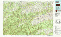 1981 Wellsboro1982 Print · USGSNorthern Pennsylvania in the early eighties shows a landscape of deep river gorges and vast state forests. Trace the rail lines of Conrail and explore old settlements from Coudersport to the Pine Creek Gorge.
 - 1986 Map of Hornell
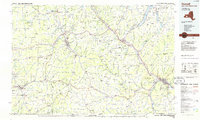 1986 Hornell1986 Print · USGSThe Southern Tier and Finger Lakes region thrive in the 1980s as rail and river corridors link Hornell to Corning. Trace local heritage through landmarks like Alfred University, the Veterans Adm Center, and the shores of Keuka Lake.2 unique versions available
 - 2010 Map of Rexville, 2010 Print
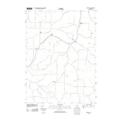 2010 Rexville2010 Print · USGSThe southern Steuben County hills come into focus here during the early twenty-first century, showing a landscape still deeply tied to its rural roots. Family historians can trace ancestral sites across hamlets like Rexville and Wileyville, or locate family burials at Hauber Cemetery and Davis Cemetery.
Showing maps 1-25 of 54
Top cities near Troupsburg
- Bath historical maps
- Alfred historical maps
- Canisteo historical maps
- Canisteo historical maps
- Woodhull historical maps
- Andover historical maps
See more
Top neighborhoods of Troupsburg
- Lila historical maps
- South Troupsburg historical maps
- Alice historical maps
- Young Hickory historical maps
Frequently asked questions
- What are the different types of historical maps available for Troupsburg?
- What is the oldest map of Troupsburg?
- Where can I purchase historical maps of Troupsburg for my home or office?
- Where can I download high-res historical maps of Troupsburg?
- Are there historical topographic maps available for Troupsburg?
- Is there historical aerial imagery available for Troupsburg?
- Where are historical maps of Troupsburg sourced from?