Old Maps of Southold, New York for Metal Detecting
Plan your next treasure hunt with 141 historic maps of Southold. Find old homesites, ghost towns, trails, and gathering spots that may be lost to time — perfect for identifying promising metal detecting locations.
- Locate forgotten sites: Uncover places like long-lost settlements, abandoned rail lines, or gathering spots.
- Plan better hunts: Use map overlays combined with LiDAR or satellite views to narrow in on historically rich areas.
- Made for detectorists: Thousands of hobbyists use these maps to discover relics, coins, and hidden history.
Use these historic maps to boost your research and find new opportunities beneath the surface of Southold.
Southold, NY maps
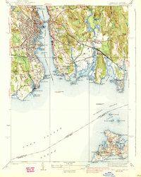
(141)- 1889 Map of Stonington
 1889 Stonington1889 Print · USGSThe Connecticut and Rhode Island borderlands are documented here at the height of the maritime and rail era. Genealogists and historians can trace family-named hills like Stewart Hill or locate industrial sites such as the Silax Mine and the rail hub at Mystic Bridge.
 - 1892 Map of New London
 1892 New London1892 Print · USGSCoastal Connecticut at the close of the nineteenth century reveals a landscape defined by its deep-water harbor and expanding rail networks. Genealogists and historians can trace old property lines and neighborhoods near Ft Trumbull, Gale Ferry, and Flanders Village.
 - 1893 Map of Stonington
 1893 Stonington1893 Print · USGSThe coastal borderlands of Connecticut and Rhode Island are captured here in the late nineteenth century, showing a landscape defined by maritime trade and river power. Genealogists can trace family landmarks like Ayer Hill and Pequot Hill or locate industrial sites such as the Silex Mine.10 unique versions available
 - 1893 Map of New London
 1893 New London1893 Print · USGSSoutheastern Connecticut at the height of the Victorian era centers on the busy maritime hub of New London and its strategic harbor. Genealogists can trace family holdings and early industry from Gale Ferry to Poquonoc Bridge, while rail enthusiasts can follow the Shore Line Division across the coast.10 unique versions available
 - 1903 Map of Sag Harbor, 1961 Print
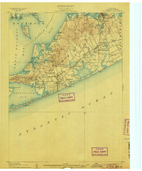
 1903 Sag Harbor1961 Print · USGSThe South Fork of Long Island at the start of the century reveals a coastal landscape of rail-linked hamlets and active life-saving stations. Researchers can trace the early layout of the Shinnecock Indian Reservation and locate historic stops like Wainscott Sta along the Long Island Railroad.
 - 1903 Map of Gardiners Island, 1962 Print
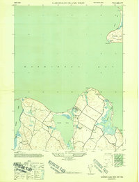
 1903 Gardiners Island1962 Print · USGSThe eastern reaches of Long Island and its surrounding sounds appear here at the opening of the twentieth century. Researchers can trace historic shorelines and maritime infrastructure, including Fort Terry on Plum Island and old settlements like Kingstown and Fireplace.
 - 1903 Map of Riverhead, 1963 Print
 1903 Riverhead1963 Print · USGSThe forks of Long Island come alive in this early 1900s survey of the bustling rail and maritime corridor. Researchers can trace the Long Island Railroad through historic hamlets like Good Ground, Aquebogue, and the early shoreline of Shinnecock Bay.
 - 1904 Map of Sag Harbor
 1904 Sag Harbor1904 Print · USGSThe South Fork of Long Island at the dawn of the 1900s reveals a maritime landscape of life-saving stations and rail-connected villages. Genealogists and historians can trace the early layout of Sag Harbor, the Montauk Division railroad stops, and the Shinnecock Indian Reservation.6 unique versions available
 - 1904 Map of Shelter Island
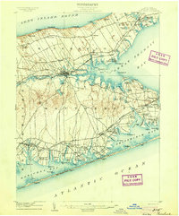
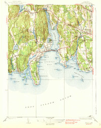
 1904 Shelter Island1904 Print · USGSEastern Long Island thrived at the dawn of the twentieth century as a premier maritime and rail destination. Trace the coastal growth of Sag Harbor and Greenport or locate family landmarks along the Long Island RR and at Orient Point.6 unique versions available
 - 1904 Map of Gardiners Island
 1904 Gardiners Island1904 Print · USGSEasthampton and its outlying islands are captured here in the early twentieth century, showing a maritime landscape defined by coastal forts and small harbor landings. Genealogists and local historians can trace family-named sites like Barnes Landing, Springs, and the military outpost at Fort Terry.6 unique versions available
 - 1904 Map of Riverhead
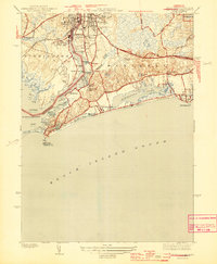
 1904 Riverhead1904 Print · USGSEastern Long Island at the turn of the century shows a landscape of rail-connected hamlets and coastal vigilance. Researchers can trace the early layout of Riverhead or locate historic life-saving outposts like Tiana L.S.S. and Potunk L.S.S. along the barrier beaches.9 unique versions available
 - 1904 Map of Montauk
 1904 Montauk1904 Print · USGSThe tip of Long Island at the turn of the century is a maritime frontier where the railway meets the Atlantic. Researchers can trace the early layout of Montauk, the vital Montauk Point L.H., and coastal life-saving stations like Ditch Plain L.S.S.6 unique versions available
 - 1921 Map of Gardiners Island
 1921 Gardiners Island1921 Print · USGSThe maritime landscape of eastern Long Island is detailed here in the years following the Great War. Researchers can trace historic shorelines and landings like Quincetree Landing, locate the military grounds of Fort Terry, or find family-named sites such as Barnes Landing and Hicks.
 - 1921 Map of New London
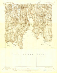
 1921 New London1921 Print · USGSCoastal Connecticut thrived between the world wars as a strategic naval and rail hub. Genealogists and historians can trace the foundations of local life through the Norwich State Hospital, the sprawling US Naval Station, and small hamlets like Gales Ferry or Flanders Village.
 - 1921 Map of Stonington
 1921 Stonington1921 Print · USGSCoastal Connecticut and Rhode Island meet here between the wars, where river and rail drive the regional economy. Genealogists can trace family footprints in North Stonington and Westerly, or locate the Silex Mine and the Light House at Stonington.
 - 1934 Map of Niantic
 1934 Niantic1934 Print · USGSCoastal Connecticut in the 1930s reveals a landscape of growing beach colonies and significant state institutions. Genealogists and historians can trace family roots through Flanders Cem, or locate landmarks like the Seaside Connecticut State Sanatorium and the New York New Haven and Hartford Railroad.
 - 1938 Map of New London
 1938 New London1938 Print · USGSThe Thames River waterfront and Fishers Island are shown in detail during the late 1930s. Researchers can trace military and maritime history at Fort Trumbull and Fort H G Wright, or locate family sites like Bethel Cem and Fishtown Chapel.3 unique versions available
 - 1938 Map of Niantic
 1938 Niantic1938 Print · USGSNiantic and East Lyme are captured here in the mid-1930s as the Connecticut shoreline evolved into a premier summer destination. Genealogists can locate family sites at Jordan Cem or St Marys Cem, while tracing the old Boston Post Road.3 unique versions available
 - 1942 Map of Block Island, 1943 Print
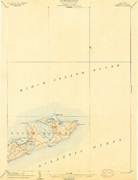
 1942 Block Island1943 Print · USGSThe coastal borderlands of Rhode Island and Connecticut are captured here during the wartime years, documenting a landscape defined by rail and sea. Researchers can trace the NY NH & H RR through historic mill villages or locate landmarks like the Silex Mine and Indian Burying Hill.2 unique versions available
 - 1943 Map of Riverhead
 1943 Riverhead1943 Print · USGSLong Island's eastern forks appear here in the early twentieth century as a landscape of coastal hamlets and maritime commerce. Trace the path of the Montauk Division railroad through RIVERHEAD or locate family roots in Mattituck, Speonk, and Good Ground.
 - 1944 Map of Mystic
 1944 Mystic1944 Print · USGSCoastal Connecticut and the waters of Fishers Island Sound are captured here during the mid-war years. Researchers can trace historic family cemeteries like Elm Grove Cem and Miner Cem, or locate the Stonington Landing Field.3 unique versions available
 - 1944 Map of Watch Hill
 1944 Watch Hill1944 Print · USGSCoastal Rhode Island and Connecticut meet along the Pawcatuck River during the mid-forties. Genealogists and historians can trace the neighborhoods of Pawcatuck, find family plots in River Bend Cem, or locate the Watch Hill Lighthouse along the sound.2 unique versions available
 - 1944 Map of Gardiners Island West, 1947 Print
 1944 Gardiners Island West1947 Print · USGSThe East Hampton shoreline during the 1940s reveals a quiet landscape of coastal hamlets and protected inlets. Genealogists and researchers can trace local routes through Springs and Eastside, or locate family landmarks like Powder Hill and Fireplace.2 unique versions available
 - 1947 Map of Orient
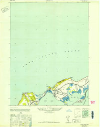 1947 Orient1947 Print · USGSThe tip of Long Island's North Fork is captured here in the late 1940s, showing a landscape defined by saltwater bays and narrow peninsulas. Genealogists and local historians can trace the homes around ORIENT and East Marion, or locate family plots in the CENTRAL CEMETERY.
 - 1947 Map of Mattituck
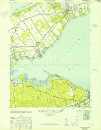 1947 Mattituck1947 Print · USGSNorth and South Fork communities are captured here in the mid-1940s as the Long Island Railroad connects rural farmlands to the bays. Genealogists and local historians can trace family-named sites like Squiretown, Northville, and Jacobs Hill across this unique double-shoreline landscape.
Showing maps 1-25 of 141
Top cities near Southold
- Southampton historical maps
- Groton historical maps
- East Hampton historical maps
- New London historical maps
- Waterford historical maps
- East Lyme historical maps
See more
Top neighborhoods of Southold
- Southold historical maps
- Mattituck historical maps
- Cutchogue historical maps
- Greenport historical maps
- Greenport West historical maps
- Laurel historical maps
See more
Frequently asked questions
- What are the different types of historical maps available for Southold?
- What is the oldest map of Southold?
- Where can I purchase historical maps of Southold for my home or office?
- Where can I download high-res historical maps of Southold?
- Are there historical topographic maps available for Southold?
- Is there historical aerial imagery available for Southold?
- Where are historical maps of Southold sourced from?