Old Maps of Neversink, New York for Hiking & Exploration
Hike through history with 54 historic maps of Neversink. Explore old trails, ghost towns, and forgotten backroads — perfect for outdoor adventurers and local explorers.
- Rediscover forgotten places: Map out old mining camps, roads, and footpaths that no longer exist on modern maps.
- Layer with modern tools: Combine with LiDAR or satellite views to plan hikes through historical terrain.
- Made for exploration: Popular among hikers, overlanders, and local history lovers.
Use these maps to find adventure and explore the hidden past of Neversink.
Neversink, NY maps
(54)- 1903 Map of Slide Mountain, 1961 Print
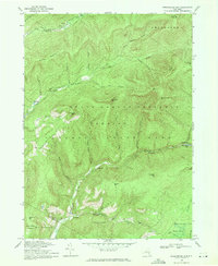
 1903 Slide Mountain1961 Print · USGSThe high peaks and deep hollows of Ulster County are captured here at the dawn of the reservoir era. Genealogists and hikers can trace old homesteads and roads near Sundown, Lackawack, and the isolated Peekamoose Lodge.
 - 1905 Map of Slide Mountain
 1905 Slide Mountain1905 Print · USGSThe Catskill high peaks meet the industrializing Rondout valley in the early twentieth century. Researchers can trace old mountain outposts like Peekamoose Lodge and Sundown, or follow the New York Ontario and Western RR through Kerhonkson.8 unique versions available
 - 1910 Map of Neversink
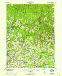
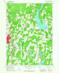
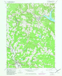
 1910 Neversink1910 Print · USGSSullivan and Ulster counties appear here in the early twentieth century, showing a region of mountain hamlets and sprawling ponds before major reservoir construction. Genealogists can trace family footprints in Grahamsville, Eureka, and Loch Sheldrake, or follow the Ontario and Western RR through Liberty.6 unique versions available
 - 1942 Map of Neversink, 1958 Print
 1942 Neversink1958 Print · USGSThe Catskills come alive in this wartime survey, showing the deep river valleys and high peaks of Sullivan and Ulster counties. Trace old rail lines like the NYO AND W RR or find family landmarks in hamlets such as Claryville, Loch Sheldrake, and Grahamsville.2 unique versions available
 - 1942 Map of Lackawack, 1959 Print
 1942 Lackawack1959 Print · USGSUlster County's Rondout Valley is captured here during the 1940s, just as reservoir construction began to transform the local landscape forever. Genealogists and historians can trace the final years of valley communities like Montela and Lackawack, alongside family-named landmarks such as Furman Cem and Yagerville Sch.
 - 1943 Map of Peekamoose Mountain
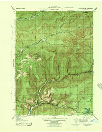 1943 Peekamoose Mountain1943 Print · USGSIn the heart of the Catskill Mountains during the mid-forties, this area remains a landscape of high summits and isolated valley settlements. Researchers can trace remote family homesteads and local institutions like the Greenville School, Richmond Camp, and the Slide Mountain Fire Tower.3 unique versions available
 - 1943 Map of Lackawack
 1943 Lackawack1943 Print · USGSThe Ulster County uplands are captured here during a period of massive hydraulic engineering. Genealogists and local historians can trace family farmsteads and rural schools like Stangle Hill School near the massive footprint of the Merriman Dam.
 - 1943 Map of Monticello, 1964 Print
 1943 Monticello1964 Print · USGSSullivan County in the early 1940s is shown at a peak of its rural development before mid-century modernization changed the landscape. Genealogists and researchers can trace local roots through numerous district schools like the Bushville School and family landmarks such as the Stewart Cem or the industrial Dye Works.
 - 1944 Map of Neversink
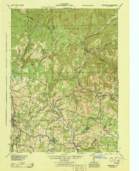 1944 Neversink1944 Print · USGSThe Catskills of the mid-1940s come alive in this survey of the river valleys before later reservoir development. Genealogists and historians can trace old homesteads near Willowemoc, follow the NYO AND W RR through Ferndale, and locate Union Ch and Divine Corners.
 - 1950 Map of Scranton, 1952 Print
 1950 Scranton1952 Print · USGSMid-century Northeast Pennsylvania and the Hudson Valley come alive in this survey of the tri-state region. Genealogists and historians can trace the dense rail networks of the Erie RR and DL&W RR between industrial hubs like Scranton and Wilkes-Barre.
 - 1953 Map of Scranton
 1953 Scranton1953 Print · USGSNortheastern Pennsylvania and the Catskills are shown in great detail during the early fifties, a time when rail lines and river valleys dictated the region's growth. Genealogists and historians can trace the industrial hearts of Scranton and Wilkes-Barre or locate remote landmarks like High Point and Lake Wallenpaupack.
 - 1959 Map of Scranton
 1959 Scranton1959 Print · USGSThe northern coalfields and the Hudson Valley meet in this mid-century survey of the Pennsylvania and New York borderlands. Genealogists and historians can trace the intricate rail networks of the Erie Railroad and the vast waters of Lake Wallenpaupack.2 unique versions available
 - 1962 Map of Scranton, 1977 Print
 1962 Scranton1977 Print · USGSThe industrial heart of eastern Pennsylvania and the New York Catskills are captured here in the early sixties. Genealogists and historians can trace the dense valley settlements from Scranton to Wilkes-Barre and the rail lines of the Erie Lackawanna Railroad.2 unique versions available
 - 1965 Map of Scranton
 1965 Scranton1965 Print · USGSThe tri-state highlands of Pennsylvania, New York, and New Jersey come alive in the mid-sixties as industry and recreation converge. Trace the intricate rail lines of the Erie Lackawanna RR or locate landmarks like the U S Military Academy.2 unique versions available
 - 1966 Map of Willowemoc, 1968 Print
 1966 Willowemoc1968 Print · USGSSullivan County during the mid-1960s remains a bastion of the Catskill wilderness, centered on the flow of Willowemoc Creek. Genealogists and historians can trace old homesteads and landmarks like the State Fish Hatchery and the settlement of Debruce.3 unique versions available
 - 1966 Map of Liberty East, 1968 Print
 1966 Liberty East1968 Print · USGSSullivan County’s resort and reservoir country is captured here during the mid-sixties, showing the transition from old rail-dependent hamlets to a landscape of local recreation and water infrastructure. Genealogists and researchers can locate landmarks like Loch Sheldrake, the St Peters Sch, and an Old Railroad Grade.2 unique versions available
 - 1966 Map of Claryville, 1968 Print
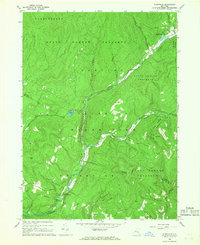 1966 Claryville1968 Print · USGSThe Upper Neversink Valley in the mid-1960s remains a landscape of protected forests and quiet river junctions. Researchers can trace the path of the Delaware Aqueduct and locate historic local landmarks like the Covered Bridge and the Lookout Tower near Claryville.3 unique versions available
 - 1966 Map of Grahamsville, 1968 Print
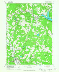 1966 Grahamsville1968 Print · USGSThe Sullivan County highlands in the mid-sixties reveal a landscape defined by state-managed forests and massive water infrastructure. Researchers can trace the paths of the Rondout Aqueduct and locate local landmarks like the Woodbourne Correctional Institute and Kural Cem.
 - 1969 Map of Rondout Reservoir, 1971 Print
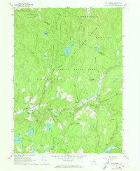
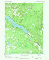 1969 Rondout Reservoir1971 Print · USGSThe Catskill highlands and the critical water infrastructure of the late sixties are captured here on the Ulster and Sullivan county line. Genealogists and hikers can trace old mountain roads and sites like Furman Cem, Ulster Heights, and the Covered Bridge near the reservoir.3 unique versions available
 - 1969 Map of Peekamoose Mtn, 1971 Print
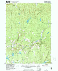
 1969 Peekamoose Mtn1971 Print · USGSUpper Ulster County in the late sixties remained a landscape of remote mountain hamlets and deep forest preserves. Local historians can trace the road networks connecting Denning and Sundown or locate landmarks like Peekamoose Lake and Buttermilk Falls Brook.2 unique versions available
 - 1982 Map of Grahamsville
 1982 Grahamsville1982 Print · USGSSullivan County and the Catskills are shown in the early 1980s during a period of established reservoir management and forest preservation. Researchers can trace the development of Grahamsville, locate the Rural Cem, and explore the grounds of the Woodbourne Correctional Institute.
 - 1986 Map of Monticello
 1986 Monticello1986 Print · USGSThe Catskills and Shawangunk Ridge meet in the mid-eighties, showing a landscape defined by massive reservoirs and valley towns. Genealogists and researchers can trace the growth of Monticello, Ellenville, and New Paltz alongside landmarks like Mohonk Preserve and Stewart Airport.2 unique versions available
 - 1997 Map of Willowemoc, 2000 Print
 1997 Willowemoc2000 Print · USGSSullivan County and the Catskill highlands are shown here in the late twentieth century, centered on the recreational and conservation lands of the forest preserve. Researchers can locate the State Fish Hatchery and local Cem, or trace the waters of Willowemoc Creek and the Neversink Res.
 - 1997 Map of Peekamoose Mtn, 2001 Print
 1997 Peekamoose Mtn2001 Print · USGSThe high peaks and river headwaters of the Catskills appear here as they were managed in the late twentieth century. Researchers can trace remote settlements like Sundown and Denning or find family landmarks such as Bangle Hill and Peekamoose Lake.
 - 2010 Map of Liberty East, 2010 Print
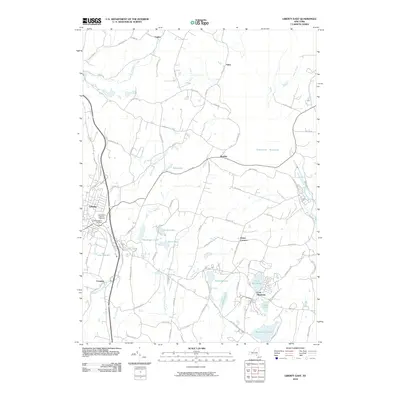 2010 Liberty East2010 Print · USGSCovers Neversink, including Fallsburg, Liberty, and other nearby areas
Showing maps 1-25 of 54
Top cities near Neversink
- Thompson historical maps
- Fallsburg historical maps
- Shawangunk historical maps
- Wawarsing historical maps
- Mamakating historical maps
- Liberty historical maps
See more
Top neighborhoods of Neversink
- Bradley historical maps
- Aden historical maps
- Claryville historical maps
- Willowemoc historical maps
- Curry historical maps
- Grahamsville historical maps
Frequently asked questions
- What are the different types of historical maps available for Neversink?
- What is the oldest map of Neversink?
- Where can I purchase historical maps of Neversink for my home or office?
- Where can I download high-res historical maps of Neversink?
- Are there historical topographic maps available for Neversink?
- Is there historical aerial imagery available for Neversink?
- Where are historical maps of Neversink sourced from?