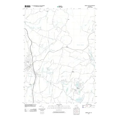
2010 Map of Liberty East
USGS Topo · Published 2010About this map
Loch Sheldrake and the eastern outskirts of Liberty define this Sullivan County landscape during the early 21st century. The map reveals a dense network of water bodies and recreational lakes, including Grossingers Lake, Sunset Lake, and Dixie Lake, which reflect the area's long-standing identity as a resort destination in the Catskill Mountains. Local history and genealogy are well-represented by the Liberty Soldiers Cemetery and Saint Peter's Catholic Cemetery, located near the western margin. Small settlements like Ferndale, Divine Corners, and Bradley are linked by winding routes such as Divine Corners Rd and Hasbrouck Rd. To the northeast, the corner of the Neversink Reservoir appears, while the Middle Mongaup River and East Mongaup River drain the central terrain. The placement of Morningside Lake and Evens Lake in the southeast highlights the concentration of vacation-oriented topography that has shaped this region for generations.
Find a feature on this map
82 named features on this map. Tap any name to fly to it.
Don’t see what you’re looking for? This feature index may not catch every label — zoom into the map to look around manually.
Map Details
Editions of this 2010 Liberty East Map
This is the sole edition of this map. No revisions or reprints were ever made.
Other maps of this area

1909 · Monticello
USGS Topo · 1:62,500

1910 · Neversink
USGS Topo · 1:62,500

1911 · Monticello
USGS Topo · 1:62,500

1921 · Livingston Manor
USGS Topo · 1:62,500

1922 · White Lake
USGS Topo · 1:62,500

1923 · Livingston Manor
USGS Topo · 1:62,500

1942 · White Lake
USGS Topo · 1:62,500

1942 · Neversink
USGS Topo · 1:62,500

1943 · White Lake
USGS Topo · 1:62,500

1943 · Monticello
USGS Topo · 1:62,500