Old Maps of Rockland, New York for Metal Detecting
Plan your next treasure hunt with 60 historic maps of Rockland. Find old homesites, ghost towns, trails, and gathering spots that may be lost to time — perfect for identifying promising metal detecting locations.
- Locate forgotten sites: Uncover places like long-lost settlements, abandoned rail lines, or gathering spots.
- Plan better hunts: Use map overlays combined with LiDAR or satellite views to narrow in on historically rich areas.
- Made for detectorists: Thousands of hobbyists use these maps to discover relics, coins, and hidden history.
Use these historic maps to boost your research and find new opportunities beneath the surface of Rockland.
Rockland, NY maps
(60)- 1901 Map of Margaretville, 1961 Print
 1901 Margaretville1961 Print · USGSThe Catskills at the turn of the century are defined here by river-valley settlements and the Ulster and Delaware railroad line. Genealogists and historians can trace family-named hollows and vanished settlements like Grant Mills, Arena, and Griffin Corners.
 - 1904 Map of Margaretville
 1904 Margaretville1904 Print · USGSThe Catskills' high-valley communities thrive along the Ulster and Delaware RR at the turn of the century. Trace old family farmsteads and rural mountain hamlets like Arena, New Kingston, and Griffin Corners as they appeared in 1904.7 unique versions available
 - 1910 Map of Neversink
 1910 Neversink1910 Print · USGSSullivan and Ulster counties appear here in the early twentieth century, showing a region of mountain hamlets and sprawling ponds before major reservoir construction. Genealogists can trace family footprints in Grahamsville, Eureka, and Loch Sheldrake, or follow the Ontario and Western RR through Liberty.6 unique versions available
 - 1921 Map of Livingston Manor, 1952 Print
 1921 Livingston Manor1952 Print · USGSSullivan County in the early twenties is captured here as a landscape of timber processing and rail-connected mountain towns. Genealogists and historians can trace numerous rural districts like the Ireland School or find specific industrial sites such as the Acid Plant and Dye Works.2 unique versions available
 - 1922 Map of Andes, 1955 Print
 1922 Andes1955 Print · USGSThe East Branch Delaware River valley is captured in the 1920s before the creation of the Pepacton Reservoir. Researchers can trace the original locations of Pepacton, Shavertown, and Union Grove, alongside numerous rural schoolhouses like Basin Clove School and Arbuckle School.2 unique versions available
 - 1923 Map of Livingston Manor
 1923 Livingston Manor1923 Print · USGSSullivan County in the early twenties shows a landscape transitioning between timber industries and mountain recreation. Genealogists and historians can locate dozens of district schools like Sprague School and trace industrial sites like the Acid Plant along the Ontario and Western RR.5 unique versions available
 - 1924 Map of Andes
 1924 Andes1924 Print · USGSDelaware County during the mid-twenties shows a landscape of mountain hollows and river valley life. Genealogists can locate family-named landmarks and local schoolhouses like Miller Hollow School, the settlement of Shavertown, and Cabin Hill Church.4 unique versions available
 - 1942 Map of Neversink, 1958 Print
 1942 Neversink1958 Print · USGSThe Catskills come alive in this wartime survey, showing the deep river valleys and high peaks of Sullivan and Ulster counties. Trace old rail lines like the NYO AND W RR or find family landmarks in hamlets such as Claryville, Loch Sheldrake, and Grahamsville.2 unique versions available
 - 1943 Map of Monticello, 1964 Print
 1943 Monticello1964 Print · USGSSullivan County in the early 1940s is shown at a peak of its rural development before mid-century modernization changed the landscape. Genealogists and researchers can trace local roots through numerous district schools like the Bushville School and family landmarks such as the Stewart Cem or the industrial Dye Works.
 - 1944 Map of Livingston Manor
 1944 Livingston Manor1944 Print · USGSThe Catskill foothills of Sullivan County are mapped here during the mid-forties, showing the vital rail and river corridor through Livingston Manor. Genealogists and local historians can trace the New York Ontario and Western RR and numerous rural schoolhouses like Hardenburgh Sch and Midway Sch.
 - 1944 Map of Neversink
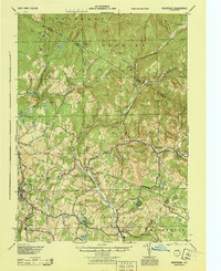 1944 Neversink1944 Print · USGSThe Catskills of the mid-1940s come alive in this survey of the river valleys before later reservoir development. Genealogists and historians can trace old homesteads near Willowemoc, follow the NYO AND W RR through Ferndale, and locate Union Ch and Divine Corners.
 - 1945 Map of Arena, 1960 Print
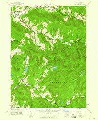 1945 Arena1960 Print · USGSThe Catskill high country in the mid-1940s reveals a network of valley settlements and upland lakes before significant modern development. Trace local heritage through the Old Stone Sch, the hamlet of Grant Mills, and the East Branch Delaware River.4 unique versions available
 - 1946 Map of Arena
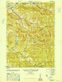 1946 Arena1946 Print · USGSThe Catskill high peaks and river valleys of Delaware and Ulster counties are captured here in the mid-1940s. Genealogists can locate family landmarks like School No 8 or the hamlet of Grant Mills along the Beaver Kill.2 unique versions available
 - 1948 Map of Binghamton, 1980 Print
 1948 Binghamton1980 Print · USGSCentral New York and the Southern Tier thrive in the late 1940s as a hub of rail traffic and mountain industry. Researchers can trace historic transit lines like the Erie Railroad through Binghamton or find old valley settlements near Oneonta and Delhi.
 - 1950 Map of Binghamton
 1950 Binghamton1950 Print · USGSBinghamton and the surrounding Southern Tier are shown in the mid-century era, highlighting the intricate rail and river networks that drove local industry. Researchers can trace the path of the Erie Railroad and locate landmarks from Otsego Lake to Sidney Mountain.2 unique versions available
 - 1950 Map of Scranton, 1952 Print
 1950 Scranton1952 Print · USGSMid-century Northeast Pennsylvania and the Hudson Valley come alive in this survey of the tri-state region. Genealogists and historians can trace the dense rail networks of the Erie RR and DL&W RR between industrial hubs like Scranton and Wilkes-Barre.
 - 1953 Map of Scranton
 1953 Scranton1953 Print · USGSNortheastern Pennsylvania and the Catskills are shown in great detail during the early fifties, a time when rail lines and river valleys dictated the region's growth. Genealogists and historians can trace the industrial hearts of Scranton and Wilkes-Barre or locate remote landmarks like High Point and Lake Wallenpaupack.
 - 1958 Map of Binghamton
 1958 Binghamton1958 Print · USGSCentral New York in the late fifties was a network of manufacturing cities and river valleys connected by vital rail lines. Genealogists and historians can trace family roots in Oneonta, Norwich, and Cooperstown or locate long-standing farms along Schoharie Creek.
 - 1959 Map of Scranton
 1959 Scranton1959 Print · USGSThe northern coalfields and the Hudson Valley meet in this mid-century survey of the Pennsylvania and New York borderlands. Genealogists and historians can trace the intricate rail networks of the Erie Railroad and the vast waters of Lake Wallenpaupack.2 unique versions available
 - 1962 Map of Scranton, 1977 Print
 1962 Scranton1977 Print · USGSThe industrial heart of eastern Pennsylvania and the New York Catskills are captured here in the early sixties. Genealogists and historians can trace the dense valley settlements from Scranton to Wilkes-Barre and the rail lines of the Erie Lackawanna Railroad.2 unique versions available
 - 1963 Map of Binghamton
 1963 Binghamton1963 Print · USGSThe Southern Tier and Catskill peaks are shown in the early sixties as new reservoirs reshaped the valleys. Trace historic rail corridors like the Erie Lackawanna RR and explore lakeside settlements such as Cooperstown and Oneonta.
 - 1965 Map of Scranton
 1965 Scranton1965 Print · USGSThe tri-state highlands of Pennsylvania, New York, and New Jersey come alive in the mid-sixties as industry and recreation converge. Trace the intricate rail lines of the Erie Lackawanna RR or locate landmarks like the U S Military Academy.2 unique versions available
 - 1965 Map of Lewbeach, 1967 Print
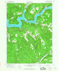 1965 Lewbeach1967 Print · USGSThe Catskills landscape underwent significant changes by the mid-1960s as the Pepacton Reservoir reshaped the valley. Genealogists and local historians can trace relocated landmarks like Shavertown and the Pepacton Cem or follow the path of the Delaware Aqueduct.4 unique versions available
 - 1965 Map of Roscoe, 1967 Print
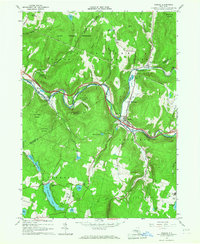 1965 Roscoe1967 Print · USGSThe western Catskills come alive in the mid-1960s at the famous meeting of the Beaver Kill and Willowemoc Creek. Genealogists and historians can trace local family landmarks around Cooks Falls, Tennanah Lake, and the rural Riverside Cem.3 unique versions available
 - 1965 Map of Livingston Manor, 1967 Print
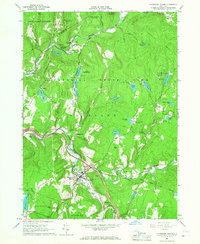 1965 Livingston Manor1967 Print · USGSLivingston Manor and the western Catskills are captured in the mid-sixties as the new highway interchanges began to reshape the valley. Genealogists can trace family names at St Aloysius Cem, find the Beaverkill Valley Ch, and locate old settlements like Morsston and Deckertown.3 unique versions available
Showing maps 1-25 of 60
Top cities near Rockland
- Thompson historical maps
- Fallsburg historical maps
- Liberty historical maps
- Walton historical maps
- Liberty historical maps
- Bethel historical maps
See more
Top neighborhoods of Rockland
- Joscelyn historical maps
- Parkston historical maps
- Beaverkill historical maps
- Craigie Clair historical maps
- Deckertown historical maps
- Grooville historical maps
See more
Frequently asked questions
- What are the different types of historical maps available for Rockland?
- What is the oldest map of Rockland?
- Where can I purchase historical maps of Rockland for my home or office?
- Where can I download high-res historical maps of Rockland?
- Are there historical topographic maps available for Rockland?
- Is there historical aerial imagery available for Rockland?
- Where are historical maps of Rockland sourced from?