Old Maps of Clintondale, New York for Academic Research
Study the evolution of Clintondale with 34 high-resolution historic maps. Whether you're teaching, researching, or modeling changes in land use, these maps provide essential visual documentation of urban, environmental, and geographic change.
- Analyze long-term change: Track patterns in development, transportation, and natural features.
- Ideal for environmental or urban studies: Support academic projects with primary historical map data.
- Use in the classroom or lab: Educators and researchers rely on these maps to bring historical context to life.
These maps are a powerful tool for teaching, research, and visualizing how Clintondale has changed over the decades.
Clintondale, NY maps
(34)- 1893 Map of Poughkeepsie
 1893 Poughkeepsie1893 Print · USGSDutchess and Ulster counties thrive during the late Victorian era as a hub of river commerce, rail junctions, and major state institutions. Researchers can trace the 1890s footprints of Vassar College, the busy Hampton Ferry, and the rail lines meeting at Hopewell Junction.
 - 1894 Map of Poughkeepsie
 1894 Poughkeepsie1894 Print · USGSThe Hudson Valley in the early 1890s was a bustling corridor of rail and river commerce connecting POUGHKEEPSIE to the industrial south. Genealogists and historians can trace old homesteads near Vassar College, find early river landings like Carthage Landing, or locate the junction at Hopewell Junction.3 unique versions available
 - 1903 Map of Poughkeepsie
 1903 Poughkeepsie1903 Print · USGSDutchess and Ulster Counties thrive at the turn of the century as a major corridor of river commerce and rail expansion. Genealogists and historians can trace institutional history at the Hudson River State Hospital or locate lost rail stops at Clove Branch Junction and Diddell.11 unique versions available
 - 1903 Map of Newburg
 1903 Newburg1903 Print · USGSThe Hudson Valley was entering a period of rapid industrial and rail expansion when this survey was conducted. Researchers can trace the path of the New England RR, find local landmarks like the Powder Works, and locate old hamlets such as Ganahgote and Leptondale.10 unique versions available
 - 1936 Map of Poughkeepsie
 1936 Poughkeepsie1936 Print · USGSDutchess County in the mid-thirties reveals a landscape of massive riverside institutions and early aviation fields along the Hudson River. Local historians can trace family roots through numerous country schools like Fairview Sch or locate the old Poughkeepsie Landing (Air Field).
 - 1943 Map of Clintondale
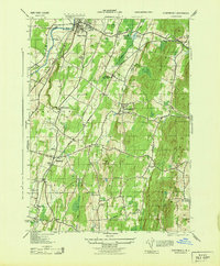 1943 Clintondale1943 Print · USGSMid-Hudson Valley farm country and orchards are shown here during the early years of the Second World War. Researchers can locate vanished landmarks such as the Normal Sch or trace early rail lines like the New York New Haven and Hartford.
 - 1943 Map of Poughkeepsie
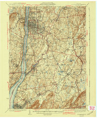 1943 Poughkeepsie1943 Print · USGSThe mid-Hudson valley is captured here in the years during the Second World War, showing the busy corridor between Poughkeepsie and Beacon. Researchers can trace old institutional lands like Vassar College or locate vanished rural schools such as Swede Sch and Devine Sch.3 unique versions available
 - 1946 Map of Newburgh, 1964 Print
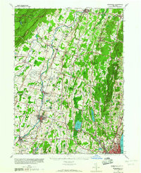 1946 Newburgh1964 Print · USGSMid-Hudson Valley life in the mid-forties is captured here, showing the region as it transitioned from a rural agricultural economy to a postwar industrial hub. Genealogists and local historians can locate dozens of small schools and cemeteries, from the New Paltz Cemetery to the Montgomery Worsted Mills.
 - 1947 Map of Hartford, 1955 Print
 1947 Hartford1955 Print · USGSSouthern New England and the Hudson Valley are shown in detail during the post-war expansion era. Genealogists and researchers can trace local landmarks from the State Capitol and Yale University to the Stratford Lighthouse and Woodlawn Cem.2 unique versions available
 - 1948 Map of Hartford
 1948 Hartford1948 Print · USGSSouthern New England is captured here in the late 1940s, showcasing a landscape of thriving industrial cities and developing parkways. Genealogists and historians can trace the rail networks of the New York New Haven and Hartford RR or locate coastal defense sites like Fort Terry and Camp Shanks.2 unique versions available
 - 1950 Map of Scranton, 1952 Print
 1950 Scranton1952 Print · USGSMid-century Northeast Pennsylvania and the Hudson Valley come alive in this survey of the tri-state region. Genealogists and historians can trace the dense rail networks of the Erie RR and DL&W RR between industrial hubs like Scranton and Wilkes-Barre.
 - 1953 Map of Scranton
 1953 Scranton1953 Print · USGSNortheastern Pennsylvania and the Catskills are shown in great detail during the early fifties, a time when rail lines and river valleys dictated the region's growth. Genealogists and historians can trace the industrial hearts of Scranton and Wilkes-Barre or locate remote landmarks like High Point and Lake Wallenpaupack.
 - 1957 Map of Clintondale, 1958 Print
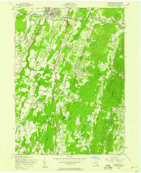 1957 Clintondale1958 Print · USGSMid-century Ulster County is captured here as the new thruway begins to reshape the rural landscape around New Paltz. Local researchers can trace the old rail lines of the New York New Haven and Hartford and locate family landmarks like Lloyd Union Cem or Modena Gardens.3 unique versions available
 - 1957 Map of Poughkeepsie, 1959 Print
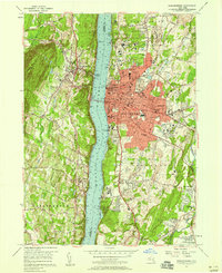 1957 Poughkeepsie1959 Print · USGSMid-century Poughkeepsie thrives as a center of academia and transport along the Hudson River during the late fifties. Researchers can trace the development of Vassar College, the industrial waterfront at Milton, and family plots in the Poughkeepsie Rural Cemetery.3 unique versions available
 - 1959 Map of Scranton
 1959 Scranton1959 Print · USGSThe northern coalfields and the Hudson Valley meet in this mid-century survey of the Pennsylvania and New York borderlands. Genealogists and historians can trace the intricate rail networks of the Erie Railroad and the vast waters of Lake Wallenpaupack.2 unique versions available
 - 1961 Map of Hartford
 1961 Hartford1961 Print · USGSSouthern New England and the Hudson Valley are shown here in the mid-fifties, capturing a landscape of booming coastal cities and interior hill towns. Researchers can trace the legacy of the New York New Haven and Hartford rail corridor and find strategic sites like Camp Shanks and Fort Michie.
 - 1962 Map of Hartford, 1971 Print
 1962 Hartford1971 Print · USGSSouthern New England and the Hudson Valley are shown in the early sixties, as suburban growth reached into the foothills. Trace the path of the New York New Haven & Hartford RR and find landmarks like Camp Nathan Hale and Gillette Castle State Park.3 unique versions available
 - 1962 Map of Scranton, 1977 Print
 1962 Scranton1977 Print · USGSThe industrial heart of eastern Pennsylvania and the New York Catskills are captured here in the early sixties. Genealogists and historians can trace the dense valley settlements from Scranton to Wilkes-Barre and the rail lines of the Erie Lackawanna Railroad.2 unique versions available
 - 1965 Map of Scranton
 1965 Scranton1965 Print · USGSThe tri-state highlands of Pennsylvania, New York, and New Jersey come alive in the mid-sixties as industry and recreation converge. Trace the intricate rail lines of the Erie Lackawanna RR or locate landmarks like the U S Military Academy.2 unique versions available
 - 1965 Map of Hartford
 1965 Hartford1965 Print · USGSSouthern New England and the Hudson Valley are shown here during the mid-sixties expansion of the Interstate era. Trace the path of the New York New Haven & Hartford RR or locate historic landmarks like West Point Military Reservation and the Merritt Parkway.2 unique versions available
 - 1985 Map of Waterbury, 1986 Print
 1985 Waterbury1986 Print · USGSThe Western Connecticut highlands and the Hudson Valley are captured in the mid-1980s, showing a landscape of deep forests and industrial river towns. Genealogists can trace family connections from Waterbury up through Litchfield and Torrington, while exploring the vast Barkhamsted Reservoir and Candlewood Lake basins.
 - 1986 Map of Monticello
 1986 Monticello1986 Print · USGSThe Catskills and Shawangunk Ridge meet in the mid-eighties, showing a landscape defined by massive reservoirs and valley towns. Genealogists and researchers can trace the growth of Monticello, Ellenville, and New Paltz alongside landmarks like Mohonk Preserve and Stewart Airport.2 unique versions available
 - 1993 Map of Waterbury
 1993 Waterbury1993 Print · USGSWestern Connecticut and the Hudson Valley appear in the early nineties as a landscape of established industrial cities and deep forest preserves. Researchers can trace the rail corridors of the Metro-North Railroad or locate family sites near the Taft School and Riverside Cemetery.
 - 1995 Map of Poughkeepsie, 1998 Print
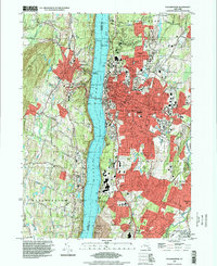 1995 Poughkeepsie1998 Print · USGSPoughkeepsie and the Hudson River valley are shown in the mid-nineties as the region's academic and medical campuses expanded. Researchers can trace the grounds of Vassar College, family plots in St Peters Cemetery, and the historic landing at Highland Landing.
 - 2010 Map of Clintondale, 2010 Print
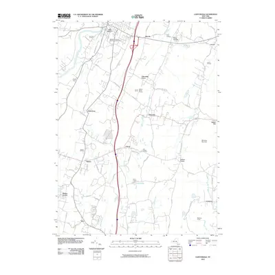 2010 Clintondale2010 Print · USGSUlster County's agricultural and academic heart is captured here in the early twenty-first century, spanning from the Wallkill River to Marlboro Mountain. Genealogists can locate family names at New Paltz Cemetery and Lloyd Union Cemetery, or trace old hamlets like Ardonia and Ohioville.
Showing maps 1-25 of 34
Top cities near Clintondale
- Poughkeepsie historical maps
- Newburgh historical maps
- Poughkeepsie historical maps
- East Fishkill historical maps
- Newburgh historical maps
- Wappinger historical maps
See more
Frequently asked questions
- What are the different types of historical maps available for Clintondale?
- What is the oldest map of Clintondale?
- Where can I purchase historical maps of Clintondale for my home or office?
- Where can I download high-res historical maps of Clintondale?
- Are there historical topographic maps available for Clintondale?
- Is there historical aerial imagery available for Clintondale?
- Where are historical maps of Clintondale sourced from?