Old Maps of Olive, New York for Metal Detecting
Plan your next treasure hunt with 71 historic maps of Olive. Find old homesites, ghost towns, trails, and gathering spots that may be lost to time — perfect for identifying promising metal detecting locations.
- Locate forgotten sites: Uncover places like long-lost settlements, abandoned rail lines, or gathering spots.
- Plan better hunts: Use map overlays combined with LiDAR or satellite views to narrow in on historically rich areas.
- Made for detectorists: Thousands of hobbyists use these maps to discover relics, coins, and hidden history.
Use these historic maps to boost your research and find new opportunities beneath the surface of Olive.
Olive, NY maps
(71)- 1892 Map of Kaaterskill, 1957 Print
 1892 Kaaterskill1957 Print · USGSThe high Catskills of the 1890s reveal a landscape of grand hotels and rugged peaks during the peak of the mountain resort era. Genealogists and historians can trace the foundations of Onteora Park, the route of the Elevating R. R., and lost hamlets like Dutch Settlement.3 unique versions available
 - 1893 Map of Kaaterskill
 1893 Kaaterskill1893 Print · USGSThe high peaks and resort colonies of the late nineteenth century are mapped here in exceptional detail. Genealogists and rail historians can trace the paths of the Otis Elevating R R and the Catskill Mtn R R or locate old sites like Dutch Settlement and Mountain House.
 - 1894 Map of Kaaterskill
 1894 Kaaterskill1894 Print · USGSThe Catskills come alive in the 1890s as a premier destination for mountain tourism and timber. You can trace the early rail lines serving the Mountain House, locate the Victorian-era enclaves of Onteora Park and Twilight Park, or find family roots in Yankeetown.
 - 1899 Map of Kaaterskill
 1899 Kaaterskill1899 Print · USGSThe Catskills in the late nineteenth century show a unique landscape of mountain tourism and rail infrastructure. Trace the early hotel era through the Mountain House, the Otis Elevating Ry., and the high-elevation hamlets of Tannersville and Onteora Park.2 unique versions available
 - 1900 Map of Phoenicia, 1963 Print
 1900 Phoenicia1963 Print · USGSThe high Catskills at the turn of the century are captured here in a moment of emerging tourism and mountain settlement. Genealogists and hikers can trace the original locations of the Grand Hotel, the remote Winnisook Lodge, and the rail stops at Mt Pleasant Station.
 - 1901 Map of Rosendale, 1961 Print
 1901 Rosendale1961 Print · USGSUlster County at the dawn of the century shows a landscape in transition as the Ashokan Reservoir reshaped the valley. Genealogists and historians can trace defunct rail stops and early hamlets from Kripplebush and Whiteport to the busy docks at Wilbur.
 - 1903 Map of Rosendale
 1903 Rosendale1903 Print · USGSUlster County was a hub of canal and rail transport at the turn of the century, centered on the Delaware and Hudson Canal. Genealogists can trace family footprints through historic settlements like Browns Station, Kripplebush, and Lomontville.11 unique versions available
 - 1903 Map of Phoenicia
 1903 Phoenicia1903 Print · USGSThe Catskills come alive at the turn of the century, showing the mountain rail corridor and early grand resorts. Researchers can trace the Ulster and Delaware line through Phoenicia to the Highmount Grand Hotel and Winnisook Lodge.9 unique versions available
 - 1903 Map of Kaaterskill, 1906 Print
 1903 Kaaterskill1906 Print · USGSThe Catskills come alive in the early twentieth century through this record of mountain resorts and steep-grade rail lines. Researchers can trace the legendary Mountain House, the Otis Elevating R.R., and the remote Dutch Settlement.10 unique versions available
 - 1903 Map of Slide Mountain, 1961 Print
 1903 Slide Mountain1961 Print · USGSThe high peaks and deep hollows of Ulster County are captured here at the dawn of the reservoir era. Genealogists and hikers can trace old homesteads and roads near Sundown, Lackawack, and the isolated Peekamoose Lodge.
 - 1905 Map of Slide Mountain
 1905 Slide Mountain1905 Print · USGSThe Catskill high peaks meet the industrializing Rondout valley in the early twentieth century. Researchers can trace old mountain outposts like Peekamoose Lodge and Sundown, or follow the New York Ontario and Western RR through Kerhonkson.8 unique versions available
 - 1942 Map of West Shokan, 1958 Print
 1942 West Shokan1958 Print · USGSThe Catskill mountain foothills in the early 1940s reveal a landscape of secluded hollows and high peaks bordering the Ashokan Reservoir. Genealogists and historians can trace old community hubs like Samsonville, Krumville, and several rural schoolhouses such as West Shokan Sch.2 unique versions available
 - 1942 Map of Ashokan, 1958 Print
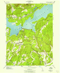 1942 Ashokan1958 Print · USGSUlster County's mountainous terrain and massive water infrastructure are frozen in time during the early 1940s. Genealogists and local historians can trace family-named settlements like Lomontville and Atwood, or locate rural landmarks including the Vly Church and Acorn Hill Chapel.2 unique versions available
 - 1942 Map of Kerhonkson, 1959 Print
 1942 Kerhonkson1959 Print · USGSUlster County's transport and settlement patterns are frozen in time during the early 1940s. Genealogists and historians can trace the New York Ontario and Western line, the old Rondout and Western Canal, and local landmarks like Soccanissing Sch.
 - 1942 Map of Mohonk Lake, 1959 Print
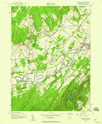 1942 Mohonk Lake1959 Print · USGSUlster County's river valleys and mountain ridges are captured here during the early 1940s as rail transit still defined local travel. Genealogists can locate family-named landmarks and rural hubs like Kyserike Sta, Stone Ridge, and the Rock Hill Sch.
 - 1943 Map of Mohonk Lake
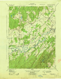 1943 Mohonk Lake1943 Print · USGSThe Shawangunk Mountains and Rondout Creek valley are captured here in the early 1940s. Trace the New York Ontario and Western rail line and find family sites like P Schmidke or local landmarks like Mohonk House.
 - 1943 Map of West Shokan
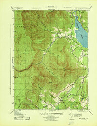 1943 West Shokan1943 Print · USGSWar-era Ulster County is defined here by the rise of the Ashokan Reservoir against the high Catskill peaks. Local historians can trace old family names and small schoolhouses like Brodhead School or visit landmarks like the Father Divine Lodge.
 - 1943 Map of Kerhonkson
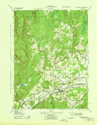 1943 Kerhonkson1943 Print · USGSMid-century Ulster County comes to life through this survey of the Rondout Valley and the Ontario and Western rail corridor. Genealogists can trace family holdings and local schools like Wawarsing School, Cherrytown, and the Frank Utter Colony Farm.
 - 1943 Map of Ashokan, 1944 Print
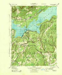 1943 Ashokan1944 Print · USGSMid-century Ulster County is defined by the massive shoreline of the Ashokan Reservoir as it appeared during the war years. Local researchers can trace old family lands and community hubs like Olive Bridge, Atwood, and the Acorn Hill Chapel.
 - 1945 Map of Bearsville, 1962 Print
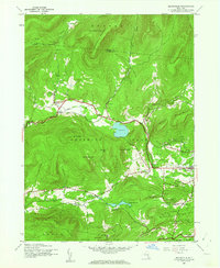 1945 Bearsville1962 Print · USGSThe Woodstock valley and the surrounding Catskill peaks appear here just after the war, showing a landscape of high summits and valley hamlets. Researchers can trace historic school districts like School No 1 and old settlements at Byrdcliffe and Lake Hill.3 unique versions available
 - 1946 Map of Bearsville
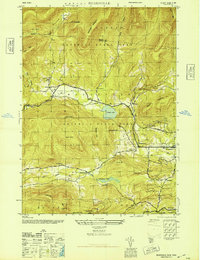 1946 Bearsville1946 Print · USGSThe Woodstock area and the eastern Catskills are captured in the mid-1940s as an established mountain retreat. Genealogists and hikers can trace the old turnpikes and district schoolhouses like School No 4 near Bearsville or the roads leading to Byrdcliffe.
 - 1946 Map of Phoenicia
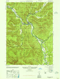 1946 Phoenicia1946 Print · USGSThe Esopus Creek valley in the mid-1940s served as a bustling mountain corridor for the New York Central railroad. Genealogists can locate family landmarks like the Shandaken Rural Cem and early landmarks such as the Lookout Tower on Tremper Mtn.
 - 1948 Map of Binghamton, 1980 Print
 1948 Binghamton1980 Print · USGSCentral New York and the Southern Tier thrive in the late 1940s as a hub of rail traffic and mountain industry. Researchers can trace historic transit lines like the Erie Railroad through Binghamton or find old valley settlements near Oneonta and Delhi.
 - 1950 Map of Binghamton
 1950 Binghamton1950 Print · USGSBinghamton and the surrounding Southern Tier are shown in the mid-century era, highlighting the intricate rail and river networks that drove local industry. Researchers can trace the path of the Erie Railroad and locate landmarks from Otsego Lake to Sidney Mountain.2 unique versions available
 - 1950 Map of Scranton, 1952 Print
 1950 Scranton1952 Print · USGSMid-century Northeast Pennsylvania and the Hudson Valley come alive in this survey of the tri-state region. Genealogists and historians can trace the dense rail networks of the Erie RR and DL&W RR between industrial hubs like Scranton and Wilkes-Barre.
Showing maps 1-25 of 71
Top cities near Olive
- Kingston historical maps
- Saugerties historical maps
- New Paltz historical maps
- Wawarsing historical maps
- Ulster historical maps
- Catskill historical maps
See more
Top neighborhoods of Olive
- Krumville historical maps
- Olivebridge historical maps
- West Shokan historical maps
- Boiceville historical maps
- Davis Corners historical maps
- Samsonville historical maps
See more
Frequently asked questions
- What are the different types of historical maps available for Olive?
- What is the oldest map of Olive?
- Where can I purchase historical maps of Olive for my home or office?
- Where can I download high-res historical maps of Olive?
- Are there historical topographic maps available for Olive?
- Is there historical aerial imagery available for Olive?
- Where are historical maps of Olive sourced from?