Old Maps of Johnsburg, New York for Hiking & Exploration
Hike through history with 59 historic maps of Johnsburg. Explore old trails, ghost towns, and forgotten backroads — perfect for outdoor adventurers and local explorers.
- Rediscover forgotten places: Map out old mining camps, roads, and footpaths that no longer exist on modern maps.
- Layer with modern tools: Combine with LiDAR or satellite views to plan hikes through historical terrain.
- Made for exploration: Popular among hikers, overlanders, and local history lovers.
Use these maps to find adventure and explore the hidden past of Johnsburg.
Johnsburg, NY maps
(59)- 1895 Map of North Creek
 1895 North Creek1895 Print · USGSUpper Warren County thrived as a rail-and-river corridor in the late nineteenth century, documented here just as the wilderness was formally preserved. Genealogists and historians can trace family-named sites from Pottersville to The Glen, alongside the Adirondack Delaware and Hudson RR and Loon Lake.
 - 1897 Map of North Creek
 1897 North Creek1897 Print · USGSThe Adirondack foothills in the 1890s are defined by the Delaware and Hudson River Railroad and the upper Hudson River. Trace old connections between Pottersville, Chestertown, and Johnsburg, or locate early landmarks like Loon Lake and the Ferry near Thurman.10 unique versions available
 - 1898 Map of Thirteenth Lake
 1898 Thirteenth Lake1898 Print · USGSWarren County and the surrounding Adirondack peaks were defined by timber and mineral interests in the late nineteenth century. Genealogists and researchers can locate the settlement at Bakers Mills and trace the paths around Moores Mine and Thirteenth Lake.10 unique versions available
 - 1950 Map of Glens Falls
 1950 Glens Falls1950 Print · USGSThe Adirondacks and the Green Mountains meet in this mid-century survey of the New York and Vermont borderlands. Researchers can trace the industrial rail corridors of the Rutland RR and Delaware & Hudson RR connecting Glens Falls, Rutland, and the shores of Lake George.
 - 1950 Map of Utica, 1951 Print
 1950 Utica1951 Print · USGSCentral New York in the post-war era showcases the industrial Mohawk Valley and the pristine Adirondack interior. Researchers can trace transportation networks like the New York Central Railroad and find early Cold War sites such as Griffiss Air Force Base.
 - 1954 Map of Thirteenth Lake, 1957 Print
 1954 Thirteenth Lake1957 Print · USGSThe Adirondack high country near Johnsburg and Chester was defined by its mineral wealth and rail lines in the 1950s. Trace old mountain roads to Bakers Mills, see the Delaware and Hudson rail line, or find the Lookout Tower on Gore Mtn.4 unique versions available
 - 1956 Map of Glens Falls, 1968 Print
 1956 Glens Falls1968 Print · USGSUpper New York and the Vermont mountains are captured here in the mid-fifties, showing the rugged rail-and-river network of the Northeast. Researchers can trace the paths of the Delaware and Hudson RR and Rutland RR as they wind through valley towns like Poultney and Whitehall.3 unique versions available
 - 1957 Map of Utica
 1957 Utica1957 Print · USGSCentral New York and the Adirondack foothills are captured here in the mid-fifties, showing a landscape defined by the Mohawk River corridor and the growing highway system. Genealogists and researchers can trace the rail lines of the New York Central and locate communities from Lowville to Gloversville.
 - 1958 Map of North Creek, 1960 Print
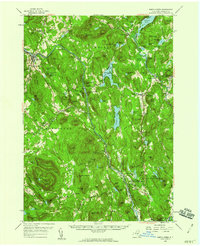 1958 North Creek1960 Print · USGSWarren County’s Adirondack heartland is captured here in the late fifties, showcasing the river-and-rail corridors of the upper Hudson. Trace local history through the Delaware and Hudson rail line, Pottersville hamlets, and the Pack Forest.3 unique versions available
 - 1959 Map of Glens Falls
 1959 Glens Falls1959 Print · USGSUpper New York and Vermont are captured here during the late 1950s, a period of transition for these mountain communities. Researchers can trace the legacy of the region's river-and-rail economy through landmarks like Lake George, Saratoga Springs, and Killington Peak.2 unique versions available
 - 1962 Map of Utica
 1962 Utica1962 Print · USGSCentral New York and the Adirondack wilderness are captured here during the mid-century era of highway and industrial expansion. Genealogists and historians can trace the development of the New York State Thruway and local rail lines connecting Utica, Rome, and Gloversville.3 unique versions available
 - 1964 Map of Glens Falls
 1964 Glens Falls1964 Print · USGSThe tri-state borderlands of New York, Vermont, and New Hampshire appear here in the mid-1960s. Researchers can trace the rail routes of the Rutland RR and find historic sites like Ticonderoga and Saratoga National Historical Park.
 - 1964 Map of Utica
 1964 Utica1964 Print · USGSCentral New York and the high wilderness of the Adirondacks are captured here during the post-war era of infrastructure expansion. Researchers can trace the development of the New York State Thruway alongside historic corridors like the Oneida Lake (Barge Canal Route) and the N. Y. Central railroad.
 - 1967 Map of Utica
 1967 Utica1967 Print · USGSCentral New York's industrial Mohawk Valley meets the Adirondack wilderness in the 1960s, showing the region's transition from manufacturing hubs to state-managed parklands. Trace historic settlements and sites like Griffiss Air Force Base, Colgate University, and the Lyons Falls Paper Mill.
 - 1968 Map of Johnsburg, 1970 Print
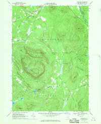 1968 Johnsburg1970 Print · USGSIn the heart of the southeastern Adirondacks during the late sixties, this map shows a landscape of timbered peaks and high ponds. Researchers can find old backcountry routes like Mud Pond Trail and follow the flow of the Hudson River past Johnsburg.3 unique versions available
 - 1968 Map of The Glen, 1970 Print
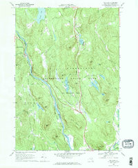 1968 The Glen1970 Print · USGSThe upper Hudson River valley comes into focus in the late sixties, showing the vital link between the Delaware and Hudson railroad and the river. Genealogists and hikers can trace old routes like Mansion Road past Darrowsville or locate family landmarks near The Glen and Friends Lake.
 - 1968 Map of North Creek, 1970 Print
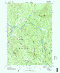 1968 North Creek1970 Print · USGSWarren County’s river valleys and Adirondack peaks are shown here in the late sixties as the timber and rail era persisted. Researchers can locate family landmarks near North Creek, the river crossing at Riparius, or the Central Sch.2 unique versions available
 - 1985 Map of Raquette Lake, 1986 Print
 1985 Raquette Lake1986 Print · USGSThe central Adirondacks are documented here in the mid-1980s, showcasing the complex lake systems and early rail routes that defined the region. Researchers can trace historic landmarks like Sagamore, isolated stops along the Adirondack RR, and the remote layout of Old Forge.2 unique versions available
 - 1986 Map of Ticonderoga
 1986 Ticonderoga1986 Print · USGSThe Lake Champlain valley in the mid-eighties shows a landscape defined by Revolutionary War history and deep wilderness. Researchers can trace the Delaware and Hudson RR through the mountains or locate local landmarks like Fort Ticonderoga, St. Genevieve Cem, and the Ore Bed.
 - 1989 Map of Ticonderoga
 1989 Ticonderoga1989 Print · USGSThe Champlain Valley and Adirondack foothills meet in the late eighties, documenting a historic borderland defined by mountain lakes and timber. Genealogists and historians can trace the paths of the Delaware and Hudson RR or locate the Hubbardton Battlefield State Historic Site.2 unique versions available
 - 1990 Map of Bakers Mills
 1990 Bakers Mills1990 Print · USGSThe Adirondack wilderness of the late eighties and early nineties reveals a complex landscape of high peaks and isolated settlements. Researchers can locate remote forest sites like Grave, the clearing at Oregon, and water features including Garnet Lake and the Siamese Ponds.
 - 1990 Map of Thirteenth Lake
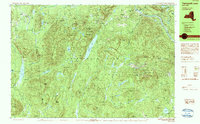 1990 Thirteenth Lake1990 Print · USGSThe Adirondack wilderness in the late twentieth century is preserved here through a dense network of peaks and high-country ponds. Genealogists and hikers can trace historic access routes like Old Farm Road or locate family-named landmarks including Edwards Hill and John Pond.2 unique versions available
 - 1997 Map of Thirteenth Lake, 1999 Print
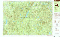 1997 Thirteenth Lake1999 Print · USGSIn the Adirondack wilderness during the late nineties, this landscape shows the convergence of high peaks and river headwaters. You can trace the rugged topography between Gore Mountain and Thirteenth Lake, finding backcountry landmarks like the Shelter at John Pond and the remote settlement of Sodom.2 unique versions available
 - 1997 Map of Bakers Mills, 2000 Print
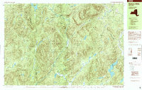 1997 Bakers Mills2000 Print · USGSWarren County’s wild interior comes into focus during the 1990s as it maintains its rugged Adirondack character. Trace local family history near Bakers Mills and Oregon, or locate remote landmarks like Burnt Shanty Clearing and the Graves sites.
 - 2010 Map of Bullhead Mountain, 2010 Print
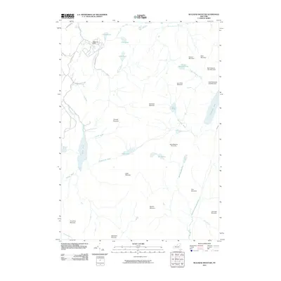 2010 Bullhead Mountain2010 Print · USGSJohnsburg and the surrounding Adirondack peaks appear in this 2010 survey of the high country north of the Sacandaga. Local historians and hikers can trace the remote trails near Wilderness Lodge or locate landmarks like Chimney Mountain and Thirteenth Lake.
Showing maps 1-25 of 59
Top cities near Johnsburg
- Warrensburg historical maps
- Chester historical maps
- Lake Luzerne historical maps
- Schroon historical maps
- Horicon historical maps
- Indian Lake historical maps
See more
Top neighborhoods of Johnsburg
- North River historical maps
- North River historical maps
- Sodom historical maps
- Christian Hill historical maps
- Oregon historical maps
- Bakers Mills historical maps
See more
Frequently asked questions
- What are the different types of historical maps available for Johnsburg?
- What is the oldest map of Johnsburg?
- Where can I purchase historical maps of Johnsburg for my home or office?
- Where can I download high-res historical maps of Johnsburg?
- Are there historical topographic maps available for Johnsburg?
- Is there historical aerial imagery available for Johnsburg?
- Where are historical maps of Johnsburg sourced from?