1980s Maps of Anson County, North Carolina
Explore 4 historic maps of Anson County from the 1980s. These maps offer a rare glimpse into what life looked like during the 1980s — showing old roads, neighborhoods, homes, and landmarks that have changed or disappeared over time.
Whether you're researching your family's past, planning a metal detecting trip, or studying how Anson County's landscape evolved across the 1980s, these high-resolution maps are a powerful tool for exploring the history of this region.
- Focus on a specific era: All maps on this page are from the 1980s, giving you a focused view of this time period.
- See what’s changed: Compare century-old streets, trails, and buildings to today's modern landscape using overlays and satellite layers.
- Research with precision: Use these maps for genealogy, historical research, land use analysis, or educational projects.
- View, download, or print: Maps are fully viewable online in high resolution, and can be downloaded or printed for your own records.
Start exploring Anson County's history through authentic maps from the 1980s. This is your window into the past.
Anson County, NC maps
(4)- 1982 Map of Southern Pines, 1983 Print
 1982 Southern Pines1983 Print · USGSCentral North Carolina in the early eighties shows a landscape defined by military expansion and historic rail corridors. Researchers can trace the legacy of the Seaboard Coast Line through Pinehurst or locate landmarks like the Town Creek Indian Mound State Historic Site.
 - 1983 Map of Laurinburg, 1984 Print
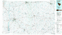
 1983 Laurinburg1984 Print · USGSThe Carolina borderlands come into focus in the early 1980s, showcasing a landscape defined by the Sandhills Game Land and major river systems. Genealogists and rail historians can trace the paths of the Seaboard Coast Line Railroad through Hamlet or locate St Andrews College and Cheraw State Park.2 unique versions available
 - 1985 Map of Charlotte, 1986 Print
 1985 Charlotte1986 Print · USGSThe Piedmont region in the mid-eighties shows the rapid growth of the Charlotte metro area alongside established textile and college towns. Trace local heritage at the Reed Gold Mine or explore the rail corridors of the Southern Railway and Winston-Salem Southbound Railway.2 unique versions available
 - 1986 Map of Lancaster
 1986 Lancaster1986 Print · USGSThe Carolina borderlands are captured in the mid-1980s as a thriving corridor of rail towns and diverse geography. Researchers can trace the region's heritage through landmarks like Forty Acre Rock, the Southern RR line, and rural sites such as Heath Springs Church.2 unique versions available
End of results
Showing maps 1-4 of 4
Top cities of Anson County
- Wadesboro historical maps
- Polkton historical maps
- Ansonville historical maps
- Morven historical maps
- Peachland historical maps
- Lilesville historical maps
See more
Frequently asked questions
- What are the different types of historical maps available for Anson County?
- What is the oldest map of Anson County?
- Where can I purchase historical maps of Anson County for my home or office?
- Where can I download high-res historical maps of Anson County?
- Are there historical topographic maps available for Anson County?
- Is there historical aerial imagery available for Anson County?
- Where are historical maps of Anson County sourced from?