Old Maps of Anson County, North Carolina for Genealogy
Trace your family roots with 132 historic maps of Anson County. These high-res maps reveal old neighborhoods, homesites, landmarks, and streets — helping you uncover where your ancestors lived and how the area evolved over time.
- Explore historic neighborhoods: Identify where your relatives may have lived in the 1800s or 1900s.
- Compare maps over time: Trace the changes in streets, buildings, and landmarks for multi-generational research.
- Perfect for genealogy & ancestry research: Used by family historians and researchers to map out lineage and migration.
These maps are an incredible resource for exploring your personal connection to Anson County's past.
Anson County, NC maps
(132)- 1941 Map of Spartanburg
 1941 Spartanburg1941 Print · USGSSouth Carolina’s Piedmont and Sandhills regions are shown here during the mid-century peak of the rail era. Researchers can trace the sprawling Fort Jackson Military Reservation and the industrial growth of hubs like Spartanburg and Rock Hill.
 - 1942 Map of Troy
 1942 Troy1942 Print · USGSMid-century central North Carolina comes alive through this 1940s survey of the rail-linked towns between the Uwharrie hills and the Sandhills. Trace the historic Norfolk Southern line through Troy, Star, and Biscoe, or locate the Morrison Training School and local springs.
 - 1942 Map of Rockingham, 1944 Print
 1942 Rockingham1944 Print · USGSThe North Carolina and South Carolina borderlands come alive in this wartime survey of the Pee Dee River valley. Researchers can trace historic mill sites like Burnt Factory Pond or locate family landmarks such as Roberdell and Old Sneedsboro.
 - 1953 Map of Florence, 1964 Print
 1953 Florence1964 Print · USGSThe Carolina borderlands in the mid-fifties were a landscape of vast river swamps and rising rail towns. Trace the legacy of the Seaboard Air Line through Florence or explore the wetlands surrounding Lake Waccamaw and the Green Swamp.3 unique versions available
 - 1953 Map of Raleigh, 1965 Print
 1953 Raleigh1965 Print · USGSCentral North Carolina in the early sixties shows a landscape of growing towns and military hubs before the full expansion of the interstate system. Genealogists can trace family footprints across the Piedmont through Wake Forest, Siler City, and the large Fort Bragg Military Reservation.4 unique versions available
 - 1953 Map of Spartanburg, 1966 Print
 1953 Spartanburg1966 Print · USGSMid-century South Carolina comes into focus through this survey of the Piedmont and the Sand Hills at a time of significant reservoir expansion. Researchers can trace the legacy of industrial transit and resource extraction from the Haile Gold Mine to the rail hubs of the Seaboard Air Line.4 unique versions available
 - 1953 Map of Charlotte, 1968 Print
 1953 Charlotte1968 Print · USGSThe North Carolina Piedmont and South Carolina borderlands are shown in detail during a period of significant growth and reservoir development. Trace the rail corridors of the Southern Railway or find family roots in towns like China Grove, Misenheimer, and Lincolnton.3 unique versions available
 - 1954 Map of Charlotte
 1954 Charlotte1954 Print · USGSThe North Carolina Piedmont in the mid-1950s shows a region of rapid growth and industrial expansion centered around Charlotte. Trace the era's infrastructure through the Southern railroad lines and locate significant landmarks like the Charlotte Naval Ammunition Depot and Lake Norman.2 unique versions available
 - 1954 Map of Florence
 1954 Florence1954 Print · USGSThe Carolinas borderlands come alive in the early fifties, showing the vital rail-and-river networks of the coastal plain. Genealogists can trace family footprints across the Green Swamp or through settlements like Red Springs, Chadbourn, and McColl.
 - 1954 Map of Raleigh
 1954 Raleigh1954 Print · USGSThe North Carolina Piedmont and Sandhills are captured in the mid-fifties during a period of steady regional growth. Genealogists and historians can trace the development of towns like Siler City or locate landmarks such as Falls of Neuse and Camp Mackall.
 - 1956 Map of Mangum, 1957 Print
 1956 Mangum1957 Print · USGSThe Pee Dee River valley in the mid-fifties shows a landscape shaped by the waters of Blewett Falls Lake and the rural communities of Anson County. Genealogists can locate family landmarks including Ingram Sch, Old Stanback Ferry, and Mt Zion Ch.3 unique versions available
 - 1956 Map of Rockingham, 1957 Print
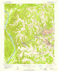 1956 Rockingham1957 Print · USGSMid-century Rockingham is shown here as a bustling hub of textile mills and rail lines along the Pee Dee River. Genealogists can trace family footprints near Cordova, Honey Town, and old rural landmarks like Stelley Tabernacle or Ashley Chapel.4 unique versions available
 - 1956 Map of Ansonville, 1957 Print
 1956 Ansonville1957 Print · USGSThe Pee Dee River valley and the settlement of Ansonville are captured here in the mid-fifties as the local railroad and river economy persisted. Family historians can locate several rural landmarks including the Rosenwald Sch, Old Leak Ferry, and Bethlehem Cem.3 unique versions available
 - 1956 Map of Mount Gilead West, 1957 Print
 1956 Mount Gilead West1957 Print · USGSThe area surrounding the Pee Dee and Rocky rivers shows a landscape of rail-connected towns and riverside power in the mid-1950s. Genealogists can trace family roots through numerous local parishes like Providence Ch and the rural community of Cedar Hill.3 unique versions available
 - 1956 Map of Lilesville, 1957 Print
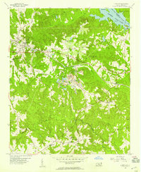 1956 Lilesville1957 Print · USGSLilesville and the surrounding Anson County countryside appear in the mid-1950s as a landscape of industrial mining and deep-rooted rural communities. Researchers can trace family sites like Henry Grove Sch, find old congregations at Gum Springs Ch, and locate the Strip Mine works near the SEABOARD AIR LINE.3 unique versions available
 - 1956 Map of Wadesboro, 1957 Print
 1956 Wadesboro1957 Print · USGSAnson County was a bustling rail hub in the mid-1950s, where three major lines converged at the county seat. Genealogists and local historians can trace the community through landmark churches like Hanna Ch, the Gatewood Sta settlement, and Eastview Cem.3 unique versions available
 - 1960 Map of Charlotte
 1960 Charlotte1960 Print · USGSMid-century North Carolina and South Carolina meet in this 1960 survey of the Piedmont's industrial and textile heartland. Trace the growth of Charlotte alongside historic landmarks like Kings Mountain National Military Park and the Charlotte Naval Ammunition Depot.2 unique versions available
 - 1960 Map of Spartanburg
 1960 Spartanburg1960 Print · USGSThe South Carolina Piedmont and North Carolina borderlands come alive in this mid-century survey of the region between Spartanburg and Columbia. Researchers can trace the Seaboard Air Line railroad and explore landmarks like Anderson Quarry, Lake Murray, and Mount Croghan.2 unique versions available
 - 1962 Map of Charlotte
 1962 Charlotte1962 Print · USGSThe North Carolina Piedmont in the early sixties showcases a landscape transformed by massive reservoirs and industrial growth. Researchers can trace the development of Lake Norman, locate the Charlotte Naval Ammunition Depot, or find family landmarks like Wesley Chapel and Brown & Norcott Mills.
 - 1963 Map of Spartanburg
 1963 Spartanburg1963 Print · USGSMid-century South Carolina comes alive in this survey, showing the rail-linked corridor between the Upstate and the Midlands. Genealogists can trace family lands near old hubs like Union and Lancaster, or along the banks of the Broad River and Pee Dee River.
 - 1964 Map of Spartanburg
 1964 Spartanburg1964 Print · USGSMid-century South Carolina comes alive in this survey of the Piedmont and Upcountry, stretching from the Blue Ridge foothills to the Sandhills. Genealogists and historians can trace the rail-and-river economy through Monarch Mills, Glenn Springs, and the Southern Railway corridor.
 - 1970 Map of Marshville, 1973 Print
 1970 Marshville1973 Print · USGSThe northern Piedmont at the start of the 1970s shows the transition from a rail-dependent economy to a highway-driven one. Genealogists can locate family landmarks such as Sturdivants Crossroads, Pine View Cem, and the rural Meltonville Ch.2 unique versions available
 - 1970 Map of Polkton, 1973 Print
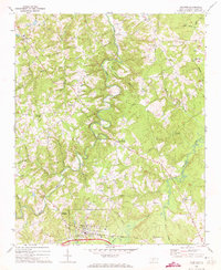 1970 Polkton1973 Print · USGSAnson County was a landscape of small farming hamlets and winding creek bottoms in the early seventies. Researchers can trace family roots through numerous local landmarks, from the Richmond-Sturdivant Cem to settlements like Sugar Town and Griffins Crossroads.
 - 1970 Map of Mt. Croghan, 1973 Print
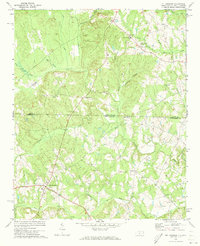 1970 Mt. Croghan1973 Print · USGSThe border country of the Carolinas is captured here in the early seventies, detailing the rural landscape of Anson and Chesterfield counties. Genealogists can trace family footprints near Mt Croghan and locate historic sites like Elizabeth Ch and Littles Quarters.2 unique versions available
 - 1970 Map of Olive Branch, 1973 Print
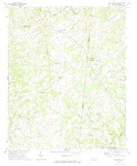 1970 Olive Branch1973 Print · USGSCrossing the border between Union and Anson counties in the early seventies, this area shows a landscape defined by small farming communities and winding creek branches. Researchers can locate family landmarks such as Baucoms Cem, Zion Crossroad Ch, and Rebel Hill.
Showing maps 1-25 of 132
Top cities of Anson County
- Wadesboro historical maps
- Polkton historical maps
- Ansonville historical maps
- Morven historical maps
- Peachland historical maps
- Lilesville historical maps
See more
Frequently asked questions
- What are the different types of historical maps available for Anson County?
- What is the oldest map of Anson County?
- Where can I purchase historical maps of Anson County for my home or office?
- Where can I download high-res historical maps of Anson County?
- Are there historical topographic maps available for Anson County?
- Is there historical aerial imagery available for Anson County?
- Where are historical maps of Anson County sourced from?