2020s Maps of West Jefferson, North Carolina
Explore 4 historic maps of West Jefferson from the 2020s. These maps offer a rare glimpse into what life looked like during the 2020s — showing old roads, neighborhoods, homes, and landmarks that have changed or disappeared over time.
Whether you're researching your family's past, planning a metal detecting trip, or studying how West Jefferson's landscape evolved across the 2020s, these high-resolution maps are a powerful tool for exploring the history of this region.
- Focus on a specific era: All maps on this page are from the 2020s, giving you a focused view of this time period.
- See what’s changed: Compare century-old streets, trails, and buildings to today's modern landscape using overlays and satellite layers.
- Research with precision: Use these maps for genealogy, historical research, land use analysis, or educational projects.
- View, download, or print: Maps are fully viewable online in high resolution, and can be downloaded or printed for your own records.
Start exploring West Jefferson's history through authentic maps from the 2020s. This is your window into the past.
West Jefferson, NC maps
(4)- 2022 Map of Warrensville, 2022 Print
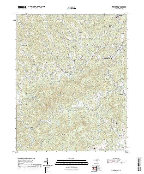 2022 Warrensville2022 Print · USGSAshe County's high country is captured here in the early twenty-first century, showing the enduring mountain communities along the North Fork New River. Genealogists can trace local roots through numerous family landmarks and burial sites like Blevins Cem, Weaver Cem, and the Friendly Grove Baptist Church.
 - 2022 Map of Jefferson, 2022 Print
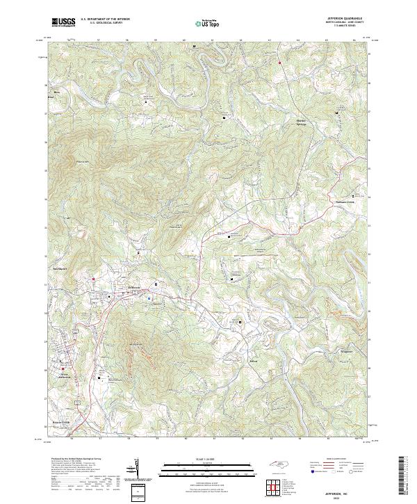 2022 Jefferson2022 Print · USGSAshe County's mountainous heart is captured here in the early twenty-first century, centered on the growing communities of Jefferson and West Jefferson. Local researchers can locate family burial sites like Howell Hill Cem and historic congregational centers such as Senter Church Cem.
 - 2022 Map of Glendale Springs, 2022 Print
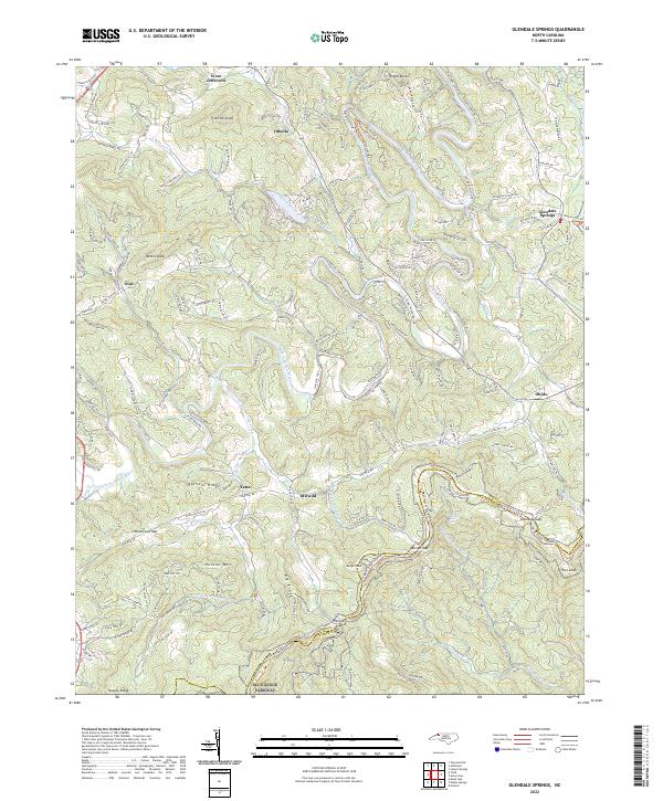 2022 Glendale Springs2022 Print · USGSIn the high country of Ashe County, this survey documents the mountain settlements and natural corridors of the early twenty-first century. Researchers can trace the path of the Blue Ridge Parkway through Benge Gap or locate communities like Idlewild and Glendale Springs.
 - 2022 Map of Todd, 2022 Print
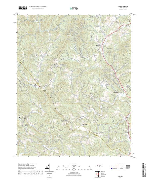 2022 Todd2022 Print · USGSThe mountain valleys of the New River come to life in this survey of the High Country. Local historians can trace family ties through old cemeteries like Bethany Cem and Mount Pleasant Cem or locate homesites near Todd and Fleetwood.
End of results
Showing maps 1-4 of 4
Top cities near West Jefferson
Frequently asked questions
- What are the different types of historical maps available for West Jefferson?
- What is the oldest map of West Jefferson?
- Where can I purchase historical maps of West Jefferson for my home or office?
- Where can I download high-res historical maps of West Jefferson?
- Are there historical topographic maps available for West Jefferson?
- Is there historical aerial imagery available for West Jefferson?
- Where are historical maps of West Jefferson sourced from?