1990s Maps of Bladen County, North Carolina
Explore 3 historic maps of Bladen County from the 1990s. These maps offer a rare glimpse into what life looked like during the 1990s — showing old roads, neighborhoods, homes, and landmarks that have changed or disappeared over time.
Whether you're researching your family's past, planning a metal detecting trip, or studying how Bladen County's landscape evolved across the 1990s, these high-resolution maps are a powerful tool for exploring the history of this region.
- Focus on a specific era: All maps on this page are from the 1990s, giving you a focused view of this time period.
- See what’s changed: Compare century-old streets, trails, and buildings to today's modern landscape using overlays and satellite layers.
- Research with precision: Use these maps for genealogy, historical research, land use analysis, or educational projects.
- View, download, or print: Maps are fully viewable online in high resolution, and can be downloaded or printed for your own records.
Start exploring Bladen County's history through authentic maps from the 1990s. This is your window into the past.
Bladen County, NC maps
(3)- 1990 Map of Whiteville
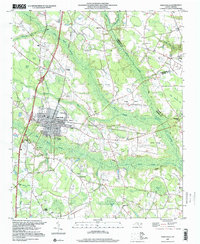
 1990 Whiteville1990 Print · USGSSoutheastern North Carolina and the South Carolina borderlands appear in the late twentieth century, showing a landscape of river-swamps and tobacco towns. Researchers can trace family history through sites like Mount Olive Ch, the Seaboard Coast Line RR, and rural centers like Tabor City.
 - 1997 Map of Saint Pauls, 2000 Print
 1997 Saint Pauls2000 Print · USGSCoastal plain wetlands and small-town North Carolina life intersect in the late nineties as the town of Saint Pauls expands. Local historians can trace family roots at McMillan Cem, find rural school sites like Pleasant View Sch, and follow the Old Grade Railroad.
 - 1997 Map of Point Caswell, 2001 Print
 1997 Point Caswell2001 Print · USGSThe Black River lowlands of Pender County are captured here at the end of the century, showing a landscape defined by tidal coves and swampy creek beds. Genealogists can locate numerous rural landmarks including Point Caswell Ch, the Flynn Cem, and an Old Railroad Grade.
End of results
Showing maps 1-3 of 3
Top cities of Bladen County
- Elizabethtown historical maps
- Bladenboro historical maps
- Clarkton historical maps
- White Lake historical maps
- East Arcadia historical maps
- Butters historical maps
See more
Frequently asked questions
- What are the different types of historical maps available for Bladen County?
- What is the oldest map of Bladen County?
- Where can I purchase historical maps of Bladen County for my home or office?
- Where can I download high-res historical maps of Bladen County?
- Are there historical topographic maps available for Bladen County?
- Is there historical aerial imagery available for Bladen County?
- Where are historical maps of Bladen County sourced from?