Old Maps of Bladen County, North Carolina for Academic Research
Study the evolution of Bladen County with 167 high-resolution historic maps. Whether you're teaching, researching, or modeling changes in land use, these maps provide essential visual documentation of urban, environmental, and geographic change.
- Analyze long-term change: Track patterns in development, transportation, and natural features.
- Ideal for environmental or urban studies: Support academic projects with primary historical map data.
- Use in the classroom or lab: Educators and researchers rely on these maps to bring historical context to life.
These maps are a powerful tool for teaching, research, and visualizing how Bladen County has changed over the decades.
Bladen County, NC maps
(167)- 1953 Map of Chadbourn, 1955 Print
 1953 Chadbourn1955 Print · USGSSoutheastern North Carolina's railroad and river economy comes alive in the 1950s, centered on the growing hubs of Chadbourn and Cerro Gordo. Researchers can trace old family names and rural landmarks from Belle View Cem to the landings along the Lumber River.2 unique versions available
 - 1953 Map of Florence, 1964 Print
 1953 Florence1964 Print · USGSThe Carolina borderlands in the mid-fifties were a landscape of vast river swamps and rising rail towns. Trace the legacy of the Seaboard Air Line through Florence or explore the wetlands surrounding Lake Waccamaw and the Green Swamp.3 unique versions available
 - 1954 Map of Florence
 1954 Florence1954 Print · USGSThe Carolinas borderlands come alive in the early fifties, showing the vital rail-and-river networks of the coastal plain. Genealogists can trace family footprints across the Green Swamp or through settlements like Red Springs, Chadbourn, and McColl.
 - 1954 Map of White Lake, 1956 Print
 1954 White Lake1956 Print · USGSCoastal Bladen and Sampson counties are shown here in the mid-fifties, dominated by the unique elliptical depressions of the Carolina Bays. Family researchers can locate remote landmarks like Kates Chapel Cem, Smith Crossroads, and the various landings along the Cape Fear River.
 - 1954 Map of Acme, 1957 Print
 1954 Acme1957 Print · USGSCoastal North Carolina river life in the mid-fifties centered on the confluence of the Cape Fear and the Black River. Genealogists can trace family names at Still Bluff and Maultbys Point, or locate the historic Lincoln High Sch and Farmers Chapel.2 unique versions available
 - 1954 Map of Bolton, 1957 Print
 1954 Bolton1957 Print · USGSCoastal North Carolina's timber and rail corridor is captured here in the mid-fifties, spanning the rugged terrain between the Cape Fear River and Green Swamp. Researchers can trace old family sites and rural congregations at Weyman Chapel, New Hope Ch, and the settlement of Wananish.2 unique versions available
 - 1955 Map of Whiteville
 1955 Whiteville1955 Print · USGSColumbus County and the town of Whiteville are shown here in the mid-fifties, dominated by timber-rich swamps and the railroads that serviced them. Researchers can trace the layout of Porterville, Wananish, and rural landmarks like Richardson Millpond.2 unique versions available
 - 1955 Map of Atkinson, 1957 Print
 1955 Atkinson1957 Print · USGSCoastal plain life in the mid-1950s revolves around the timberlands and rail-stops between the Black River and Moores Creek. Genealogists and historians can trace family ties through dozens of rural landmarks like Newtons Crossroads, St. Marys Ch, and Bland High Sch.2 unique versions available
 - 1955 Map of Elizabethtown, 1958 Print
 1955 Elizabethtown1958 Print · USGSBladen County's landscape in the mid-1950s reveals a network of rural communities and unique Carolina Bays. Genealogists can trace family landmarks like Wesley Chapel, Washington High Sch, and the Seaboard Air Line rail stops.2 unique versions available
 - 1957 Map of Bladenboro, 1958 Print
 1957 Bladenboro1958 Print · USGSCoastal plain swamp lands and small railroad towns meet in the 1950s along the border of Robeson and Bladen counties. Genealogists can trace family landmarks like Floyd Temple Ch, the Littlefield High Sch, and the historic path of the Old Stage Road.
 - 1959 Map of Roseboro, 1960 Print
 1959 Roseboro1960 Print · USGSSampson and Bladen Counties appear here in the late fifties, showcasing a unique geography of elliptical bays and vast swamps. Local historians can locate the Cedar Grove Lookout Tower, trace the railroad through Roseboro, or find family sites near Dove Chapel and Simmons Mill Pond.2 unique versions available
 - 1959 Map of Garland, 1960 Print
 1959 Garland1960 Print · USGSSampson County at the end of the fifties shows a rural landscape of small townships and vital rail connections along the Atlantic Coast Line. Genealogists can locate family-named landmarks and country crossroads such as Butlers Crossroads, Andrews Chapel, and Elizabeth Ch.2 unique versions available
 - 1959 Map of Saint Pauls, 1961 Print
 1959 Saint Pauls1961 Print · USGSThe rural stretches of Cumberland and Robeson counties are captured here in the late fifties, showing a landscape defined by the Cape Fear River and its rail networks. Researchers can trace numerous country landmarks like Antioch Ch, Spring Hill Cem, and the timber bay of Gallberry Bay.2 unique versions available
 - 1980 Map of Point Caswell, 1985 Print
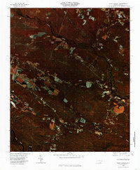 1980 Point Caswell1985 Print · USGSThe riverine landscapes of Pender County are captured in this color infrared aerial survey from the early 1980s. Local researchers can trace family lands and rural property boundaries near Point Caswell, Long View, and the winding banks of the Black River.
 - 1982 Map of Elizabethtown, 1983 Print
 1982 Elizabethtown1983 Print · USGSSoutheastern North Carolina's coastal plain is captured here in the early eighties, showcasing a landscape defined by the Cape Fear River and mysterious Carolina Bays. Genealogists and researchers can trace the rail network of the Seaboard Coast Line through rural communities like Autryville, Ivanhoe, and the recreational hub of White Lake.
 - 1983 Map of Point Caswell, 1984 Print
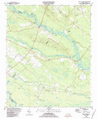 1983 Point Caswell1984 Print · USGSThe river-and-swamp country of Pender and Bladen Counties is captured here in the early 1980s. Genealogists can trace family landmarks like Haw Bluff Ch, Rosa Green Ch, and the Moore Cem along the winding BLACK RIVER.
 - 1984 Map of Atkinson
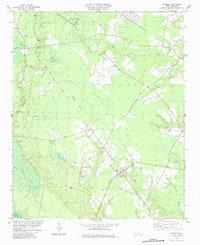 1984 Atkinson1984 Print · USGSThe town of Atkinson and the Black River bottomlands are captured here in the early 1980s, revealing a landscape of family-run farms and vast bay-swamp geography. Researchers can trace local history through sites like New Zion Ch, Atkinson Cem, and the old Railroad Grade.
 - 1986 Map of Lake Waccamaw East
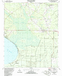 1986 Lake Waccamaw East1986 Print · USGSCoastal plain wetlands and small-town rail corridors define this mid-1980s look at Columbus County. Researchers can trace the Seaboard System tracks through Bolton and locate family landmarks like Union Chapel and Goose Hollow.
 - 1986 Map of Freeman
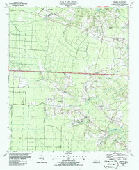 1986 Freeman1986 Print · USGSSoutheastern North Carolina in the mid-1980s reveals a landscape of rural communities and railroad corridors along the Bladen and Columbus county line. Genealogists can trace family footprints through numerous country churches and cemeteries near Byrdville, Freeman, and East Arcadia.
 - 1986 Map of Garland
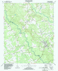 1986 Garland1986 Print · USGSSampson and Bladen counties in the mid-1980s are defined by the convergence of the South River and several distinctive Carolina Bays. Researchers can trace rural community centers through old landmarks like Smith Chapel, Antioch Ch, and Parkersburg.
 - 1986 Map of Singletary Lake
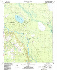 1986 Singletary Lake1986 Print · USGSBladen County in the mid-1980s reveals a landscape shaped by the Cape Fear River and a distinctive network of Carolina Bays. Researchers can trace old river access points like Coal Mine Landing and family landmarks such as Marshall Cem and Atkinson Landing.
 - 1986 Map of Kelly
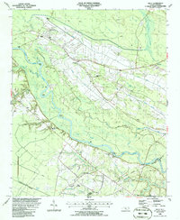 1986 Kelly1986 Print · USGSThe Cape Fear River valley in the mid-1980s reveals a landscape of river-crossing ferries and swamp-land canals. Researchers can trace rural community roots through the Elwells Ferry crossing, the Bladen Technical College campus, and local settlements like Kelly and East Arcadia.
 - 1986 Map of Council
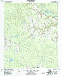 1986 Council1986 Print · USGSThe rural landscapes of Bladen and Columbus counties are captured here in the mid-1980s, centered on the rail-side community of Council. Researchers can trace old family landmarks and local gathering places like McEwen Cem, Zion Ch, and the waters of Meares Millpond.
 - 1986 Map of Tomahawk
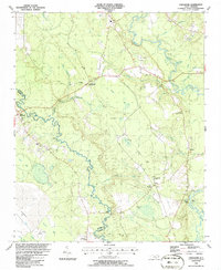 1986 Tomahawk1986 Print · USGSCoastal plain river life and unique swamp geography define this Sampson County region in the mid-1980s. Researchers can trace rural lineages through sites like Trinity Ch and Harmony Ch or locate old river access points at Fowler Landing and Jackie Landing.
 - 1986 Map of Whiteville
 1986 Whiteville1986 Print · USGSSoutheastern North Carolina and the South Carolina borderlands are captured here in the mid-1980s as a landscape of vast swamps and rail towns. Researchers can trace historic rail routes through Chadbourn, locate the namesake Lake Waccamaw, and explore family-named sites like Peacocks.
Showing maps 1-25 of 167
Top cities of Bladen County
- Elizabethtown historical maps
- Bladenboro historical maps
- Clarkton historical maps
- White Lake historical maps
- East Arcadia historical maps
- Butters historical maps
See more
Frequently asked questions
- What are the different types of historical maps available for Bladen County?
- What is the oldest map of Bladen County?
- Where can I purchase historical maps of Bladen County for my home or office?
- Where can I download high-res historical maps of Bladen County?
- Are there historical topographic maps available for Bladen County?
- Is there historical aerial imagery available for Bladen County?
- Where are historical maps of Bladen County sourced from?