Old Maps of Long View, North Carolina for Metal Detecting
Plan your next treasure hunt with 13 historic maps of Long View. Find old homesites, ghost towns, trails, and gathering spots that may be lost to time — perfect for identifying promising metal detecting locations.
- Locate forgotten sites: Uncover places like long-lost settlements, abandoned rail lines, or gathering spots.
- Plan better hunts: Use map overlays combined with LiDAR or satellite views to narrow in on historically rich areas.
- Made for detectorists: Thousands of hobbyists use these maps to discover relics, coins, and hidden history.
Use these historic maps to boost your research and find new opportunities beneath the surface of Long View.
Long View, NC maps
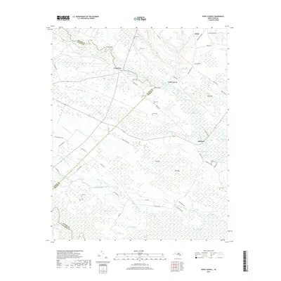
(13)- 1953 Map of Florence, 1964 Print
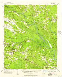
 1953 Florence1964 Print · USGSThe Carolina borderlands in the mid-fifties were a landscape of vast river swamps and rising rail towns. Trace the legacy of the Seaboard Air Line through Florence or explore the wetlands surrounding Lake Waccamaw and the Green Swamp.3 unique versions available
 - 1954 Map of Florence
 1954 Florence1954 Print · USGSThe Carolinas borderlands come alive in the early fifties, showing the vital rail-and-river networks of the coastal plain. Genealogists can trace family footprints across the Green Swamp or through settlements like Red Springs, Chadbourn, and McColl.
 - 1954 Map of Acme, 1957 Print
 1954 Acme1957 Print · USGSCoastal North Carolina river life in the mid-fifties centered on the confluence of the Cape Fear and the Black River. Genealogists can trace family names at Still Bluff and Maultbys Point, or locate the historic Lincoln High Sch and Farmers Chapel.2 unique versions available
 - 1980 Map of Point Caswell, 1985 Print
 1980 Point Caswell1985 Print · USGSThe riverine landscapes of Pender County are captured in this color infrared aerial survey from the early 1980s. Local researchers can trace family lands and rural property boundaries near Point Caswell, Long View, and the winding banks of the Black River.
 - 1983 Map of Point Caswell, 1984 Print
 1983 Point Caswell1984 Print · USGSThe river-and-swamp country of Pender and Bladen Counties is captured here in the early 1980s. Genealogists can trace family landmarks like Haw Bluff Ch, Rosa Green Ch, and the Moore Cem along the winding BLACK RIVER.
 - 1986 Map of Whiteville
 1986 Whiteville1986 Print · USGSSoutheastern North Carolina and the South Carolina borderlands are captured here in the mid-1980s as a landscape of vast swamps and rail towns. Researchers can trace historic rail routes through Chadbourn, locate the namesake Lake Waccamaw, and explore family-named sites like Peacocks.
 - 1990 Map of Whiteville
 1990 Whiteville1990 Print · USGSSoutheastern North Carolina and the South Carolina borderlands appear in the late twentieth century, showing a landscape of river-swamps and tobacco towns. Researchers can trace family history through sites like Mount Olive Ch, the Seaboard Coast Line RR, and rural centers like Tabor City.
 - 1997 Map of Point Caswell, 2001 Print
 1997 Point Caswell2001 Print · USGSThe Black River lowlands of Pender County are captured here at the end of the century, showing a landscape defined by tidal coves and swampy creek beds. Genealogists can locate numerous rural landmarks including Point Caswell Ch, the Flynn Cem, and an Old Railroad Grade.
 - 2010 Map of Point Caswell, 2010 Print
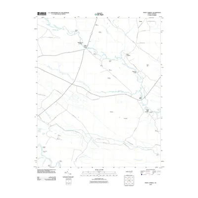 2010 Point Caswell2010 Print · USGSCovers Long View, including Long Bluff Landing, Sparkleberry Landing, and other nearby areas
 - 2013 Map of Point Caswell, 2013 Print
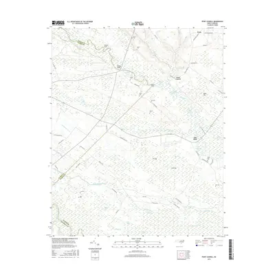
 2013 Point Caswell2013 Print · USGSCovers Long View, including Long Bluff Landing, Sparkleberry Landing, and other nearby areas
 - 2016 Map of Point Caswell, 2016 Print
 2016 Point Caswell2016 Print · USGSCovers Long View, including Long Bluff Landing, Sparkleberry Landing, and other nearby areas
 - 2019 Map of Point Caswell, 2019 Print
 2019 Point Caswell2019 Print · USGSCovers Long View, including Long Bluff Landing, Sparkleberry Landing, and other nearby areas
 - 2022 Map of Point Caswell, 2022 Print
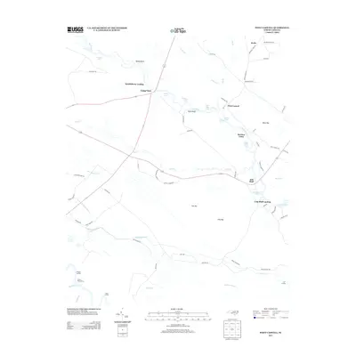
 2022 Point Caswell2022 Print · USGSCoastal plains and riverine lowlands dominate this corner of Pender County in the early 2020s. Genealogists can trace family landmarks and rural burial grounds like Larkins Cem, Long Bluff Cem, and the riverfront settlement at Point Caswell.
End of results
Showing maps 1-13 of 13
Top cities near Long View
- Leland historical maps
- Navassa historical maps
- Northwest historical maps
- East Arcadia historical maps
- Bolton historical maps
- Sandyfield historical maps
See more
Frequently asked questions
- What are the different types of historical maps available for Long View?
- What is the oldest map of Long View?
- Where can I purchase historical maps of Long View for my home or office?
- Where can I download high-res historical maps of Long View?
- Are there historical topographic maps available for Long View?
- Is there historical aerial imagery available for Long View?
- Where are historical maps of Long View sourced from?