Old Maps of Batarora, North Carolina for Academic Research
Study the evolution of Batarora with 13 high-resolution historic maps. Whether you're teaching, researching, or modeling changes in land use, these maps provide essential visual documentation of urban, environmental, and geographic change.
- Analyze long-term change: Track patterns in development, transportation, and natural features.
- Ideal for environmental or urban studies: Support academic projects with primary historical map data.
- Use in the classroom or lab: Educators and researchers rely on these maps to bring historical context to life.
These maps are a powerful tool for teaching, research, and visualizing how Batarora has changed over the decades.
Batarora, NC maps
(13)- 1943 Map of Lewis Swamp, 1962 Print
 1943 Lewis Swamp1962 Print · USGSCoastal North Carolina during the mid-forties reveals a landscape defined by the wetlands of the Green Swamp and local timber history. Researchers can locate family landmarks such as the Old Cumbee Place, identify rural congregations like Christian Hope Ch, and trace the paths of an Old Railroad Grade.
 - 1944 Map of Lewis Swamp
 1944 Lewis Swamp1944 Print · USGSCoastal North Carolina during the mid-forties reveals a landscape of dense swamps and scattered rural settlements like Batarora and Rabontown. Genealogists can locate family landmarks such as the Old Cumbee Place and Flowers Corner alongside local country churches.
 - 1953 Map of Florence, 1964 Print
 1953 Florence1964 Print · USGSThe Carolina borderlands in the mid-fifties were a landscape of vast river swamps and rising rail towns. Trace the legacy of the Seaboard Air Line through Florence or explore the wetlands surrounding Lake Waccamaw and the Green Swamp.3 unique versions available
 - 1954 Map of Florence
 1954 Florence1954 Print · USGSThe Carolinas borderlands come alive in the early fifties, showing the vital rail-and-river networks of the coastal plain. Genealogists can trace family footprints across the Green Swamp or through settlements like Red Springs, Chadbourn, and McColl.
 - 1980 Map of Lewis Swamp, 1985 Print
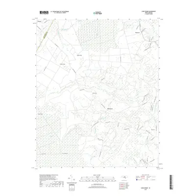
 1980 Lewis Swamp1985 Print · USGSCoastal North Carolina's rural landscape is revealed in this 1980 color infrared study of the wetlands and timberlands. Researchers can trace remote crossroads and family-named locales such as Rabontown, Flowers Corner, and the depths of Green Swamp.
 - 1986 Map of Whiteville
 1986 Whiteville1986 Print · USGSSoutheastern North Carolina and the South Carolina borderlands are captured here in the mid-1980s as a landscape of vast swamps and rail towns. Researchers can trace historic rail routes through Chadbourn, locate the namesake Lake Waccamaw, and explore family-named sites like Peacocks.
 - 1990 Map of Whiteville
 1990 Whiteville1990 Print · USGSSoutheastern North Carolina and the South Carolina borderlands appear in the late twentieth century, showing a landscape of river-swamps and tobacco towns. Researchers can trace family history through sites like Mount Olive Ch, the Seaboard Coast Line RR, and rural centers like Tabor City.
 - 1990 Map of Lewis Swamp, 1991 Print
 1990 Lewis Swamp1991 Print · USGSCoastal Brunswick and Columbus counties are captured here in the early nineties, revealing a landscape defined by the vast Green Swamp and rural crossroads. Genealogists and local historians can trace family locations near Rabontown, Flowers Corner, and Christian Hope Ch.
 - 2010 Map of Lewis Swamp, 2010 Print
 2010 Lewis Swamp2010 Print · USGSCovers Batarora, including Rabontown, Old Cumbee Place, and other nearby areas
 - 2013 Map of Lewis Swamp, 2013 Print
 2013 Lewis Swamp2013 Print · USGSCovers Batarora, including Rabontown, Old Cumbee Place, and other nearby areas
 - 2016 Map of Lewis Swamp, 2016 Print
 2016 Lewis Swamp2016 Print · USGSCovers Batarora, including Rabontown, Old Cumbee Place, and other nearby areas
 - 2019 Map of Lewis Swamp, 2019 Print
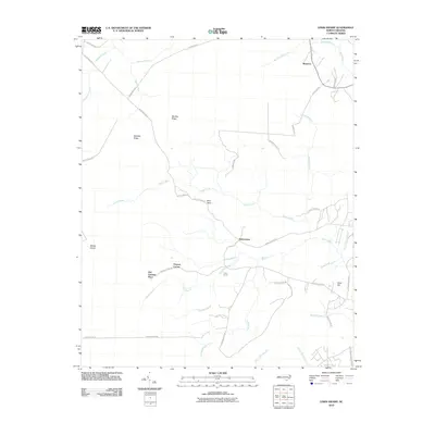
 2019 Lewis Swamp2019 Print · USGSCovers Batarora, including Rabontown, Old Cumbee Place, and other nearby areas
 - 2022 Map of Lewis Swamp, 2022 Print
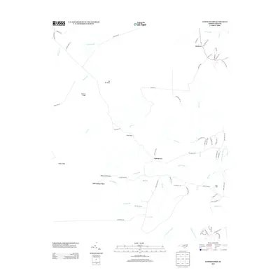
 2022 Lewis Swamp2022 Print · USGSSoutheastern North Carolina's coastal lowlands are captured here in the early 2020s, showing a landscape defined by expansive wetlands and isolated communities. Researchers can trace rural family sites near Rabontown and Batarora or explore the drainage of Lewis Swamp and Green Swamp.
End of results
Showing maps 1-13 of 13
Top cities near Batarora
- Wilmington historical maps
- Leland historical maps
- Boiling Spring Lakes historical maps
- Navassa historical maps
- Northwest historical maps
- East Arcadia historical maps
See more
Frequently asked questions
- What are the different types of historical maps available for Batarora?
- What is the oldest map of Batarora?
- Where can I purchase historical maps of Batarora for my home or office?
- Where can I download high-res historical maps of Batarora?
- Are there historical topographic maps available for Batarora?
- Is there historical aerial imagery available for Batarora?
- Where are historical maps of Batarora sourced from?