Old Maps of Mill Creek, North Carolina for Academic Research
Study the evolution of Mill Creek with 12 high-resolution historic maps. Whether you're teaching, researching, or modeling changes in land use, these maps provide essential visual documentation of urban, environmental, and geographic change.
- Analyze long-term change: Track patterns in development, transportation, and natural features.
- Ideal for environmental or urban studies: Support academic projects with primary historical map data.
- Use in the classroom or lab: Educators and researchers rely on these maps to bring historical context to life.
These maps are a powerful tool for teaching, research, and visualizing how Mill Creek has changed over the decades.
Mill Creek, NC maps
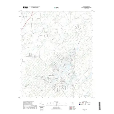
(12)- 1943 Map of Funston, 1962 Print
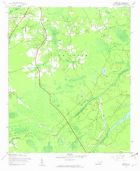 1943 Funston1962 Print · USGSCoastal Brunswick County during the early 1940s is shown here as a landscape of interconnected wetlands and small rural outposts. Researchers can trace family-named water features and local landmarks like Brunswick Station, Christian Chapel, and Orton Pond.2 unique versions available
 - 1953 Map of Florence, 1964 Print
 1953 Florence1964 Print · USGSThe Carolina borderlands in the mid-fifties were a landscape of vast river swamps and rising rail towns. Trace the legacy of the Seaboard Air Line through Florence or explore the wetlands surrounding Lake Waccamaw and the Green Swamp.3 unique versions available
 - 1954 Map of Florence
 1954 Florence1954 Print · USGSThe Carolinas borderlands come alive in the early fifties, showing the vital rail-and-river networks of the coastal plain. Genealogists can trace family footprints across the Green Swamp or through settlements like Red Springs, Chadbourn, and McColl.
 - 1980 Map of Funston, 1985 Print
 1980 Funston1985 Print · USGSCoastal development meets the low-lying wetlands of Brunswick County in the early eighties as Boiling Spring Lakes begins to expand. Researchers can trace the layout of residential streets near Brunswick Station and follow the intricate waterways of Orton Creek and Bell Swamp.
 - 1986 Map of Whiteville
 1986 Whiteville1986 Print · USGSSoutheastern North Carolina and the South Carolina borderlands are captured here in the mid-1980s as a landscape of vast swamps and rail towns. Researchers can trace historic rail routes through Chadbourn, locate the namesake Lake Waccamaw, and explore family-named sites like Peacocks.
 - 1990 Map of Whiteville
 1990 Whiteville1990 Print · USGSSoutheastern North Carolina and the South Carolina borderlands appear in the late twentieth century, showing a landscape of river-swamps and tobacco towns. Researchers can trace family history through sites like Mount Olive Ch, the Seaboard Coast Line RR, and rural centers like Tabor City.
 - 1990 Map of Funston, 1991 Print
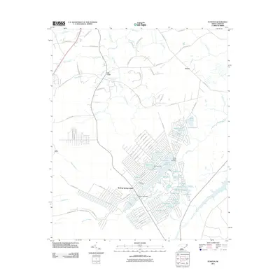
 1990 Funston1991 Print · USGSBrunswick County at the start of the nineties reveals a landscape of growing residential developments and coastal defense. Researchers can trace family sites at Lebanon Ch and Funston or locate the sprawling Military Ocean Terminal Sunny Point.
 - 2011 Map of Funston, 2011 Print
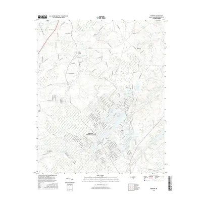
 2011 Funston2011 Print · USGSCovers Mill Creek, including Boiling Spring Lakes, Funston, and other nearby areas
 - 2013 Map of Funston, 2013 Print
 2013 Funston2013 Print · USGSCovers Mill Creek, including Boiling Spring Lakes, Funston, and other nearby areas
 - 2016 Map of Funston, 2016 Print
 2016 Funston2016 Print · USGSCovers Mill Creek, including Boiling Spring Lakes, Funston, and other nearby areas
 - 2019 Map of Funston, 2019 Print
 2019 Funston2019 Print · USGSCovers Mill Creek, including Boiling Spring Lakes, Funston, and other nearby areas
 - 2022 Map of Funston, 2022 Print
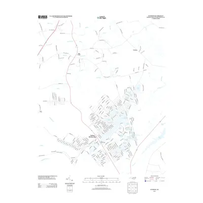
 2022 Funston2022 Print · USGSBrunswick County at the start of the 2020s shows the expansion of Boiling Spring Lakes amidst the coastal wetlands. Local researchers can trace family landmarks like the Lebanon Baptist Church and Cem near Funston.
End of results
Showing maps 1-12 of 12
Top cities near Mill Creek
- Wilmington historical maps
- Leland historical maps
- Oak Island historical maps
- Boiling Spring Lakes historical maps
- Carolina Beach historical maps
- Southport historical maps
See more
Frequently asked questions
- What are the different types of historical maps available for Mill Creek?
- What is the oldest map of Mill Creek?
- Where can I purchase historical maps of Mill Creek for my home or office?
- Where can I download high-res historical maps of Mill Creek?
- Are there historical topographic maps available for Mill Creek?
- Is there historical aerial imagery available for Mill Creek?
- Where are historical maps of Mill Creek sourced from?