Old Maps of Paint Fork, North Carolina for Genealogy
Trace your family roots with 16 historic maps of Paint Fork. These high-res maps reveal old neighborhoods, homesites, landmarks, and streets — helping you uncover where your ancestors lived and how the area evolved over time.
- Explore historic neighborhoods: Identify where your relatives may have lived in the 1800s or 1900s.
- Compare maps over time: Trace the changes in streets, buildings, and landmarks for multi-generational research.
- Perfect for genealogy & ancestry research: Used by family historians and researchers to map out lineage and migration.
These maps are an incredible resource for exploring your personal connection to Paint Fork's past.
Paint Fork, NC maps
(16)- 1900 Map of Mount Mitchell, 1963 Print
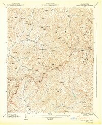
 1900 Mount Mitchell1963 Print · USGSWestern North Carolina at the turn of the century shows a landscape of high peaks and isolated river settlements before the arrival of modern highways. Genealogists and mountain historians can trace early homesteads along the Cane River or follow the Southern RR through Old Fort and Black Mountain.3 unique versions available
 - 1902 Map of Mount Mitchell, 1937 Print
 1902 Mount Mitchell1937 Print · USGSThe high peaks of Western North Carolina are captured here at the start of the twentieth century, showing the rail and river corridors that shaped the region. Trace early settlements like Burnsville, Montreat, and the winding Southern Railway.3 unique versions available
 - 1935 Map of Craggy Pinnacle
 1935 Craggy Pinnacle1935 Print · USGSThe high ridges of Buncombe County are captured here in the mid-1930s, showing a transition from remote mountain homesteads to early forestry and recreational sites. Genealogists can trace family names at Beetree Cem and Huey Cem, or locate landmarks like Camp Sequoyah and Union Valley Ch.
 - 1946 Map of Craggy Pinnacle, 1972 Print
 1946 Craggy Pinnacle1972 Print · USGSBuncombe County high country is documented here just after the war as the mountain gaps and valleys supported small rural communities. Genealogists and hikers can trace old family sites like Ballard Cem, early structures at Blackberry Inn, and landmarks along the Blue Ridge Parkway.2 unique versions available
 - 1947 Map of Craggy Pinnacle
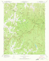
 1947 Craggy Pinnacle1947 Print · USGSBuncombe County's high ridges and coves are documented here in the late forties as the Blue Ridge Parkway was still a fresh addition to the skyline. Genealogists can locate family landmarks such as Ballard Cem, Paint Fork Chapel, and the community at Riceville.6 unique versions available
 - 1955 Map of Knoxville
 1955 Knoxville1955 Print · USGSThe Southern Appalachians and the Smoky Mountains are shown here at a peak of mid-century development and conservation. Genealogists and historians can trace the early road networks connecting Gatlinburg, Waynesville, and the Cherokee Indian Reservation across the high ridges.
 - 1957 Map of Knoxville, 1966 Print
 1957 Knoxville1966 Print · USGSThe Southern Appalachians of Tennessee and North Carolina are mapped here during the mid-twentieth century as new highways reached the high country. Genealogists and historians can trace the topography between Knoxville and Asheville, locating family landmarks near Fontana Lake or along the Blue Ridge Parkway.4 unique versions available
 - 1960 Map of Knoxville
 1960 Knoxville1960 Print · USGSThe Southern Appalachians come alive in the 1950s, showing the intersection of new national park tourism and deep-rooted mountain industry. Trace old rail lines like the Clinchfield RR and find high-altitude landmarks from Mt Le Conte to the Cherokee Indian Reservation.2 unique versions available
 - 1964 Map of Knoxville
 1964 Knoxville1964 Print · USGSThe Southern Appalachians and Great Smokies are captured here during the mid-sixties, showing the rugged borderlands of Tennessee and North Carolina. Researchers can trace historic mountain routes like U S 441, the expanse of Pisgah National Forest, and the growing footprints of Asheville and Knoxville.
 - 1985 Map of Asheville
 1985 Asheville1985 Print · USGSWestern North Carolina during the mid-eighties shows a region of deep mountain heritage and expanding highway networks. Genealogists and historians can trace the foundations of Asheville alongside older rail corridors like the Clinchfield Railroad and the high elevations of Mount Mitchell.2 unique versions available
 - 1997 Map of Craggy Pinnacle, 2001 Print
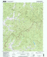 1997 Craggy Pinnacle2001 Print · USGSThe high peaks of the Blue Ridge Mountains are documented here in the late twentieth century, showing the rugged interface of national forest land and remote settlements. Researchers can trace family sites like Ballard Cem, local landmarks like Rattlesnake Lodge, and the early development of Riceville.
 - 2011 Map of Craggy Pinnacle, 2011 Print
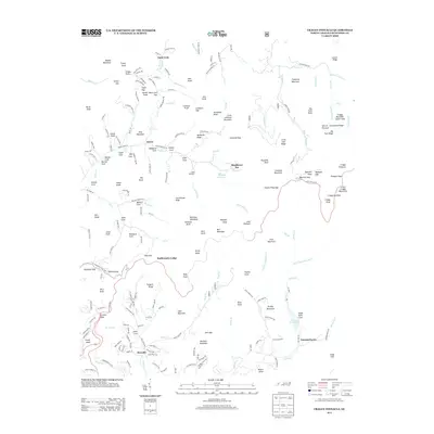
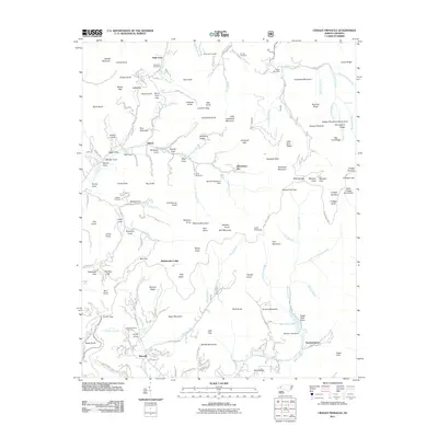 2011 Craggy Pinnacle2011 Print · USGSCovers Paint Fork, including Asheville, Swannanoa, and other nearby areas
 - 2013 Map of Craggy Pinnacle, 2013 Print
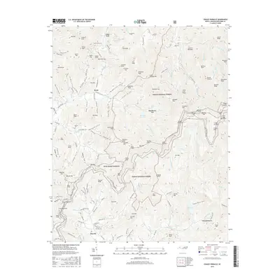
 2013 Craggy Pinnacle2013 Print · USGSCovers Paint Fork, including Asheville, Swannanoa, and other nearby areas
 - 2016 Map of Craggy Pinnacle, 2016 Print
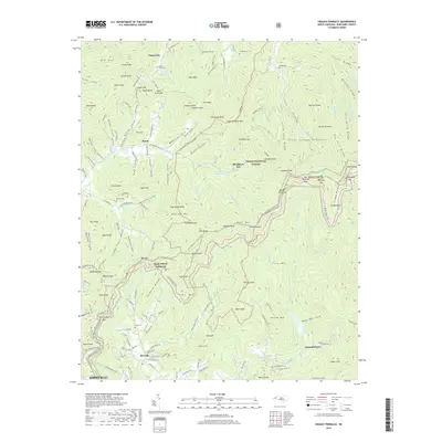
 2016 Craggy Pinnacle2016 Print · USGSCovers Paint Fork, including Asheville, Swannanoa, and other nearby areas
 - 2019 Map of Craggy Pinnacle, 2019 Print
 2019 Craggy Pinnacle2019 Print · USGSCovers Paint Fork, including Asheville, Swannanoa, and other nearby areas
 - 2022 Map of Craggy Pinnacle, 2022 Print
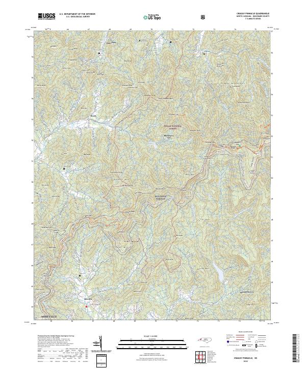 2022 Craggy Pinnacle2022 Print · USGSThe high peaks of Buncombe County are detailed here as they appear today, spanning the heights between the Blue Ridge Parkway and Pisgah National Forest. Genealogists and hikers can locate several remote burial sites like Huey Cemetery and Webb Cemetery or trace the Mountains-to-Sea Trail near Craggy Gardens.
End of results
Showing maps 1-16 of 16
Top cities near Paint Fork
- Asheville historical maps
- Black Mountain historical maps
- Swannanoa historical maps
- Woodfin historical maps
- Weaverville historical maps
- Mars Hill historical maps
See more
Frequently asked questions
- What are the different types of historical maps available for Paint Fork?
- What is the oldest map of Paint Fork?
- Where can I purchase historical maps of Paint Fork for my home or office?
- Where can I download high-res historical maps of Paint Fork?
- Are there historical topographic maps available for Paint Fork?
- Is there historical aerial imagery available for Paint Fork?
- Where are historical maps of Paint Fork sourced from?