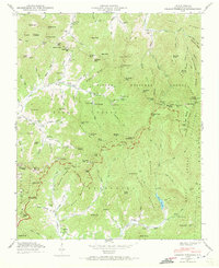
1946 Map of Craggy Pinnacle
USGS Topo · Published 1972About this map
Pisgah National Forest dominates this mid-century landscape in Buncombe County, where the high ridges of the Great Craggy Mountains are traversed by the winding Blue Ridge Parkway. The terrain is defined by extreme elevation changes, rising from the settlement at Riceville to the prominent peak of Craggy Pinnacle. The presence of numerous family-named burial grounds like Anderson Cem and Paint Fork Cem alongside rural congregations at Browns Chapel and Riceville Ch indicates a deeply rooted mountain community. Water management is a central feature of the area, evidenced by the Beetree Reservoir, Woodfin Res, and Weaverville Reservoir, which capture runoff from the surrounding peaks. In the northern reaches, the small settlement of Paint Fork sits near the headwaters of Flat Cr, while isolated landmarks like the Lookout Tower on Little Snowball Mtn overlook the complex network of coves and gaps.
Find a feature on this map
133 named features on this map. Tap any name to fly to it.
Don’t see what you’re looking for? This feature index may not catch every label — zoom into the map to look around manually.
Map Details
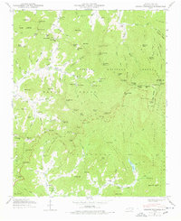
Editions of this 1946 Craggy Pinnacle Map
2 editions found
Other maps of this area

1894 · Asheville
USGS Topo · 1:125,000

1900 · Mount Mitchell
USGS Topo · 1:125,000

1901 · Asheville
USGS Topo · 1:125,000

1902 · Mount Mitchell
USGS Topo · 1:125,000

1935 · Montreat
USGS Topo · 1:24,000

1935 · Black Brothers
USGS Topo · 1:24,000

1935 · Black Mountain
USGS Topo · 1:24,000

1935 · Barnardsville
USGS Topo · 1:24,000

1935 · Craggy Pinnacle
USGS Topo · 1:24,000

1936 · Weaverville
USGS Topo · 1:24,000