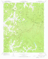
1946 Map of Craggy Pinnacle
USGS Topo · Published 1978About this map
The Blue Ridge Parkway winds through this 1946 topography, tracing the high elevations of Richland Mtn and the Black Mountains. This era shows a landscape where mountain agriculture and early conservation efforts met, evidenced by the scattered communities of Beech and Coles nestled in the coves. The presence of Camp Sequoyah and Rattlesnake Lodge near the Pisgah National Forest boundary indicates the area's development as a destination for outdoor recreation and seasonal retreats. Local genealogy is well-represented through family-named landmarks like McDairis Ridge and numerous small burial grounds, including the Anderson Cem and Webb Cem. Water management is a defining feature of the southern portion of the map, where the Woodfin Res and Beetree Reservoir capture mountain runoff, supporting the growth of nearby settlements like Riceville.
Find a feature on this map
143 named features on this map. Tap any name to fly to it.
Don’t see what you’re looking for? This feature index may not catch every label — zoom into the map to look around manually.
Map Details
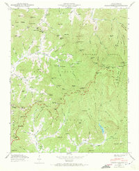
Editions of this 1946 Craggy Pinnacle Map
2 editions found
Other maps of this area

1894 · Asheville
USGS Topo · 1:125,000

1900 · Mount Mitchell
USGS Topo · 1:125,000

1901 · Asheville
USGS Topo · 1:125,000

1902 · Mount Mitchell
USGS Topo · 1:125,000

1935 · Montreat
USGS Topo · 1:24,000

1935 · Black Brothers
USGS Topo · 1:24,000

1935 · Black Mountain
USGS Topo · 1:24,000

1935 · Barnardsville
USGS Topo · 1:24,000

1935 · Craggy Pinnacle
USGS Topo · 1:24,000

1936 · Weaverville
USGS Topo · 1:24,000