1990s Maps of Tranquil Hill, North Carolina
Explore 2 historic maps of Tranquil Hill from the 1990s. These maps offer a rare glimpse into what life looked like during the 1990s — showing old roads, neighborhoods, homes, and landmarks that have changed or disappeared over time.
Whether you're researching your family's past, planning a metal detecting trip, or studying how Tranquil Hill's landscape evolved across the 1990s, these high-resolution maps are a powerful tool for exploring the history of this region.
- Focus on a specific era: All maps on this page are from the 1990s, giving you a focused view of this time period.
- See what’s changed: Compare century-old streets, trails, and buildings to today's modern landscape using overlays and satellite layers.
- Research with precision: Use these maps for genealogy, historical research, land use analysis, or educational projects.
- View, download, or print: Maps are fully viewable online in high resolution, and can be downloaded or printed for your own records.
Start exploring Tranquil Hill's history through authentic maps from the 1990s. This is your window into the past.
Tranquil Hill, NC maps
(2)- 1993 Map of Lenoir, 1996 Print
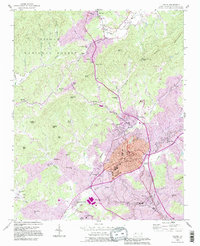 1993 Lenoir1996 Print · USGSLenoir and the surrounding North Carolina foothills are captured in the early nineties as the community expanded toward the Pisgah National Forest. Researchers can trace family sites and local landmarks from Belleview Cem to the rural District 9 Sch and Hibriten Ch.
 - 1994 Map of Lenoir, 1998 Print
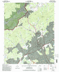 1994 Lenoir1998 Print · USGSLenoir and its surrounding foothills are shown in the mid-1990s as the community expanded toward the Pisgah National Forest. Genealogists and local historians can trace legacy sites like Harpertown Sch, Nazareth Ch, and the many family-named landmarks from Patterson to Whitnel.
End of results
Showing maps 1-2 of 2
Top cities near Tranquil Hill
- Hickory historical maps
- Boone historical maps
- Lenoir historical maps
- Morganton historical maps
- Sawmills historical maps
- Granite Falls historical maps
See more
Frequently asked questions
- What are the different types of historical maps available for Tranquil Hill?
- What is the oldest map of Tranquil Hill?
- Where can I purchase historical maps of Tranquil Hill for my home or office?
- Where can I download high-res historical maps of Tranquil Hill?
- Are there historical topographic maps available for Tranquil Hill?
- Is there historical aerial imagery available for Tranquil Hill?
- Where are historical maps of Tranquil Hill sourced from?